Ushbu mintaqaviy sho'ng'in bo'yicha qo'llanma allaqachon malakali mutaxassislarni taqdim etishga mo'ljallangan suvosti sho'ng'inchisi mahalliy aholi yoki mehmon sifatida, Keyp yarim oroli va False Bay suvlarida sho'ng'inlarni rejalashtirishga yordam beradigan ma'lumotlar bilan. Ma'lumot zarar etkazmasdan taqdim etiladi va ularga aniq yoki to'liq kafolat berilmaydi. O'zingizning tavakkalingizdan foydalaning. Imkoniyat bo'lganda uni kengaytiring yoki tuzating.
Ta'riflangan mintaqa kattaroq qismdan bir kunlik yo'l bo'ylab sayohat qiladi Keyptaun, ichida G'arbiy Keyp viloyati Janubiy Afrika va pozitsiyalar yozilgan 280 dan ortiq sho'ng'in joylarini o'z ichiga oladi, bu har qanday yo'nalish uchun juda muhimdir.
Shaxsiy sho'ng'in saytlari haqida batafsil ma'lumot quyidagi havoladan berilgan pastki maqolalarda keltirilgan Sho'ng'in saytlari Bo'lim. Sayt tavsiflaridagi ma'lumotlar sayt haqida ma'lum bo'lgan narsalarga qarab, yuzaki dan juda batafsil ma'lumotlarga qadar. Xarita bo'lishi mumkin. SURGMAP-ning batimetrik jadvallari yangi so'rov ma'lumotlari to'planganda va yangilangan bo'lib, GPS shamshirini tortib konturlarini suzish orqali xaritaga tushiriladi. Ular juda aniq, odatda bir necha metr masofada va ko'rsatilganlarga ishonchli, ammo kamdan-kam hollarda to'liq. Balki baland cho'qqilar o'tkazib yuborilgan bo'lishi mumkin. Siz uni qayiq bilan urib kashf qilmasligingizga kafolat yo'q. Agar shunday qilsangiz, iltimos, bizga xabar bering.
Ba'zi hollarda, sho'ng'in saytining pastki maqolasi bir-biriga yaqin bo'lgan bir nechta saytlarni o'z ichiga oladi, chunki ma'lumotlarning barchasi ularning barchasi uchun umumiy bo'ladi. Boshqa holatlarda, odatda halokat joylari ishtirokida, ikkita qo'shni uchastkaning har biri o'z kichik maqolasiga ega bo'ladi, lekin agar ikki yoki undan ortiq vayronalar bir xil holatidadir yoki bir-birining ustiga o'ralgan bo'lsa, ular o'sha kichik maqolada tavsiflanadi.
Tushuning


Umumiy topografiya
Keyptaun shahri shimoliy oxirida tashkil etilgan Keyp yarim oroli, eng kengligi 11 km va uzunligi 50 km dan oshgan tor tog'li quruqlik. Shimoliy chegarasi - Stol ko'rfazining qirg'og'i, bitta orolga ega bo'lgan katta ochiq ko'rfaz, Robben oroli, og'zida.
Yirtilgan qirg'oq Atlantika okeanining g'arbiy chegarasini belgilaydi. Bir nechta kichik koylar qirg'oq bo'ylab bitta katta bilan, Hout ko'rfazi, taxminan yarim yo'l. Keyingi janubda Keyp Poyntda oxirigacha yarimorol torayib boradi. Shimoliy uchida stol tog'i 1085 m bo'lgan bir qator tog'lar yarimorolning orqa miya qismini tashkil qiladi. Janubiy yarim orolning eng baland joyi Svartkop bo'lib, 678 m balandlikda, Simonning shahri yaqinida joylashgan. Yarim orol qirg'oqning katta qismida ancha qiyaliklarga ega, janubiy uchining g'arbiy qismidan tashqari nisbatan tekis erlarning juda tor joylari mavjud.
Tik sharqiy tomon False Bay bilan chegaradosh bo'lib, ushbu qirg'oq chizig'i kichikroq Smitswinkel ko'rfazini, Saymon ko'rfazini va Fish Hoek ko'rfazini o'z ichiga oladi, bu erda ikkala tomonning qirg'oqlari orasida pasttekislik chizig'i cho'zilgan. Muizenbergda qirg'oq chizig'i nisbatan pastroq va qumli bo'lib, janubiy chegarasi bo'ylab sharqqa buriladi Cape Flats False Bayning shimoliy chegarasini tashkil qilish uchun Gordon ko'rfaziga. Kimdan Gordon ko'rfazi qirg'oq chizig'i taxminan janubga siljiydi va zig-zaglar Hottentotning Golland tog 'tizmasi etagida Keyp-Point bilan deyarli bir xil kenglikda joylashgan Xangklip burniga boradi. Bu tomonning eng baland cho'qqisi - 1269 m balandlikdagi Kogelberg.
Rejada buxta taxminan to'rtburchak shaklda, tebranadigan qirralari bilan, taxminan shimoldan janubga sharqdan g'arbga (30 km) teng, butun janubiy tomoni okeanga ochiq. Soxta ko'rfazning maydoni taxminan 1090 km² o'lchangan va hajmi taxminan 45 km³ (o'rtacha chuqurlik 40 m). Quruqlik perimetri 1: 50,000 masshtabli xaritadan 116 km masofada o'lchandi.
Soxta ko'rfazning pastki morfologiyasi odatda silliq va etarlicha sayoz bo'lib, shimoldan janubga muloyimlik bilan pastga egilib, og'izning markazidagi chuqurlik taxminan 80 m ga teng. Pastki qismi dag'aldan juda mayingacha cho'kindi bilan qoplangan, mayda cho'kindi va loyning ko'p qismi ko'rfazning markazida joylashgan. Asosiy istisno - bu Strenddan janubga qarab Stenbras daryosining og'zi bilan bir tekislikgacha cho'zilgan cho'kindi jinslarning uzun tizmasi. Ushbu tizmaning janubiy uchi Steenbras Deep nomi bilan mashhur.
Ko'rfazda bitta haqiqiy orol bor, u Seal Island, uzunligi 200 metr bo'lgan va maydoni taxminan 2 ga bo'lgan granitning bepusht va tosh toshi. Strandfonteindan janubda 6 km uzoqlikda va eng baland nuqtasida dengiz sathidan 10 m dan pastroqda joylashgan. Yuqori suv belgisidan yuqoriga cho'zilgan bir qator mayda toshli adacıklar va boshqa toshlar va shollar er yuziga yaqinlashadi. Ularning aksariyati granit Yarim orol pluton, ammo Seal Islandning sharqida ular odatda qumtoshdir, ehtimol Tygerberg ko'rfazda hosil bo'lishi, ammo ba'zilari bo'lishi mumkin Stol tog ' seriyali. Ushbu rif maydonlarining eng kattasi - Uittl Rok, granitning suv osti tepaligi, qumli tubdan sirtdan taxminan 40 metrgacha va diametri 1 km gacha ko'tarilgan.
Ko'rfaz tashqarisida, ammo undagi to'lqin naqshlariga ta'sir ko'rsatadigan Rokki Bank keng qamrovli rifdir Stol tog ' tepada 20 dan 30 m gacha chuqurlikda va janubga 100 m dan chuqurroq pastga egilib.
Qat'iy aytganda, False Bay Atlantika okeanining bir qismidir, u Agulhas burniga qadar cho'zilgan, ammo Keyptaunda bo'lganida, Atlantika odatda Keyp yarim orolining g'arbiy dengiz qirg'og'iga ishora qiladi va sharqiy tomoni False Bay deb nomlanadi yoki Simon shahri tomoni. Ushbu anjuman ushbu qo'llanma davomida qo'llaniladi.
Mahalliy topografiya
Mahalliy relyefga eng kuchli ta'sir mahalliy geologiyadir. Loy, qum yoki shag'alning konsolidatsiyalangan konlari ancha tekis bo'lib turadi. Shingle va mayda toshlar yanada qiyalikka burilib ketishi mumkin, toshlar va yirik toshlar atrofdagi birlashtirilmagan tubdan biroz yuqoriga ko'tarilib, jarlik yuzlari va burmalariga osilgan narsalarga qadar bo'lishi mumkin. Qoyalar turi va cho'kindi qatlamlar uchun botish va urish mumkin bo'lgan rif shakllari doirasiga katta ta'sir ko'rsatadi.
Hozirgi rif tuzilmalari muzlik davrida, ular dengiz sathidan baland bo'lgan davrda relyef shakllari sifatida rivojlangan va granit riflar asosan er osti ob-havo jarayoni natijasida ancha uzoq davrlarda shakllangan. Granitlar ancha qadimgi va tektonik kuchlar bilan birlashtirilgan va yoriqlarning qirralari er osti suvlari bilan uzoq vaqt davomida kimyoviy eroziyaga uchragan va burchaklarni yumalab chuqur chuqurliklarni hosil qilgan, keyinchalik ular eroziya ta'sirida bo'lgan. saprolitning tarkibiga kiradi va koreston va tors deb nomlanuvchi inshootlarga ta'sir qiladigan yuzalarni ob-havosi va eroziyasi bilan o'zgartiriladi. Xuddi shu tarzda, ochiq cho'kindi jinslar er ostiga tushganda yemirildi. Muzliklarning erishi paytida dengiz sathi ko'tarilganda, ushbu relyef shakllari shunchaki suv bosgan va avvalgi shakli va xarakterini saqlab qolgan. O'shandan beri qirg'oq eroziyasi etarlicha yuqori energiya to'lqinlari ta'siriga duchor bo'lgan joylarda riflarni o'zgartirgan va cho'kindilarning ba'zi harakatlari to'lqinlar va oqimlar tufayli sodir bo'ladi.
Iqlim, ob-havo va dengiz sharoitlari

G'arbiy Cape iqlimi
Janubi-g'arbiy Keypning iqlimi Janubiy Afrikaning qolgan qismidan sezilarli farq qiladi, bu yozgi yog'ingarchilik mintaqasi bo'lib, yog'ingarchilikning ko'p qismini dekabrdan fevralgacha yoz oylarida oladi. Janubi-g'arbiy Keyp O'rta er dengizi tipidagi iqlimga ega bo'lib, yog'ingarchilikning ko'p qismi qish oylarida iyundan sentyabrgacha.
Yoz davomida mintaqadagi ob-havoni belgilovchi asosiy omil - Keyp qirg'og'ining g'arbiy qismida joylashgan Janubiy Atlantika okeanining ustida joylashgan Atlantika balandligi deb nomlanuvchi yuqori bosim zonasi. Bunday tizimdan soat yo'nalishi bo'yicha teskari yo'nalishda aylanadigan shamollar janubi-sharqdan Keypga etib boradi va bir necha kungacha kuchli shamollar va ochiq osmonni hosil qiladi. Ushbu janubi sharqiy shamollar mahalliy sifatida Cape Doctor nomi bilan mashhur. Ular mintaqani nisbatan salqin tutadilar va sanoat hududlari va Keyp-Fleytsdan ifloslangan havoni dengizga chiqarishga yordam beradi. False Bay janub tomonga qarab, bu shamollarga, ayniqsa g'arbiy tomonga ta'sir qiladi, Stol ko'rfazida va yarim orolning g'arbiy qirg'og'ida offshor shamol esadi. Ushbu shamol sxemasi mahalliy relef shamollari esishi mumkin bo'lgan darajada relyef ta'sirida Gordon ko'rfazi , taxminan 10 km uzoqlikda joylashgan Somerset G'arb shiddatli va shamolsiz kun bo'lishi mumkin.
Janubi-g'arbiy Keypdagi qish sirkumpolyar g'arbiy shamollarning buzilishi bilan ajralib turadi, natijada sharqqa qarab ketma-ket harakatlanuvchi frontal tushkunliklar paydo bo'ladi. Ular shimoliy-g'arbdan salqin bulutli ob-havo, shamol va yomg'irni olib keladi, so'ngra harorat pasayadi va old tomondan o'tayotganda janubi-g'arbiy shamolga o'tadi. Janubiy Atlantika ustidan janubiy g'arbiy shamollar qish oylariga xos bo'lgan janubiy-g'arbiy shishishni keltirib chiqaradi, ular ochiq Atlantika qirg'oqlari va Soxta ko'rfazning sharqiy qismida urishadi. Keyp yarim orolining tog'lari Soxta ko'rfazning g'arbiy qismida ushbu shamoldan va janubiy g'arbiy to'lqinlardan himoya qiladi - bu gubernator Simon van der Stelga Saymon ko'rfazini Gollandiyaning Sharqiy Hindiston kompaniyasi uchun qishki tayanch sifatida tanlashida ta'sir ko'rsatgan. Keyptaun uchun kemalar. Shimoliy-g'arbiy qishki bo'ronlar asrlar davomida Stol ko'rfaziga langar tashlagan ko'plab kemalarni buzdi. Bugungi kunda ham, texnik taraqqiyotga va ob-havoning yaxshilanishiga qaramay, bu hali ham davom etmoqda, garchi o'tmishdagiga qaraganda kamroq bo'lsa ham, bugungi kunda qutqaruv ishlari muvaffaqiyatli kechmoqda.
Ob-havo
Umumiy tendentsiya ob-havoning g'arbdan kirib, frontal tizimlar bilan sharqqa qarab siljishidir, lekin bundan tashqari ko'proq mahalliy ob-havo hodisalari bo'lishi mumkin, masalan, momaqaldiroq (kamdan-kam) va 'berg' shamollari, ya'ni iliq shamollar ichki tog'lar. Har qanday kunda ushbu qo'llanmada ko'rsatilgan hududdagi turli xil saytlar o'rtasida ob-havo sharoitida sezilarli farq bo'lishi mumkin, ammo umumiy tendentsiya o'xshash bo'lishi mumkin. Masalan, Keyp yarim orolida ertalab yomg'ir yog'ishi mumkin, tushdan keyin esa bu holat Soxta ko'rfazning sharqiy tomoniga o'tib ketgan va yarim orol shimoldan g'arbdan janubi-g'arbiy tomonga yo'naltirilgan siljish bilan tozalanishi mumkin. Shamol kuchining mahalliy o'zgarishi haddan tashqari va ba'zan ishonish qiyin bo'lishi mumkin, chunki bir joyda o'lik tinchlik va bir necha kilometr narida uvillagan shamol bo'lishi mumkin. Janubi-sharqiy va shimoliy g'arbiy shamollar ta'sirida ma'lum bo'lgan joylar mavjud, ba'zilari u yoki bu tomondan panoh topgan, janubiy-g'arbiy qismlar aksariyat joylarni esib turadi, lekin odatda bir xil darajada emas. Amalda bu nimani anglatadi, ya'ni siz aniq bir vaqtda bo'lgan ob-havo sharoiti sho'ng'in joyidagi ob-havodan kunning biroz ko'proq qismida farq qilishi mumkin.
Berg shamoli, odatda qishda, katta eskarpantadan yuqori sovuq va quruq markaziy plato hududlarida balandlikdagi ichki yuqori bosim tufayli va sohilidagi past bosim bilan birga keladi. Shamol eskarpment bo'ylab oqadi va siqish bilan isitiladi. Harorat ko'tarilishi sezilarli darajada va qisqa vaqt ichida bo'lishi mumkin. Ushbu issiq va quruq shamol dengizda va sho'ng'in sharoitlariga katta ta'sir ko'rsatmaydi, lekin odatda bulutli, tuman va qor yog'adigan quruq salqin shamollar kuzatiladi va ko'pincha qishda g'arbdan sovuq jabhaning yaqinlashishi bilan bog'liq kuchli g'arbiy shamollar va frontal yomg'ir yog'ishi mumkin.
Dengiz sharoitlari
To'lqinlar va shishadi
Soxta ko'rfaz va Keyp yarim orolining qirg'oqlariga etib boradigan to'lqinlarni mahalliy shamol to'lqinlarining kombinatsiyasi deb hisoblash mumkin va uzoq manbalardan shishiradi. Shish, odatda, qit'aning janubida, ba'zida juda uzoq masofada joylashgan ob-havo tizimlari tomonidan ishlab chiqariladi, ularning eng muhimi shamol to'lqinlarini hosil qiladigan janubiy Atlantika frontal tizimlari bo'lib, ular keyinchalik manbalaridan tarqalib, vaqt o'tishi bilan turli xil zonalarga bo'linadi. davr. Uzoq davr to'lqinlari tezroq va ko'proq quvvatga ega bo'lib, qisqa davr tarkibiy qismlaridan oldinroq harakat qiladi, shuning uchun ular birinchi navbatda qirg'oqqa etib borishadi. Bu sörfçülarga zarba sifatida ma'lum va odatda asta-sekin qisqarish davri kamroq kuchning shishishi bilan kuzatiladi.
Mahalliy shamollar to'lqinlarni keltirib chiqaradi va bu ularning ta'sirini shish bilan birlashtiradi. Dengiz shamollari odatda qoida tariqasida dengizni tekislab qo'yadi, chunki olish (shamol suv ustida bosib o'tgan masofa) odatda katta yoki uzunlikdagi to'lqinlarni hosil qilish uchun juda kichikdir. Boshqa tomondan quruqlikdagi shamollar, agar etarlicha kuchli bo'lsa, qisqa va yoqimsiz pirzola paydo bo'ladi, bu kirish va chiqishni bezovta qilishi mumkin, er usti suzish yoki qayiqda sayr qilish yoqimsiz.
Sho'ng'ishni rejalashtirishda shish va shamol to'lqinlarining kombinatsiyasini hisobga olish kerak. Buning uchun bir qator tashkilotlar tomonidan o'zgaruvchan aniqlik bilan prognoz qilinadigan ushbu shartlarni bilish, ba'zi hollarda oldinda etti va undan ortiq kun talab qilinadi. Aniqlik odatda prognoz oralig'iga teskari proportsionaldir. Odatda, ikki yoki uch kun oldin qarash juda ishonchli, ammo bir haftadan ko'proq vaqt davomida biroz tebranishi mumkin. Ob-havo shunga o'xshash.
Uy-joylar
Ekman transporti tufayli dengiz qirg'og'ida va Keys yarim orolining g'arbiy qismida va Soxta ko'rfazning sharqiy qismida esadigan janubiy-sharqiy shamollar dengiz qirg'og'ining g'arbiy qismida dengiz sathining harakatlanishiga sabab bo'ladi. Suvning qirg'oqdan uzoqlashishi bu chuqurroq suvning ko'tarilishi bilan qoplanadi.
Ushbu binolar g'avvos uchun juda qiziqish uyg'otadi, chunki g'arbiy qirg'oqda ko'tarilgan suv sovuq va nisbatan toza. Biroq, ko'tarilgan suv tarkibida ozuqaviy moddalar miqdori yuqori bo'lganligi sababli, binolar ko'pincha "qizil oqim" deb nomlanuvchi plankton gulining kashshoflari bo'lib, bu ko'rinishni keskin pasaytiradi. G'arbiy sohil ko'tarilayotganda suvning harorati 12 ° C dan pastga tushishga moyildir va vaqti-vaqti bilan sovuq 7 ° S ga etishi mumkin.
Soxta ko'rfazning sharqiy qismida uylarning ko'rinishi yomon ko'rinishga olib keladi, chunki ular ko'rfazning u tomonida, ayniqsa Gordon ko'rfazining sayoz qismida keng tarqalgan juda mayda va past zichlikdagi cho'kindilarni bezovta qilishi mumkin. Suv ham nisbatan sovuq, ammo odatda yarimorolning g'arbiy qismidagi kabi sovuq emas va harorat bir-ikki kun ichida 19 ° C dan 12 ° C gacha pasayishi mumkin.
Tides
Mahalliy suv oqimlari oyda ustunlik qiladi, yarim kunlik va nisbatan kuchsizdir, Atlantika sohilida yoki False Bayda kuchli oqim oqimlari yo'q. Olingan suv oqimlari sho'ng'in uchun juda oz natija beradi, asosiy ta'sir sho'ng'in joyidagi chuqurlikdagi engil o'zgarishlar va suv sathidagi suv o'tlari to'siqlari tomonidan yuzaga keladigan to'siqlar o'zgarishi bo'lib, bu suv o'tlari orqali o'tish uchun zarur bo'lgan harakatlarga ta'sir qilishi mumkin. sirt. Shu nuqtai nazardan, odatda yuqori oqimda osonroq bo'ladi.
Ba'zi qaymoq yo'llarida qayiqni uchirish qiyin kechishi mumkin, bu vaqti-vaqti bilan qayiqqa sho'ng'ish jadvaliga ta'sir qilishi mumkin, va bahorning pastligi taxminan birinchi uchirish vaqtida (taxminan 09:00 dan 09:30 gacha).
Keyptaundagi maksimal to'lqinlanish diapazoni taxminan 1,86 m (bahor fasllari) va Simon's Town-da 1,91 m, har ikkala joyda minimal diapazonlar 0,26 m (yangi to'lqinlar).
Suv harorati
Keyp yarim orolidan tashqarida Atlantika okeanining yozgi o'rtacha harorati 10 ° dan 13 ° C gacha. Pastki harorat bir necha daraja sovuqroq bo'lishi mumkin. Minimal harorat taxminan 8 ° C ni tashkil qiladi, ammo da'volar 6 ° gacha, maksimal esa 17 ° C ga teng.
Keyp yarim orolidan tashqaridagi Atlantika okeanining qishki o'rtacha harorati 13 ° dan 15 ° C gacha. Chegaradagi pastki harorat deyarli bir xil.
Soxta ko'rfazning qishki o'rtacha harorati taxminan 15 ° C, pastki harorati esa bir xil yoki bir oz pastroq, soxta ko'rfazning yozgi o'rtacha harorati taxminan 19 ° C. Pastki harorat odatda qishga qaraganda 1 ° dan 3 ° C gacha pastroq, ammo 10 ° dan 12 ° C gacha bo'lganligi noma'lum emas.
Oqimlar
Ushbu mintaqadagi sho'ng'in joylarida oqimlar odatda muammo deb hisoblanmaydi. Sayoz sirt oqimi qisqa vaqt ichida kuchli shamollar tomonidan ishlab chiqarilishi mumkin, bu dengizga o'rnatilsa, noqulaylik tug'dirishi mumkin. Oqimning chuqurligi shamol qancha vaqt esganiga bog'liq va agar sho'ng'in paytida to'satdan shamol ko'tarilsa, oqim sayoz bo'ladi va g'avvos oqimning katta qismidan 3-6 metr chuqurlikda qirg'oqqa qaytishi mumkin. G'alati oqimlar ahamiyatsiz va faqat bir nechta izolyatsiya qilingan sho'ng'in joylarida, masalan Shamol tegirmoni plyaji, bahorgi to'lqinlar paytida ba'zi bir shish paydo bo'lganda. Shuni yodda tutingki, shamol tomonidan boshqariladigan sirt oqimi Coriolis effektlari tufayli shamol yo'nalishining chap tomoniga oqib o'tadi va burchak kuchayadi va chuqurlik bilan quvvat kamayadi.
Katta oqimlarga duch kelishi mumkin bo'lgan ikkita joy, yolg'on Bayning og'zida joylashgan Rokki banki va Qo'rqinchli toshAgulhas oqimidan kelib chiqadigan burg'ulashlar tez-tez engil va o'rta kuchga ega oqim hosil qiladi, bu esa Bellov Rok atrofidagi sayoz joylarda noqulaylik tug'dirishi uchun etarlicha kuchli bo'lishi mumkin. Saymon shahridan janubdagi janob va Atlantika dengiz bo'yida Dyuker Point va Robben oroli yaqinida. Ushbu oqimlar, odatda, pastki qismida ancha zaifroq va odatda g'avvoslar uchun katta qiyinchilik tug'dirmaydi, ammo ular DSMB-dan foydalanishni yanada muhimroq qilishadi, chunki hatto xavfsizlik to'xtashi bilan normal ko'tarilishda ham uzoq yo'lni bosib o'tish mumkin. . Ushbu sirt oqimlari sho'ng'in boshlanishida ko'proq noqulaylik tug'dirishi mumkin, chunki agar siz pastga tushish haqida tezkor xabar bermasangiz, ular sizni chiziq chizig'idan o'tib ketishadi, bu chiziq paydo bo'lishi bilanoq amalga oshirilishi kerak. Shuningdek, tortish chizig'idagi bo'shliqqa qarab, shamshir bir necha metrga pastga va pastga qarab yo'nalgan bo'ladi. Vakolatli skipper bir oz yordam beradi va sho'ng'inni suv oqimining yuqori qismiga tashlaydi.
Ob-havo ma'lumotlari
False Bay uchun ob-havoning real vaqt ma'lumotlari a ob-havo shamasi Okeanografiya kuzatuv markazi tomonidan boshqariladi. Hozirgi va 7 kunlik tarixiy ma'lumotlar havo va dengiz sathining harorati, shamol kuchi va yo'nalishi hamda barometrik bosim uchun ko'rsatiladi. Suzgichning holati turlicha bo'lishi mumkin, ammo 2012 yil oktyabr oyida u 34 ° 11'19 "S, 18 ° 27'03" E darajasida edi. (Simon's Town portidan taxminan 700 m sharqda)
Ob-havo va dengiz sharoitlarini bashorat qilish
Ushbu mintaqada sho'ng'in sharoitlarini bashorat qilish juda murakkab. Kabi veb-saytlar mavjud Buoyweather, Surf-prognoz va Vindguru shamol va shishish uchun oqilona ishonchli prognozlarni taqdim etadi. Bu suv harorati va ko'rinishning so'nggi holatlari to'g'risidagi ma'lumotlar bilan birlashtirilib, bir necha kun oldin sharoitlarni etarlicha ishonchli taxmin qilishga imkon beradi. Mahalliy Wavescape veb-sayt va bemaqsad hisoboti, shuningdek, o'ziga xos Janubiy Afrikadagi muhitga ega qimmatbaho ma'lumotnoma, garchi boshqalar singari, u birinchi navbatda sörfçülarga mo'ljallangan va g'avvoslar biroz interpolatsiya qilishlari kerak.
Atlantika qirg'og'ida oqimlar va nisbatan qo'pol cho'kindilar tufayli ko'rinishni juda tez (bir kechada) tozalash mumkin. Soxta ko'rfazning g'arbiy qismida u biroz sekinroq va ko'rfazning sharqiy qismida cho'kindilar mayda va engil bo'lgan joyda bir necha kun, hatto haftalar o'tishi mumkin.
Sun'iy yo'ldosh dengiz sathining harorati va xlorofill ma'lumotlari ham Internetdan tashqarida mavjud bo'lib, ular sirt sharoitlarini bashorat qilishga yordam berishi mumkin, ammo ular pastki sharoitlarni qanday taxmin qilishlari ma'lum emas.
Ushbu protsedura haqida o'zingizni his qilmaguningizcha, tajribaga ega odamlar yoki tashkilotlardan ikkinchi fikrlarni olish foydalidir.
Mahalliy sho'ng'in charter operatorlarining ba'zilari ob-havoni bashorat qilishda boshqalarnikiga qaraganda yaxshiroq obro'ga ega va ba'zilari deyarli har doim sharoit yaxshi yoki yaxshi deb da'vo qiladiganlar bor. The Moviy chaqnash haftalik axborot byulleteni boshqalari singari yaxshi va ko'pchilikdan yaxshiroqdir. Bu Cape yarim orolining afzal joylariga, shu jumladan False Bayning g'arbiy tomoniga tegishli. False Bayning sharqiy qismida joylashgan ma'lumot uchun siz Indigo Divers-ga qo'ng'iroq qilib ko'rishingiz mumkin.
Dengiz ekologiyasi

Bioregionlar
Keyp Yarim orolining uchida joylashgan Keyp-punkt Janubiy Afrikaning dengiz sohilidagi beshta mintaqasining ikkitasi o'rtasidagi chegara hisoblanadi. Keyp-Pointning g'arbida salqin va sovuqdan mo''tadil janubi-g'arbiy Cape qirg'og'idagi bioregion, sharqda esa iliqroq mo''tadil Agulhas qirg'oq bioregioni joylashgan. Keyp-Point tanaffusi bioregionlarning nisbatan aniq o'zgarishi deb hisoblanadi va buni dengiz hayotining yarim orolning Atlantika dengiz sohili va Yolg'on Bay o'rtasidagi farqidan yaqqol ko'rish mumkin.
Yashash joylari
Ushbu mintaqada dengizda substratning tabiati bilan ajralib turadigan to'rtta asosiy yashash joylari mavjud. Substrat yoki asosiy material, organizmning o'zini tutib turadigan bazasini ta'minlashi bilan muhimdir, bu ma'lum bir joyda turishi kerak bo'lgan organizmlar uchun juda muhimdir. Rokki qirg'oqlari va riflari qat'iy sobit substrat bilan ta'minlaydi. o'simliklar va hayvonlarni biriktirish uchun. Ulardan ba'zilari Kelp o'rmonlariga ega bo'lishi mumkin, bu esa to'lqinlarning ta'sirini kamaytiradi va ko'plab organizmlar uchun oziq-ovqat va boshpana beradi. Qumli plyajlar va tublar nisbatan beqaror substrat bo'lib, suv o'tlari yoki boshqa bentik organizmlarni tutib turolmaydi. Nihoyat, substrat ustida va suv o'tlari o'rmonida toza suv mavjud, u erda organizmlar suzishi yoki suzishi kerak. Aralashgan yashash joylari ham tez-tez uchraydi, ular yuqorida aytib o'tilganlarning kombinatsiyasi hisoblanadi. Yashash joylari keyingi bo'limlarda batafsilroq tavsiflanadi.
Qoyali qirg'oqlar va riflar

Mahalliy suvlarda mashhur sho'ng'in joylarining aksariyati toshli riflar yoki aralash toshli va qumli diplarda joylashgan bo'lib, ularning ko'p qismi vayronalar bilan ta'minlangan bo'lib, ular yashash muhitini tasniflash uchun toshli riflarga tengdir, chunki umuman dengiz organizmlari agar to'qima va quvvat mos bo'lsa va u toksik bo'lmasa, substratning materiali. Ko'pgina dengiz organizmlari uchun substrat dengiz organizmining yana bir turi bo'lib, bir necha qatlamlarning birga yashashi odatiy holdir. Bunga misol qilib, odatda gubkalar, astsidiyalar, bryozoanlar, anemonlar va gastropodlar bilan o'ralgan qizil o'lja po'stlog'ini, odatda atrofdagi toshlarda topilganlarga o'xshash dengiz o'tlari bilan qoplanadigan, odatda turli xil boshqa organizmlar yashaydigan dengiz o'tlarida.
Rif jinsining turi ma'lum ahamiyatga ega, chunki u mahalliy relyef uchun imkoniyatlar doirasiga ta'sir qiladi, bu esa o'z navbatida taqdim etilgan yashash joylari doirasiga va shuning uchun aholining xilma-xilligiga ta'sir qiladi.
Granit riflari odatda santimetrdan dekimetrgacha shkalada nisbatan silliq sirtga ega, lekin ko'pincha metr shkalasida yuqori profilga ega, shuning uchun ular yashash joylarining nisbatan gorizontal yuqori sathidan, vertikal tomonlaridan tortib to osma, teshik va tunnelgacha makro o'zgarishini ta'minlaydi, toshlar va toshlarning o'zlariga o'xshash miqyosda. Umumiy sirt maydoniga nisbatan kichik yoriqlar nisbatan kam.
Qumtosh va boshqa cho'kindi jinslar yemiriladi va ob-havo juda boshqacha bo'lib, cho'kish va urilish yo'nalishiga va chuqurlikning tikligiga qarab, nisbatan tekislikdan balandlikka qadar bo'lgan va kichik yoriqlarga to'la riflarni hosil qilishi mumkin. Ushbu xususiyatlar qirg'oq va to'lqin jabhalariga turli xil burchaklarda bo'lishi mumkin. Qumtosh riflarida kichik g'orlar va suzish joylari juda kam, lekin ko'pincha chuqur, ammo past gorizontal yoriqlar mavjud. Ba'zi hududlarda rif asosan to'lqinli dumaloq o'rta va kichik toshlardir. Bu holda toshning turi unchalik katta ahamiyatga ega emas.
Ushbu mintaqadagi qirg'oq chizig'i so'nggi muzlik davrida ancha past bo'lgan va sho'ng'in joylarining detallari topografiyasi asosan dengiz sathidan yuqori ta'sir qilish davrida shakllangan. Natijada, sho'ng'in joylari asosan dengiz sathidan eng yaqin landshaftga juda o'xshashdir.
Suv ustidagi va ostidagi tosh boshqa turga ega bo'lgan istisnolar mavjud. Ular asosan Smitsvinkel ko'rfazining janubidagi False Bayda joylashgan bo'lib, u erda granit rifli qumtosh sohili mavjud.
Kelp o'rmonlari

Kelp o'rmonlari toshli riflarning xilma-xilligi, chunki kelp suv o'tlari o'simliklariga sudrab boradigan takrorlanadigan to'lqinlarning yuklariga bardosh bera oladigan darajada kuchli va barqaror substratni talab qiladi. Dengiz bambusi Ekkloniya maxima suv bilan o'sib chiqadi, chunki u gaz bilan to'ldirilgan po'stlog'i bilan yuzaga chiqishi uchun etarlicha sayoz bo'ladi, shuning uchun jabhalar sirtdan pastda zich qatlam hosil qiladi. Qisqa Split-fan kelp Laminariya pallida asosan dengiz bambukidan unchalik katta raqobat bo'lmagan chuqurroq riflarda o'sadi. Ushbu ikkala kelp turlari turli xil organizmlar uchun oziq-ovqat va boshpana beradi, xususan, epifitlarning keng doirasi uchun asos bo'lgan Dengiz bambusi, bu esa o'z navbatida ko'proq organizmlar uchun oziq-ovqat va boshpana beradi.
Quviq suvi Macrocysta angustifolia shuningdek, bir nechta saytlarda, asosan Robben oroli yaqinida joylashgan. Bu dunyodagi bir qator joylarda uchta suv o'tlari turkumi joylashgan joylardan biridir.
Qumli plyajlar va tublar (shag'al, shag'al va shag'al tagliklari, shu jumladan)
Qumli tublar bir qarashda juda bepusht joylar bo'lib ko'rinadi, chunki ularda juda ko'p ajoyib rifga asoslangan turlarni qo'llab-quvvatlash uchun barqarorlik yo'q va yirik organizmlarning xilma-xilligi nisbatan past. Qum har doim ob-havo sharoiti va hududning ta'siriga qarab katta yoki kichik darajada to'lqin ta'sirida harakatlanadi. Bu shuni anglatadiki, o'tirgan organizmlar ularda rivojlanish uchun nisbatan bo'shashgan substrat maydonlariga moslashtirilishi kerak va qumli yoki shag'al tubida uchraydigan turlarning xilma-xilligi ushbu omillarga bog'liq bo'ladi.
Shu sabablarga ko'ra qumli va shag'al tagliklari odatda yangi joylarni jalb qiladigan yangi boshlovchilar va mehmonlar uchun mashhur emas, balki dengiz muhitining xilma-xilligi bilan qiziqadigan g'avvos ular uchun tetiklantiruvchi va ajoyib o'zgarishlarni taqdim etishi mumkin, chunki bu quyi turlarda topiladigan ko'plab organizmlar mavjud. Ko'pincha ularni rif zonalari yonida topish mumkin, ammo asosan qumli bo'lgan bir nechta joylar mavjud.
Qumli diplarning beqarorligi uchun bitta muhim kompensatsiya mavjud, hayvonlar qumga singib ketishi va uning qatlamlari bo'ylab yuqoriga va pastga siljishi mumkin, bu esa ovqatlanish imkoniyatini va yirtqich hayvonlardan himoya qiladi. Boshqa turlar o'zlarini boshpana beradigan teshiklarni qazishlari mumkin yoki tunnel orqali olingan suvni filtrlash yoki bu funktsiyaga moslashgan tana qismlarini qum ustidagi suvga cho'zish orqali oziqlanishi mumkin.
Qizil dengiz fasllari
Yarim orolning g'arbiy qirg'og'ida va soxta ko'rfazning sharqiy qismida janubiy sharqiy shamollar chuqur, sovuq va ozuqaviy moddalarga boy suvlarning ko'tarilishiga olib kelishi mumkin. Bu, odatda, shamollar eng kuchli bo'lgan yozda sodir bo'ladi va bu yozning kuchli quyosh nurlari bilan birgalikda fitoplanktonning tez o'sishi uchun sharoit yaratadi. Agar yuqoriga ko'tarilish keyin engil shamol yoki quruqlikdagi shamollar davri bilan davom etsa, fitoplanktonning ba'zi turlari shunchalik zich gullashi mumkinki, ular suvni bo'yashadi, eng muhimi qizil to'lqin deb ataladigan qizil yoki jigarrang rang.
Turli xil turlarga qarab, ushbu qizil oqimlar turli sabablarga ko'ra dengiz hayvonlarida ommaviy o'limga olib kelishi mumkin. Ba'zi hollarda organizmlar mavjud bo'lgan barcha ozuqa moddalarini iste'mol qilishi va keyin nobud bo'lishi mumkin, bu esa kislorod suvini kamaytiradigan va hayvonlar hayotini bo'g'adigan chirigan qoldiqlarni qoldirishi mumkin, boshqalari shunchalik zichlashib ketadiki, ular dengiz hayvonlarining gilosini yopib qo'yadi va shu kabi ta'sirga ega. Uchinchi guruh tabiatan toksik bo'lib, ular ayniqsa muammoli bo'lishi mumkin, chunki ba'zi filtrlanadigan oziqlanadigan turlari toksinlarga qarshi immunitetga ega, ammo ularni to'qimalarida to'playdi va keyinchalik ularni iste'mol qilishi mumkin bo'lgan odamlar uchun toksik bo'ladi.
Qizil dengiz fasllari ko'rinishni kamaytiradigan sho'ng'in sharoitlariga to'g'ridan-to'g'ri ta'sir qiladi. Ko'rinishning pasayishi sirt qatlamlaridagi yumshoq ta'sirdan tortib to sezilarli darajada chuqurlikka qadar kamayib borishi mumkin.
Qizil suv oqimlari kichik va mahalliy bo'lishi mumkin va odatda bir necha kunga cho'zilishi mumkin, ammo o'ta og'ir holatlarda Doringbaaydan Keyptaunning ikki tomoniga bir necha yuz kilometr uzoqlikda va tarqalish uchun haftalar davom etishi ma'lum bo'lgan (2005 yil mart).
Uskunalar
Standart uskunalar
Ushbu mintaqadagi sho'ng'in joylarining aksariyati nisbatan sayoz va oddiy sho'ng'in sho'ng'in uskunalari bilan havoda bajarilishi mumkin, bunga quyidagilar kiradi:
- Kamida 5 mm qalinlikdagi to'liq ho'l kostyum, kaput, etik va qo'lqop.
- Jabduqlar, regulyator va suvosti bosim ko'rsatkichi bo'lgan silindr.
- Suzuvchi kompensator qurilmasi (BCD).
- Niqob va shnorkel.
- Fins.
- Qolgan uskunalar uchun to'g'ri kalibrlangan tortib olinadigan og'irlik tizimi.
- Sho'ng'in uchun mo'ljallangan kompyuter yoki chuqurlik o'lchagich va taymer, dekompressiya jadvallari va sho'ng'in rejasi.
Bunga quyidagilarni qo'shishingiz mumkin:
- Siz yoki sizning sertifikat beruvchi agentligingiz majburiy deb hisoblashi mumkin bo'lgan har qanday qo'shimcha uskunalar, masalan, ikkinchi darajali regulyator, past bosimli BCD shishiruvchisi, pichoq va boshqalar.
- Siz olib yuradigan yoki shaxsiy xohishingiz bilan foydalanadigan har qanday uskunalar, masalan, kamera, signalizatsiya moslamasi, bilaguzuk shifer, quruq kostyum, g'altak va sirt markerlari shamshirasi, muqobil gaz ta'minoti, kompas va boshqalar.
Tavsiyalar
- Agar sizning qanotingiz to'la oyoq cho'ntagiga ega bo'lsa (yopiq tovon) va nam kostyum botinkangiz yumshoq taglikka ega bo'lsa, sho'ng'in sho'ng'inida kirish joyiga etib borish uchun poyabzal kiyishingiz kerak bo'lishi mumkin. Ushbu mintaqaning aksariyat qirg'oqlariga sho'ng'in uchun ochiq to'piq suyaklari va qattiq taglikdagi botinkalar tavsiya etiladi, chunki er dag'al bo'lib qoladi va sho'ng'in paytida qaytib kelganingizda poyabzal siz qoldirgan joyda bo'lmasligi mumkin.
- Oddiy suv o'tlari o'sadigan joyda sirtni markerni suzishga tavsiya etilmaydi, chunki u tez-tez chayqatiladi va cheksiz bezovtalanishni ta'minlaydi. Bunday joylarda "joylashtiriladigan yoki" kechiktirilgan "marker yaxshiroqdir va qayiq sho'ng'inida yurish har doim yaxshi narsadir.
- Yuqorida sanab o'tilgan narsalardan birini tark etish o'zingizga bog'liq. There are divers who will not wear hoods, or gloves, or boots, or feel that a snorkel or BC is not necessary, or that they can dive in a 3 mm suit. Try this on an easy dive first, where you can get out quickly. It may work for you – there are divers who manage in each of these cases, but you have been warned.
Additional equipment

For each dive site there may be additional or alternative equipment required or recommended, which may improve the dive experience or improve safety at that site. The most commonly recommended items are:
- Compass
- Dry suit
- Light
- Nitrox
- Reel with DSMB
Use of a compass is recommended wherever it may be desirable to swim back to shore below the surface to avoid wind or boat traffic, or to keep below the kelp fronds. It is required for the compass navigation routes.
A dry suit is recommended for most dives on the Atlantic seaboard, or in general if the dive is deeper than about 20 m and the water is colder than 13°C. An appropriate undergarment is required for the dry suit, at this is what provides the insulation. With a suitable combination it is possible to enjoy an hour's dive in comfort at a water temperature of 8°C, when most of the divers in 7-mm wetsuits are cold after 30 minutes. If your face and head are particularly sensitive to cold, a full-face mask will keep your face warm.
Recommendations for a light are for daytime dives, as lights are considered standard equipment on night dives. Backup lights should be carried on night dives from a boat. Underwater flashers may not be well received by the other divers as they are extremely annoying. If you feel you must use one, warn the others and stay away from those divers who do not wish to have a light continually flashing in their peripheral vision and distracting them. A strobe which may be switched on in an emergency is another matter entirely, and is accepted as a valuable safety aid.
The equipment recommendations are for divers who are competent to use those items, and if you are not, you should consider whether your competence is sufficient to dive the site without this equipment.
No recommendations are made regarding equipment for wreck penetration dives and deep dives. If you do not know exactly what equipment is required and have it with you, or are not competent in its use, you should not do the penetration. Depth, wrecks and caves are nature’s tools for culling reckless divers.
Recommendations for gas mixtures are generic. You must choose the appropriate mixture based on your qualifications, competence and the dive plan. Nitrox mixtures are generally recommended to increase dive time without obligatory decompression stops, and Trimix to reduce narcotic effects. Nitrox is available from many of the dive shops, and charter operators will usually provide cylinders filled with the blend of your choice if given sufficient notice. Trimix is more difficult to arrange, as not many filling stations keep Helium in stock, so it may require a bit of shopping around.
Decompression dives should generally only be planned by divers who are familiar with the site, and are competent and properly equipped for the planned dive. Recommendations in this regard are outside the scope of this article, and it will be necessary to discuss any planned decompression dives well in advance with the dive operator, as only a few of them are competent and willing to support planned decompression dives, and those will usually require strong evidence of your competence to do the dive, and advance notice of your dive plan.
Exotic equipment

Diving equipment other than open circuit back mounted scuba with half mask and mouth-grip demand valve is considered to be exotic for this section.This would include surface supplied breathing apparatus and full face masks, used as standard equipment by commercial divers, and rebreathers, seldom used by commercial divers, but frequently used by military divers and gaining popularity with Technical recreational divers.
Also considered as exotic equipment is side-mount scuba and diver propulsion vehicles (scooters), as they are not used by many recreational divers.
Generally speaking, any use of surface supplied diving equipment will require special preparation and logistics, which are not available from the listed service providers, but are perfectly legal for use and technical support is available from the suppliers to the commercial diving industry in Cape Town.
Rebreathers are relatively uncommon, but are used by a few local aficionados, and sorb is available over the counter at a few suppliers. There is even one charter boat which regularly runs dives for mainly rebreather divers. Expect to be checked out for skills and certification before being allowed to join these dives, so it would be advisable to make prior arrangements. Technical support is available for a limited range and parts will usually only be available from overseas agencies. Most of the local dive sites do not really justify the expense and relative risk of rebreathers, and they are mostly used by divers who also use them in other places where they are more of an advantage, and by those who just enjoy the technology. They are not available for rental, except in some cases as part of a training package.
Full-face masks will not be a problem, provided you can show your ability to provide buddy support if diving with a partner (some charters will insist that you dive with a buddy). Technical support and parts are available from local agencies for most of the more popular models used for commercial and technical diving, but you may have to wait some time if parts are not in stock. The use of a full-face mask can be a particular advantage when the water is cold, and if you have one and prefer to use it, by all means bring it to Cape Town.
Side mount scuba is relatively uncommon in Cape Town, but there should be no problems if you chose to use it. Do not expect boat crews to know how to help you kit up, but they will probably respond well to explanations. There is a growing number of local side-mount aficionados, including several instructors for side-mount.
Diver propulsion vehicles (scooters) are rare but not unknown. Check with the charter boat whether will be space on board for your unit, and don't expect to find one for rental.
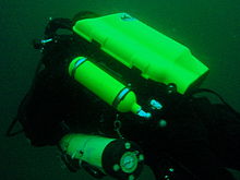
Decompression and bailout sets are not considered exotic, but are not easily available for rental. Bring your own, or ask around. Some of the service providers carry a small range of cylinders suitable for sling mount, but may not have the gas mixture you want in stock. Almost all the local divers that carry decompression or bailout cylinders routinely have their own equipment
Sho'ng'in saytlari


The dive sites described in these articles include some which are well known favourites and have been dived frequently and by many divers for decades, and also newly described sites, which may only have been dived a few times, and by a few divers. There are also sites which have been known for years, but seldom dived due to their relative inaccessibility, and a few which are basically not particularly interesting, but have been included in the interests of completeness, as the information is available, and occasionally people want to know what they are like. With a few exceptions, the information provided is based on personal observation at the sites by Wikivoyagers. All photos of marine life and features of interest were taken at the listed site.
Geographical information is provided in as much detail as is available. Sites are geolinked, which allows them to be identified on various internet map systems. Positional accuracy is usually good. The maps provided should be usable, to scale, and accurate, but are not guaranteed either to be correct in all details or complete. Clicking on the thumbnail will open a link to a higher resolution image.
Atlantic coast of the Cape Peninsula

Introduction and some tips on diving the Atlantic coast.
This coastline from Table Bay to Cape Point is exposed to the south westerly swells generated by the cold fronts of the Southern Ocean. The continental shelf is narrow in this part of the coast and swells are not greatly influenced by the narrow band of shallow water, so they retain most of their deep-water energy. These swells pound this coast most of the winter, and to a lesser extent in summer, so diving in this region is mostly a summer activity, and the frontal weather patterns far to the south are more important than local weather for swell prediction.
North westerly winds are a feature of the approach of a cold front, and in winter they can be very strong for a few days before swinging to southwesterly as the front passes. These north westerly winter storms were responsible for many shipwrecks in Table Bay and other parts of the west coast, and the associated wind waves can be severe. However the fetch is short and these onshore wind waves do not last long after the storm. They do mess up the visibility though, and this effect lasts for some time after the waves have dissipated.
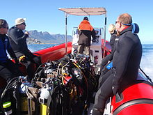
The south easterly winds are longshore to offshore in this area and tend to knock the swell down a bit. They also cause an offshore displacement of the surface water, which results in deeper water rising to take its place. This upwelling brings colder, initially cleaner water to the inshore areas, and can produce conditions of 20 m visibility and temperatures down to 8°C, though more usually 10° to 12°C. The diving is wonderful if you are sufficiently insulated. Out of the water, however, it is commonly fine and hot, with blazing sunshine high ultraviolet levels and air temperatures in the high 20 and 30° Celsius. This means you will be overheating until you get in the water, hence the comment that summer diving in Cape Town is one easy step from hyperthermia to hypothermia.
There is no escaping the need for a well-fitting, thick (preferably 7 mm), wet suit or a dry suit with an adequate undergarment for these conditions if you intend to stay for more than a few minutes. Carrying a bottle of water with your equipment to wet the outside of your suit before or after putting it on will help keep the temperature down due to evaporative cooling, specially on a windy day. Overheating after leaving the water is seldom a problem. The alternative option of kitting up at the water’s edge requires a shore party to look after your clothes, etc., while you dive, so it has become less common. Do not leave equipment unattended if you wish to see it again.
An upwelling is frequently followed by a plankton bloom, often called a red tide. This will reduce visibility considerably, particularly near the surface. Often the water will be much clearer below the surface layer, though the light levels may be a bit dim and the colour relatively green, or even brownish. The phytoplankton will bloom while the sun shines, so it is much more developed in summer.
The south-easter is an offshore wind at some sites, and besides its influence on temperature and visibility, it also affects the swim back to shore after the dive. The south-easter can appear seemingly out of nowhere on a previously cloudless and windless day, and build up to near gale force in the time you are underwater on a dive, though it is usually predictable, so take note of weather forecasts, and in any case, allow sufficient reserve air to swim back a few metres below the surface. A compass is extremely useful if you do this as it allows you to swim shallower, which is good for air consumption, decompression and warmth. A depth of 3 to 5 m is recommended for a long swim home. The strong south-easter in these cases produces a short, steep wind chop with white-caps which does not penetrate to any significant depth, but the constant slapping of waves and the spray in the air can make snorkelling unpleasant and difficult. There may also be a shallow offshore wind drift (surface current), but this takes some time to develop and gets rapidly weaker with depth and is not usually a problem below about a metre depth inshore. Further offshore the wind induced current can take you several hundred metres during a decompression stop, at a rate of about 0.5 to 1 kph.
When boat diving a deployable surface marker buoy (DSMB) is useful to both facilitate controlled ascent and accurate decompression or safety stop depth, and as a signal to the boat that you are on your way up. In strong wind conditions it will also improve your visibility on the surface, specially if your equipment is all black, so it is worth carrying even if only as a signalling device. Bright yellow has been shown to be best for all round visibility at sea, but orange and red are fairly good too.
Robben Island

These sites are all boat dives. There is no other practical way to get to them, as they are all several kilometres from the mainland across major shipping lanes.The waters around Robben Island were proclaimed a Marine Protected Area in 2019, so a permit is required to dive there. The boat operator will have to have a permit for the restricted area. Details of how this will be done are not yet known.
Local geography:Robben Island is a low, rocky shored island in the mouth of Table Bay. The island and surrounding reefs are rock of the Tygerberg series of the late Precambrian Malmesbury group. These are folded sedimentary rocks, frequently with very steep dip, which often weather to form rather jagged outcrops.
The sites include:
- 1 MV Treasure: S33°40.45' E018°19.95' (approximate)
- Wreck dive. Boat access only. Depth: 30 to 50 m
- On 23 June 2000 the damaged Panamanian registered bulk ore carrier sank off the coast of South Africa approximately 7 nautical miles north of Robben Island.
- The vessel lies upright on a fairly level bottom at about 50 m depth. The superstructure was removed shortly after the sinking by sawing it off at about 30 m depth with a cable towed by tugs as it was a hazard to shipping.
- 2 Robben Island steamer wreck: S33°49.886', E018°21.524' (approximate centre of wreckage)
- Wreck dive. Boat access only. Depth: 30 to 36 m
- Unidentified wreck of a steel steamship about 48 m long in reasonable structural condition.
- 3 MV Afrikaner: S33°50.012' E018°20.686'
- Boat access only. Deep wreck dive. Depth 43 to 50 m
- The 61 m fishing vessel struck Whale Rock in 1993 and sank while being towed away from the rock.
- 4 Whale Rock: S33°50.112' E018°22.858'
- Reef dive. Boat access only. Depth: Mostly less than 10 m
- A large shoal area of rocky reef, usually with a break over the pinnacle, which is the last resting place of a few ships.
- 5 SS Hypatia: S33°50.10’ E018°22.90’ (Turner 1988)
- Wreck and reef dive. Boat access only. Depth: Shallow, maximum probably about 15 m
- British Houston Line steamer of 5 728 tons, built in 1902. Wrecked on Whale Rock in Table Bay on 29 October 1929 in fog while on a voyage from Beira to New York with a cargo of blister copper and chrome ore.
- 6 MV Daeyang Family: S33°50.388' E18°23.133
- Wreck and reef dive. Boat access only. Maximum depth about 15 m
- A large Korean ore carrier which was wrecked on Whale Rock on 1 March 1986 when anchors dragged in heavy weather. The wreckage lies at a depth of about 15:nbsp;m
Table Bay

- 7 MV Winton: S33°52.1514' E18°29.1828 (Engine block)
- Wreck dive. Boat access, though shore access is feasible. Close to surf line. Maximum depth about 6 m.
- Wreck of a small steel freighter on a flat sand bottom.
- 8 MV Gemsbok: S33°53.0' E018°20.5'
- Boat access only. Deep wreck dive. Depth about 57 m on the sand.
- The 50 m 313 tonne buoy tender MV Gemsbok capsized and sank about 4 km from Green Point Lighthouse on 2 Seprember 1975 while transferring an anchor chain of a cargo vessel. The chain snagged and the weight of the chain caused the vessel to capsize and sink within minutes. The wreck lies on its starboard side.
- 9 Highfields: S33°53.13’ E018°25.83’ (Bow)
- Wreck dive. Boat access only. Close to major shipping lane at harbour mouth. Maximum depth 24 m.
- Wreck of a steel barque which sank after a collision in 1902.
- 10 SS Cape Matapan: S33°53.233' E018°24.533' About a kilometer north of Granger Bay harbour
- Wreck and reef dive. Boat access only. Maximum depth 25 m. The wreck is close to the shipping lane and there are no landmarks nearby.
- Wreck of a steel fishing boat which was sunk in a collision in 1960 in heavy fog.
- 11 RMS Athens: S33°53.85’ E018°24.57’
- Wreck and reef dive. Shore or boat access. Maximum depth about 7 m
- Union Company iron steam screw barque of 739 tons, built in 1856. Wrecked between Mouille Point and Green Point on 17 May 1865 during a north-west gale while trying to steam out of Table Bay. The site can be identified by the remains of the engine-block, which is visible above the water.
- 12 SS SA Seafarer: S33°53.80’ E018°23.80’
- Wreck and reef dive. Boat access recommended. Depth: Fairly shallow. Mostly between 5 and 9 m.
- The 8000-ton Safmarine freighter SS South African Seafarer was wrecked in a north westerly gale on 1 July 1966, and lies in front of the Green Point lighthouse.
- 13 Two Oceans Aquarium: S33°54.476’ E018°25.074’
- Shore access only. Confined water. Maximum depth 6 m
- Visitors may dive in the Predator tank, which is a large oval tank, or the Kelp Forest tank, which is roughly square. There are large windows, almost full height on one side, through which you can observe the other visitors watching you if you get bored with the fish.
Sea Point

Local Geography:There is a narrow coastal plain at the base of Signal Hill and Lion’s Head. The contact zone between the intrusive granites of the Yarim orol pluton and the sedimentary greywackes and shales of the Tygerberg formation of the Malmesbury series is in this area.The northern sites are on the Tygerberg rocks, which are steeply dipped and form parallel ridges and gullies, while Bantry Bay is on the granite, and has the characteristic corestone topography of rounded boulders and outcrops with sand bottom in deeper areas.
The sites include:
- 14 Three Anchor Bay: S33°54.36’ E018°23.85’
- Reef dive. Shore access. Depth: Shallow
- A small sand bottomed bay with reef to both sides. Easy access.
- 15 Sea Point Ridge Pinnacles: S33°54.905' E018°21.421'
- Reef dive. Boat access. Depth: 17 to 27 m
- An isolated pair of corestone pinnacles on a low granite ridge.
- 16 Bantry Bay: S33°55.56’ E018°22.65’
- Reef dive. Shore or boat access Depth: Less than 10 m
- This little bay is at the southern end of Sea Point, towards Clifton.
Clifton

Clifton Rocks is generally considered a shore dive, but the Paws are quite a distance offshore and are only dived from boats. Parking in Clifton is often a problem, particularly in the kind of weather in which you may wish to go diving. Weekdays will be better and early morning will help. The offshore dives avoid this problem by using boats from Oceana Power Boat Club slipway, which has its own parking problems, though not quite as serious.
Local geography:The suburb of Clifton is built on the rather steep slopes of the base of Lion’s Head above Clifton Bay. There are four beaches in the bay which are famous for white sand, shelter from the south easter and cold water. North Paw is offshore of the headland to the north, and South Paw is offshore from Clifton Rocks, on the south headland. Access to the area by road is from Sea Point to the north and Camps Bay to the south.
The reefs of Clifton are granite corestones of the Yarim orol pluton. In this area the granite base of the mountain extends to approximately the height of Signal Hill, and is capped by sandstones of the Graafwater and Table Mountain formations. Occasional rounded granite outcrops can be seen on the mountainside, which is mostly deeply weathered granitic saprolite, with some sandstone scree.
The sites include:
- North Lion’s Paw: S33°55.854’ E018°21.849’ (Exposed Rock)
- Reef dive. Boat access only. Depth: 15 to 23 m.
- A spectacular site in good conditions. A popular part of the site is the cave rock, which is slightly offshore from the exposed rocks.
- 17 North Lion’s Paw Northern Pinnacles
- 18 North Lion’s Paw Monty's Pinnacles
- 19 North Lion’s Paw Eastern Pinnacle
- 20 North Lion’s Paw Barry's Pinnacles
- 21 North Lion’s Paw Cave Rock
- 22 North Lion’s Paw Main Reef
- 23 South Lion’s Paw: S33°56.308’ E018°21.890’
- Reef dive. Boat access only. Maximum depth about 20 m.
- An extensive reef of granite corestones marked by the large outcrop which extends above the water.
- 24 Clifton Rocks: S33°56.346’ E018°22.222’
- Reef dive. Shore or boat access. Maximum depth about 14 m.
- A large area of granite corestones, bounded to the north by sand bottom. The reef extends to seaward from the shoreline at the point.
- 25 Cleeve's Tunnel: S33°56.540' E018°21.894'
- Reef dive. Boat access. Maximum depth about 20 m.
- A large corestone pinnacle with a long low tunnel
Camps Bay
Local geography:Camps Bay is in the corner made by Lion’s Head and Table Mountain. Access is over Kloof Nek from the city bowl, and round the coast from Sea Point via Clifton to the north, and from Hout Bay via Oudekraal to the south
The reefs of this area are like those of Clifton.
The sites include:
- 26 Bakoven Rock: S33°57.555’ E018°22.204’
- Reef dive. Shore or boat access. Maximum depth 17 m.
- This site is generally considered a shore dive. Parking is limited so it is most conveniently dived during the working week when there is less competition for space, otherwise get there early.
Oudekraal

This area includes some of the best and most popular shore dive sites on the Atlantic seaboard. Most can also be dived from a boat, and this is of particular importance to divers with restricted mobility on shore, as there is generally a rugged bit of coast to negotiate and in some cases a long climb. There is also a moderate to long swim at some of the sites, and at some states of the tide, heavy kelp inshore.
Local geography:The coastline at the base of the Twelve Apostles range just south of Table Mountain is steep, and south of Camps Bay, virtually undeveloped. Fortunately for divers, the coastal road is not far above sea level in the north of this area, and though there are not many off-road parking areas, the road is wide enough to park along the side.
This is an area of pale grey Yarim orol Granite corestone outcrops and boulders with some Table Mountain Sandstone boulders which have rolled down the mountainside to the water’s edge. The mountainside below the sandstone cliffs is deeply weathered granite saprolite with occasional corestone outcrops. The cuttings at the roadside display the granular yellow-brown saprolite with a thin soil covering. The underwater topography is almost entirely corestones exposed by erosion, surrounded by samd, and is a continuation of the granite boulders and outcrops at the water’s edge.

North Oudekraal
The sites include:
- 27 Dreadlocks Reef: S33°58'22.05" S18°21'42.59"
- Reef dive. Boat access. Depth: 1.5 to 20 m.
- A relatively new site. First survey 30th January 2010. This granite ridge peaks about 1.5m from the surface at low tide, but the tip is small and seldom breaks. Bottom on low granite at about 20m. Colourful and diverse invertebrate cover, and notable for the relatively large colonies of Dreadlock hydroids.
- 28 Geldkis Blinder: S33°58.67’ E018°21.62’
- Reef dive. Boat or shore access. Maximum depth about 20 m.
- A relatively infrequently dived site. The highest rock on the reef is a blinder beyond Geldkis rock which occasionally breaks the surface at low tide. Huge boulders and outcrops, and a few swimthroughs.
- 29 Strawberry Rocks: S33°58.725’ E018°21.658’ (approximate)
- Reef dive. Shore or boat access. Maximum depth about 15 m.
- The two smaller rocks to the north of Geldkis rock. Several small caverns and swimthroughs.
- 30 Geldkis: S33°58.73’ E018°21.61’
- Reef dive. Shore or boat access. Maximum depth about 15 m.
- A large group of rocks with lots of overhangs, swimthroughs and chimneys. The Dutch East Indiaman Het huys te Craijestein was wrecked on the rocks in the bay at Oudekraal on 27 May 1698 in thick mist. Three chests of treasure disappeared and the name "Geldkis" (money-chest) appears on maps of the area and is now applied to the offshore rocks.
- 31 Boardroom: S33°58.761’ E018°21.151’
- Reef dive. Boat access, though possible from shore. Maximum depth about 21 m near the pinnacle, but deeper water nearby. about 10 m on top.
- A very large boulder with a large swimthrough cave and a large overhang in an area of high profile boulder reef.
- 32 Het Huis te Kraaiestein: S33°58.85’ E018°21.65’
- Wreck and reef dive. Shore access. Maximum depth 10 m.
- Remnants of the Dutch East Indiaman Het Huis te Kraaiestein of 1,154 tons, which was wrecked in the bay at Oudekraal on 27 May 1698 in thick mist while trying to find the way into Table Bay. Some cannon, anchors and a few baulks of timber are all that are usually visible above the sand.
- 33 Mushroom Pinnacle: S33°58.781’ E018°21.521’
- Reef dive. Shore or boat access. Maximum depth 17 m.
- A submerged granite tor (stacked group of large corestones) between Geldkis and Justin’s Caves. The pinnacle is surrounded by lower outcrops separated by sandy gullies.
- 34 Sandy Cove: S33°58.90’ E018°21.65’
- Reef dive. Confined waters. Shore access. Maximum depth 4 m
- A shallow sheltered cove at Oudekraal, suitable for open water training exercises, refresher courses and testing equipment when you don’t need depth. Entry area for several other sites.
- 35 Justin’s Caves: S33°58.85’ E018°21.50’
- Reef dive. Shore or boat access. Maximum depth about 13 m.
- A group of big granite corestone outcrops and boulders with several swimthroughs, overhangs, caves and deep narrow gaps between the rocks. Spectacular in good visibility, colourful reef life.

Central Oudekraal
The sites include:
- 36 Antipolis: S33°59.06’ E018°21.37’ (Bow section)
- Wreck and reef dive. Shore or boat access. Maximum depth about 10 m.
- The tankers "Romelia" and "Antipolis" were under tow on 28 July 1977 during a north westerly gale when the tow cable to the "Antipolis" snagged on the sea bed. In the ensuing confusion the cables broke and the two ships were driven aground by the wind. The "Antipolis" ran aground at Oudekraal and was later cut down to water level.
- 37 Klein Pannekoek: S33°58.91’ E018°21.09’
- Reef dive. Boat or shore access. Maximum depth about 15 m.
- A group of large fairly low and flat rocks visible offshore to the west of the "Antipolis" and north of Coral Gardens.

South Oudekraal
The sites include:
- 38 Groot Pannekoek: S33°59.13’ E018°20.75’
- Reef dive. Boat or shore access. Maximum depth about 15 m
- A large flattish outcrop of granite, which extends a short way above the sea level at all tides. Some overhangs, crevices and small caves.
- Marjon bog'lari (Oudekraal): S33°59.270' E018°20.782' (The pinnacles)
- Reef dive. Shore or boat access. Maximum depth 17 m
- A spectacular dive in good conditions. Huge granite boulders in groups with open patches between them. There are overhangs, small caverns, a few swimthroughs, and many deep gaps and crevices. Extensively covered in colourful reef life. Possibly the best shore dive on the Atlantic side of the Cape Peninsula on a good day.
- 39 Marjon bog'lari
- 40 Coral Gardens Offshore Pinnacle
Llandudno

These sites can be accessed from the shore or by boat. Parking is limited, but the area is reasonably secure. Some walking is required, but no serious climbing as the parking is near the sea level.
Local geography:The small residential suburb of Llandudno is built on the moderately steep slopes of the Cape Peninsula below the peak of Klein-Leeukop, where the coast road (M6 – Victoria Drive) from Camps Bay crosses over the neck to Hout Bay. There is only one way into Llandudno by road, which is from the M6 near the top of the pass.This is an area of granite corestone reefs with sand bottom.
The sites include:
- 41 13th Apostle: S33°59.486' E18°19.922'
- Reef dive. Boat access. Depth: 10 to 24 m.
- A large granite pinnacle on an area of low granite reef with occasional sand patches.
- 42 Llandudno Reef: S34°00.037' E18°19.897'
- Reef dive. Boat access. Depth: 10 to about 30 m, on sand
- An unsurveyed granite reef, with several pinnacles, outcrops and gullies.
- 43 Logies Bay: S34°00.25’ E018°20.53’
- Reef dive. Shore access. Maximum depth probably about 10 m.
- A small rocky cove to the north of Llandudno beach.
- 44 MV Romelia: S34°00.700’ E018°19.860’ approximately
- Wreck and reef dive. Shore or boat access. Maximum depth about 24 m.
- The tankers Romelia va Antipolis were under tow on 28 July 1977 during a north westerly gale when the tow cable to the Antipolis snagged on the sea bed. In the ensuing confusion the cables broke and the two ships were driven aground by the wind. The Romelia ran aground at Sunset Rocks, Llandudno, where its back was broken by the heavy surf and the ship split in two. Later the bow section sank, leaving the stern mostly above sea level on the rocks. Over the years the stern section has also broken up and is no longer visible above the water.
Oude Schip headland
Local geography:Oude Schip headland lies at the foot of the Karbonkelberg between Sandy Bay to the north and Leeugat to the south, It is a low rocky headland of Peninsula granite, with several reef dives and one known wreck. It is a fairly exposed section of coast but protected from the south easterly winds by the mountain. The sites are only accessible by boat as there is no road access to this part of the shore, and most are too far offshore to safely swim.
This is an area of granite bedrock of the Yarim orol pluton, The reefs are exposed corestone outcrops and boulders, with sand patches in the deeper areas
The sites include:
- 45 Steps: S34°01.330’ E018°18.600’
- Reef dive. Boat access only. Maximum depth about 20 m.
- An area of high granite reef with deep gullies. Not actually in Leeugat, but just north of Oude Schip headland.
- 46 MV Harvest Capella: S34°01.600’ E018°18.750’
- Wreck dive. Boat access only. Maximum depth about 15 m.
- An area of mostly flattish granite reef with a few ridges and some wreckage of a steel motor fishing vessel, some of which has washed up onto the point and is visible from a distance. Not actually in Leeugat, but on the north shore of Oude Schip headland.

The Blue Flash Reefs
- 47 Rachel's Reef: S34°01.431' E018°18.151'
- Reef dive. Boat access only. Depth between about 3 and 21 m.
- Rachel's Reef is a compact granite pinnacle with surrounding high profile reef.
- 48 Humpback Ridge: S34°01.548' E018°18.142'
- Reef dive. Boat access only. Depth between about 4 and 21 m.
- A fairly massive granite pinnacle in the middle of a more extensive north-south ridge rising to about 12 m. Humpback whales have been seen near these reefs on several occasions.
- 49 Wilhelm's Wall: S34°01.502’ E018°17.931’
- Reef dive. Boat access only. Depth between about 12 and 31 m.
- A granite ridge somewhat more than 50 m long with sheer faces to the north and south, a flattish bottomed gully to the south, and another, more broken ridge south of the gully. Colourful sessile invertebrates on the sides and seaweeds on top.
The Middelmas reefs:
- Hakka Reef (Middelmas): S34°01.747’ E018°18.328’
- Reef dive. Boat access only. Maximum depth about 21 m.
- 50 Die Middelmas is a rock that projects several metres above the water at all tides, to the west of the Oude Schip peninsula.
- 51 Hakka Reef Southeast pinnacles is off this rock.
- 52 Hakka Reef Sven's Caves pinnacles is nearby at a set of pinnacles near a sand patch.
- 53 Twin Towers: S34°01.920’ E018°18.330’
- Reef dive. Boat access only. Depth about 20 m at the tops of the pinnacles to 34 m on the sand.
- A small but tall double-peaked granite pinnacle on a narrow base reef and surrounded by sand.
Leeugat (Maori Bay)

.jpg/220px-Gelderland_(1).jpg)
Although several of the sites are quite close inshore, this area is in practice only accessible by boat, as the distance to the nearest parking is too far to carry dive gear (about 3 km as the crow flies, more on foot).
Local geography:Leeugat, also known to divers as Maori Bay, lies at the foot of the Karbonkelberg, between the northern headland of Oude Schip, and Duikerpunt to the south. It is a small bay, but fairly deep close inshore, which in combination with the partial barrier afforded by the reefs at the headlands, has provided the wrecks in Leeugat bay with better protection from wave action than those on more exposed parts of the coastline. This means that not only have they lasted well for their ages, but conditions are suitable for diving more often than for many other wrecks on the Atlantic seaboard of the Cape Peninsula.
This is an area of granite bedrock of the Yarim orol pluton, The reefs are exposed corestone outcrops and boulders, with sand patches in the deeper areas
The sites include:
- 54 MV Keryavor and the Jo May: S34°02.037’ E018°18.636’
- Wreck and reef dive. Boat access only. Depth: Not available, probably between 25 and 30 m.
- These two wrecks lie next to each other approximately between the Maori and the Gelderland. The Jo May sank first and not much of her wooden structure remains. The Ker Yar Vor was a steel lobster fishing vessel and several chunks of hull structure and twisted sections of plating remain.
- 55 SS Maori: S34°02.062’ E018°18.793’ (Machinery)
- Wreck and reef dive. Boat access only. Depth: 6 to 21 m
- The SS Maori was a typical British steam cargo vessel of the early 1890s. The ship was wrecked in the bay between Oude Schip and Duikerpunt on 5 August 1909 in thick fog and drizzle while on a voyage from London to New Zealand.
- 56 SAS Gelderland: S34°02.070’ E018°18.180’
- Wreck and reef dive. Boat access only. Depth: 30 to 35 m
- The Ford class Seaward Defense Boat SAS Gelderland was scuttled on 21s ecember 1988, north west of Duiker Point, as demolition trials.
- The vessel was about 40 m long but the main part of the wreckage is now only about 20 m long as the bow and stern sections were blown right off.
- Plan B pinnacle is just to the south of the southernmost wreckage.
- 57 SS Oakburn / MV Bos 400: S34°02.216’ E018°18.573’
- Wreck and reef dive. Boat access only. Depth: Maximum 22 m
- The "Oakburn", a British cargo steamer of 3865 tons, was wrecked on the north side of Duikerpunt in fog on 21 May 1906, on a voyage from New York to Sydney. The Oakburn has pretty much fallen apart, and on 27 June 1994, the French pipe-laying crane barge Bos 400, broke its towline and stranded virtually on top of the older wreck. The Bos has started to break up, and two large sections have collapsed into the sea, though the main crane section is still firmly stuck on top of the rocks.
Outer Hout Bay


This area includes the dive sites between Duiker Point and Duiker Island and the extensive reefs to the south as far as Vulcan Rock and Tafelberg Reef. All of these are only accessible by boat. There are a number of sites being explored in this area: the reefs between Kanobi’s wall and Stonehenge, and a wreck of a lifeboat which was used to salvage materials from the Boss 400 and which lies between Stonehenge and Duiker Island are among these. There are several unexplored pinnacles in the region identified on the SAN charts as bakleiplaas, where the sea is often very lumpy due to the influence of the underwater topography on the swell.
Local geography:The suburb of Hout Bay lies in the valley between the Constantiaberg to the east and the peninsula formed by Karbonkelberg and its lesser peaks to the west. One of these peaks, the Sentinel, gives its name to a dive site at its foot. At the mouth of the valley is the business area of Hout Bay, with its small commercial fishing harbour and marina, and a public slipway used by dive charters and private dive boats for access to most of the southern peninsula dive sites on the Atlantic coast. The slipway is in good condition, wide and accessible, and has a large parking area, which on occasions can be crowded due to heavy use by commercial fishing skiboats.
The bedrock of this area is granite of the Yarim orol pluton, and most of the sites are on corestone reefs of this rock.
The sites include:
Duiker Point sites:
- 58 Die Perd: S34°02.282’ E18°18.324’
- Reef dive. Boat access only. Depth: Not available, maximum probably about 20 m
- This rock off Duiker Point extends above the water and is surrounded by rugged reefs of high outcrops and deep gullies.
- 59 Kanobi’s Wall: S34°02.365’ E018°18.138’
- Reef dive. Boat access only. Maximum depth about 25 m.
- This blinder off Duiker Point is a good site with rugged topography, good biodiversity and large depth variation. Huge boulders are stacked, with tunnels, overhangs and caves of various sizes, and lots of vertical walls, some probably 10 m or more in height.
- 60 SURG Pinnacles: S34°02.375' E018°18.015'
- Reef dive. Boat access only. Depth 9 to over 30 m.
- A group of steep granite corestone pinnacles, probably mostly huge boulders, with walls, overhangs and a swimthrough. Deep narrow cracks divide the pinnacles. Spectacular topography, covered with lots of sea urchins and vast numbers of hairy brittlestars, a moderate variety of sponges, noble corals, gorgonians, and patches of cauliflower soft coral. Red bait and Laminaria on the tops of the pinnacles. Surge can be strong when a long swell is running.
- Star Wall: S34°02.466' E18°18.087' (pinnacle)
- Reef dive. Boat access only. Depth: 6 to 32 m.
- This site has the tallest and longest wall known in the Cape Town area and is a dive site well worth visiting. A massive and continuous granite wall of about 25m almost vertical height, extending for a length of 100 m on the south face and 50 m on the south-east face. Very diverse and colourful invertebrate cover on the wall face. The sites are:
- 61 Star Wall
- 62 Star Wall - M&M Cave
- 63 Star Wall - Lollipop Pinnacle
- 64 Sunfish Pinnacle: S34°02.475' E18°18.290' (pinnacle)
- Reef dive. Boat access only. Depth: 7 to 26 m.
- A fairly large pinnacle on a rocky bottom on the way to Duiker Point from Hout Bay harbour, which has been picked up quite frequently on the echo sounders of dive boats passing over it. It has now been dived, and to some extent mapped. The site is quite pretty and should make a pleasant alternative site. Topography is rugged, with high vertical walls on two sides of the pinnacle.
Stonehenge sites:
- 65 Canyon: S34°02.595’ E018°18.073’
- Reef dive. Boat access only. Maximum depth about 35 m.
- The area is named for a gully between rows of pinnacles. Big boulders and rock outcrops cover an extensive area.
- Stonehenge: S34°02.838’ E018°18.316’
- Reef dive. Boat access only. Maximum depth about 22 m.
- The area is named for a group of tall rocks which break the surface. Big boulders and rock outcrops cover an extensive area. High profile in the deeper areas, with swimthroughs, holes and overhangs. Heavy kelp in some areas. Included in this area, Stonehenge Blinder, a pinnacle that approaches the surface and breaks in a large swell or at low tide.
- 66 Stonehenge Dusky Pinnacles - Coral Pinnacle
- 67 Stonehenge North
- 68 A-340 Pinnacle
- 69 Stonehenge Central
- 70 Stonehenge South
- 71 Stonehenge Blinder
- 72 Stonehenge Wreck
Seal Island sites:
- 73 Seal Island (Duiker island): S34°03.458’ E018°19.562’
- Reef dive. Boat access only. Chuqurlik: Sayoz, asosan 6 m dan kam.
- Xaritalarda va jadvallarda Duikereiland deb nomlangan kichik toshli orolcha turistik diqqatga sazovor joyga aylangan muhrlar koloniyasi tufayli Seal Island deb nomlandi. Buni chalkashtirib yubormaslik kerak Seal Island False Bayda.
Vulkan Rok saytlari:

- 74 Di ning yoriqlari: S34 ° 03.855 'E018 ° 18.400' - Katta 14 metrli cho'qqisi - rif tepasidagi tosh .Vulkan qoyasining 300 m shimoliy g'arbiy qismida (328 ° magnit).
- Rifga sho'ng'iydi. Faqat qayiqqa kirish. Chuqurlik: 10 dan 30 m gacha.
- Ko'rinish yaxshi bo'lsa, ajoyib sho'ng'in. Ko'plab devorlar va osmalar, suv havzalari va chuqur, keng yoriqlar. Boy umurtqasizlar qopqog'i. Dramatik keng burchakli manzarali fotosuratlar uchun yaxshi sayt.
- 75 Vulkan qoyasi: S34 ° 03.967 'E018 ° 18.582'
- Rifga sho'ng'iydi. Faqat qayiqqa kirish. Maksimal chuqurlik tosh yaqinida 25 m dan yuqori.
- Vulkan jinsi yirik granit rifining eng baland nuqtasi bo'lib, suv oqimining ba'zi holatlarida sirtini buzadi. U past va tepada tekis. Ko'rinish yaxshi bo'lsa, ajoyib sho'ng'in.
Tafelberg rifi saytlari:
- 76 Tafelberg rifi: S34 ° 04.22 ’E018 ° 18.93’
- Rifga sho'ng'iydi. Faqat qayiqqa kirish. Chuqurlik: 8 dan 30 m gacha.
- G'arbiy qismida taxminan 29 m balandlikda yuqori relyefli va qum tubi bo'lgan qo'pol granit chiqindilarining keng maydoni. Chuqur yoriqlar va jarliklar. Juda ko'p emas, balki vertikal yuzlar juda ko'p. Yaxshi ko'rinishda juda qo'pol va ajoyib topografiya.
- 77 Klein Tafelberg rifi (Salat kosasi, Yaxta halokati): S34 ° 04.442 ’E018 ° 19.191’
- Rifga sho'ng'iydi. Faqat qayiqqa kirish. Chuqurlik: 14 dan 36 m gacha.
- Katta toshlar bilan ulkan granit chiqishi. Chuqurroq joylarda qum tubi. Kuchli va ajoyib topografiya. GRP yaxtasi qoldiqlari cho'qqining eng yuqori qismida joylashgan. Rifning sharqidagi qumdan boshlab 40 dan 45 m gacha sho'ng'in qilish va shimoliy-g'arbiy yo'nalishda rif bilan suzish mumkin, ammo, ehtimol, agar siz oxirigacha etib borsangiz, dekompressiya talab qilinadi sayoz tepalik.
- Tafelberg chuqurligi:
- Rifga sho'ng'iydi. Faqat qayiqqa kirish. Qumda maksimal chuqurlik taxminan 40 m.
- Pastga va o'rta profilli granit chiqindilar, yuqoriga qarab burilgan Tafelberg chuqur cho'qqisi tepalikning janubida Klein Tafelberg rifida joylashgan. 50 m sho'ng'in qilish va rifda suzish mumkin, ammo biroz dekompressiya kerak bo'ladi.
- 78 Tafelberg chuqurligi
- 79 Tafelberg chuqur cho'qqisi
Hout ko'rfazi


Ushbu hudud Sentinel va Chapmans cho'qqisi orasidagi joylarni o'z ichiga oladi. Ularning aksariyati qayiqda sho'ng'in. Bitta istisno - Sentinelga quruqlik orqali katta qiyinchiliklarsiz kirish mumkin, ammo xavfsizlik muammosi mavjud.
Sentinel - granit qirg'oq chizig'ining odatiy maydoni, qirg'oq bo'ylab toshlar va toshli toshlar ko'p bo'lib, odatiy yumaloq profillar mavjud, Aster va Katsu Maru qoldiqlari tekis qum tubida, Die Josie-da joylashgan joy. Quyi Chapman cho'qqisi qoyalari etagida nisbatan unweathered granit
Saytlarga quyidagilar kiradi:
- 80 Sentinel:
- Rifga sho'ng'iydi. Sohilga yoki qayiqqa kirish. Chuqurlik: Ko'pincha 10 m dan kam.
- Bu Atlantika sohilidagi 30 metr chuqurlikdagi kontur qirg'oqqa eng yaqin bo'lgan joy.
- Sentinel ba'zi odamlar tomonidan vertikal jarliklar ostidagi maydon deb qaraladi va ko'plab suv o'tlari va quti meduzalari va ba'zi katta toshlar bilan tekis rif maydonidir.
- Pinnacles - qirg'oq yaqinidagi Hout ko'rfazidagi portdan tashqarida, kanalizatsiya ishlariga yaqin bo'lgan toshlar guruhi.
- 81 MV Aster: S34 ° 03.891 'E018 ° 20.955'
- Vayronagarchilik sho'ng'idi. Faqat qayiqqa kirish. Maksimal chuqurlik 28 m.
- 340 tonna, 27 m uzunlikdagi "Aster" motorli baliq ovlash kemasi Janubiy Afrikada ro'yxatdan o'tgan omar baliq ovi kemasi bo'lib, u inshootning teshiklarini tozalash va kesish bilan g'avvoslarga qulay sun'iy rif sifatida tayyorlangan va Hout ko'rfazida halokatga uchragan. "MV Katzu Maru" 1997 yil 9 avgustda. U dengiz osti kemalariga kirib borish uchun mashg'ulot maydoni sifatida ishlatilgan. Kema pastki qismida tik va buzila boshlaydi.
- 82 MV Katsu Maru: S34 ° 03.910 ’E018 ° 20.942’ (halokatning o'rtasi)
- Vayronagarchilik sho'ng'idi. Faqat qayiqqa kirish. Maksimal chuqurlik taxminan 30 m.
- Yaponiyaning "Katsu Maru # 25" trauleri dengizda noma'lum narsani urib yubordi va port tomoniga ilib qo'yildi. Hout ko'rfaziga olib borilayotganda, kemani suv bosdi va u 1978 yil 7-avgustda ko'rfazda cho'kib ketdi. Qoldiq qumning pastki qismida dengiz sathida yotadi.
- 83 Jozi o'l: S34 ° 04.497 ’E018 ° 21.256’
- Rifga sho'ng'iydi. Faqat qayiqqa kirish. Chuqurlik: 7 dan 17 m gacha.
- Hout Bay portiga yaqin bo'lgan va tungi sho'ng'in uchun mos bo'lgan Chapman cho'qqisi ostidagi sayoz rif. Granit ob-havoning ta'siriga qarab yumaloq bo'lmagan joylardan biri, bu sayt ustidagi jarliklardan ko'rinib turibdi.
Atlantika janubiy yarim oroli

Ushbu hudud Nordxukdan janubdagi yarimorolning barcha qirg'oqlarini o'z ichiga oladi. Bu tez-tez ko'ngil ochish maqsadida sho'ng'iydi, chunki u yaxshi uchirish joylaridan uzoqdir va yaxshi sho'ng'in joylari ma'lum emas. Ushbu sohada, xususan Albatros Rocks / Olifantsbospuntda bir nechta halokatlar mavjud. Qoldiqlarning faqat bir nechtasi ijobiy aniqlangan.
Saytlarga quyidagilar kiradi
- 84 SS Clan Monroe: S34 ° 08.817 'E18 ° 18.949'
- Vayronagarchilik va rif sho'ng'iydi. Faqat qayiqqa kirish. Chuqurlik: 4 dan 8 m gacha.
- Kommetjie shahridagi Slangkop dengiz chiroqidan bir oz shimolga qulab tushdi. Juda kamdan-kam hollarda sho'ng'iydi. Sayoz yassi qumtosh rifi, parchalanib ketgan joylari korallin suv o'tlari bilan o'ralgan.
- SS Tomas T. Taker:
- Vayronagarchilik va rif sho'ng'iydi. Faqat qayiqqa kirish. Chuqurlik: sayoz
- Ushbu kema toshlar ustida halokatga uchragan va qirg'oqning ba'zi qismlari ko'rinib turadi. Qoldiqlarning aksariyati juda sayoz suvda.
- 85 Afrika yulduzi:
- Vayronagarchilik va rif sho'ng'iydi. Faqat qayiqqa kirish. Chuqurlik: maksimal 27 m.
- 86 SS BiaKamon bo'limi: S34 ° 16.140 'E018 ° 22.812' Asosiy qism: S34 ° 16.217 'E018 ° 22.638'
- Vayronagarchilik va rif sho'ng'iydi. Faqat qayiqqa kirish. Chuqurlik: 3 dan 8 m gacha.
- 87 SS Umhlali: S34 ° 16.435 'E18 ° 22.487'
- Vayronagarchilik va rif sho'ng'iydi. Faqat qayiqqa kirish. Chuqurlik: 5 dan 8 m gacha.
- 88 Albatros qoyasi: S34 ° 16.495 'E18 ° 22.197'
- Rifga sho'ng'iydi. Faqat qayiqqa kirish. Chuqurlik: Ehtimol, tosh yaqinida 15 m dan kam.
- Janubi-g'arbiy riflar:
- Rifga sho'ng'iydi. Faqat qayiqqa kirish. Chuqurlik: noaniq.
- Yarim orolning g'arbiy qismida sayoz rif va suv o'tlari yotoqlarining ulkan maydoni. Bu nayzachi va kerevitlarni ov qiluvchilarning ovi va akvatoriyada o'rganilmagan.
Keyp yarim orolining yolg'on Bay sohillari


Kirish va Keyp yarim orolining Yolg'on Bay sohiliga sho'ng'ish bo'yicha ba'zi maslahatlar (Simon's Town tomoni)
Mintaqaning qolgan qismidan farqli o'laroq, Soxta ko'rfazning g'arbiy tomoni qishki g'arbiy qismdan himoyalangan, ammo buning evaziga Janubiy-Pasxa tomon yo'l oladi. Natijada, mintaqa odatda qishda sho'ng'iydi, Janubiy-Pasxa kamdan-kam hollarda uzoq vaqt yoki katta kuch bilan esadi.
Janubiy okean bo'ylab qishki frontal bo'ronlar shishlarni keltirib chiqaradi, ular kontinental shelf tomonidan sekinlashadi va Cape yarim orolining sinishi va tarqalishi natijasida ular asosan qirg'oq chizig'iga parallel ravishda tarqaladi va o'zlarining egiluvchan vaqtigacha o'zlarining ko'p kuchlarini yo'qotadilar. qirg'oq. Bu erdagi qirg'oqning notekis shakli ham ba'zi hududlarni boshqalarga qaraganda ko'proq himoya qiladi. Umuman aytganda, shimoliy g'arbdan janubi-sharqiy yo'nalishda harakatlanadigan qirg'oqning shimoliy qismidan janubiy g'arbiy shishishdan yaxshi himoyalangan, shuning uchun sho'ng'in joyini tanlash so'nggi ob-havo sharoitlariga bog'liq.
Yoz oylarida Janubi-Pasxa tez-tez, uzoqroq va umuman qattiqroq esganda, bu joy tez-tez sho'ng'in qilinmaydi va ko'rinishga, odatda, boshqa sharoitlar mos bo'lsa ham, qishga qaraganda yomonroq bo'ladi.
Ushbu hududda qish oylarida suvning harorati, odatda yozda Atlantika okeanining qirg'og'iga qaraganda issiqroq bo'ladi, bu kunduzgi soatlarning qisqarishi va ko'pincha sovuq va yomg'irli ob-havo uchun biroz kompensatsiya.
Suv harorati chuqurlikka qarab o'zgarishi mumkin. Odatda yozda termoklin bor va ko'rish termoklin ostida sezilarli darajada o'zgarishi mumkin. Sirt 18 yoki 19 ° C, pastki qismida 10 yoki 11 ° S bo'lishi mumkin, ammo farq 5 ° C yoki undan kam bo'lishi mumkin. Chuqurlikdagi sharoitlarni osongina bashorat qilish mumkin emas va ular er yuziga qaraganda yaxshiroq yoki yomonroq bo'lishi mumkin. Yuzaki qatlamlarda plankton gullab-yashnashi va sovuqning pastki suvida 3 m dan kamdan 10 m gacha ko'rinishni keskin yaxshilashi mumkin. Termoklin chuqurligi ham oldindan aytib bo'lmaydi, ammo yoz oxirida 12 dan 20 m gacha bo'lganligi ma'lum bo'lgan.
Qishda suv yuqoridan pastgacha bir xil haroratda bo'lishi mumkin va fitoplanktonning gullab-yashnashi uchun quyosh nuri kam bo'lganligi sababli, yorug'lik kam bo'lishiga qaramay, ko'rish va tabiiy yoritish yaxshi bo'lishi mumkin.
Sovuq va yomg'irli jabhalar o'rtasida shamol tez-tez esadigan yoki shamol bo'lmaydigan, yumshoq va iliq quyoshli kunlar bo'ladi, suv tekis va tiniq va sho'ng'in ajoyib bo'lsa, saytlarning ko'pligi qaerga borishni hal qilishni qiyinlashtiradi tanlov juda ko'p. Afrikaning oxirida bu erda qiyin hayot, lekin kimdir buni qilishi kerak.
Qish paytida suvning harorati odatda 13 ° C dan 17 ° C gacha, ammo 11 ° C gacha pasayishi ma'lum bo'lgan, shuning uchun bu erda yaxshi kostyum ham kerak. Yozda harorat 20 ° C dan oshishi mumkin, ammo 17 ° C dan 19 ° C gacha bo'lishi mumkin.
Sohil bo'ylab sho'ng'inlarning aksariyati nisbatan sayoz, maksimal chuqurligi 8 m dan 15 m gacha bo'lgan tartibda, garchi u erga etib borish uchun 700 metrga suzishga qarshi bo'lmasangiz, 30 metrlik qirg'oqqa sho'ng'in qilish mumkin. Sayoz suvlar quruq kostyumni unchalik foydasiz qiladi, ammo shamol va ho'l yomg'ir ostida ho'l kostyumdan chiqish kechasi quruq kostyumni kerakli variant sifatida yana yuqoriga ko'taradi. Tanlovni tanlash juda yoqimli va ko'plab mahalliy sho'ng'inchilar rejalashtirilgan sho'ng'inga qarab nam va quruq kostyumlarni almashtiradilar.
Muizenberg - Kalk ko'rfaziga

Ushbu joylar Soxta ko'rfazning g'arbiy tomonidagi eng shimoliy joylardir. Ular sayoz va janubda sharqiy shamollar va to'lqinlarga ta'sir qiladi, shuning uchun odatda qishki sho'ng'in deb hisoblanadi.
Mahalliy geografiya:Tog'lar va dengiz o'rtasida Seynt Jeyms va Kalk ko'rfazi shaharlari egallagan tor quruqlik bor va uning janubiy uchida Trappieskop nomli kichik tepalik bor. Shu payt qirg'oq chizig'i Baliq Hoek ko'rfazini hosil qilish uchun orqaga burilishdan oldin False Bay tomon buriladi. Kalk ko'rfazidagi baliq ovining kichik savdo porti ushbu koyda qurilgan.
Bu sohil Stol tog'i seriyasining qumtoshi bo'lgan maydon va janubga qariyb 7 ° ga yaqin gorizontal. Natijada paydo bo'lgan qirg'oq odatda toshloq bo'lib, ba'zi qumli joylar bilan ajralib turadi va tog 'yonbag'rining tikligini hisobga olgan holda ajablanarli darajada sayozdir. Qumning tubi Deyl Brukdan taxminan 5 m chuqurlikda va bandargohdan 9 m yaqinroqda boshlanadi.
Saytlarga quyidagilar kiradi:
- 1 Muizenberg trollari halokati
- Vayronagarchilik sho'ng'in, qayiqqa kirish. Maksimal chuqurlik taxminan 18 m.
- 1970-yillarda yoki u erda bomba portlatish amaliyoti bilan mashg'ul bo'lgan ikkita temir trauller. Ular etarlicha isrof bo'ldilar, ammo korpus tuzilmalari o'rtacha darajada buzilmagan va umurtqasizlar juda ko'p o'sgan.
- 2 Deyl Bruk: S34 ° 07.436 ’E018 ° 27.154’
- Rifga sho'ng'iydi. Sohilga kirish. Maksimal chuqurlik taxminan 6 m.
- Ushbu sayt ilmiy adabiyotlarda dengiz hayotining xilma-xilligi bilan yaxshi tanilgan va u uzoq vaqtdan beri qo'riqxona zonasi bo'lgan, ammo kamdan-kam sport g'avvoslari tomonidan sho'ng'in qilingan. Bu sayoz chuqurlik va rif hayotining xilma-xilligi tufayli sho'ng'in sayohati sifatida juda mos keladi va tinch sharoitda juda yoqimli suv osti sho'ng'inidir. Bu yarim orolning sharqiy qismida shaharning ko'p qismidan yo'lga kirish uchun eng yaqin joy.
- 3 Kalk Bay Makoni devori: S34: 07.787 'E018: 26.967'
- Rifga sho'ng'iydi. Sohilga kirish. Maksimal chuqurlik taxminan 10 m.
- Qumli va past toshli rifli beton port porti. Pastki relyef juda baland emas. Taxminan 8 dan 9 m gacha bo'lgan qumtoshlarning past rifi, tosh va qum yamoqlari.
Fish Hoek va Glencairn
Ushbu nisbatan sayoz joylar janubi sharqiy shamolga ta'sir qiladi va shishadi va odatda qishki sho'ng'in hisoblanadi. Hammasi qirg'oqqa sho'ng'in sifatida amalga oshirilishi mumkin, ammo Fish Hoek Reef va Quarry Barge odatda qayiqqa sho'ng'in sifatida amalga oshiriladi, chunki qirg'oqdan uzoq suzish mavjud. Buyuk Oq akulalar ushbu sohada sayr qilayotganini ko'rishgan.
Mahalliy geografiya:Baliq Hoekning past va nisbatan tekis vodiysi janub tomonidan Brakkloofrant va Else cho'qqilarining tik yon bag'irlari bilan chegaralangan bo'lib, u ham sharqda dengizga qiyalikka burilgan.
Fish Hoek Reef plyajdan bir oz uzoqlikda joylashgan va ushbu hududning boshqa sho'ng'in joylari toshli qirg'oqning ushbu qisqa qismida joylashgan. Simon's Town-ga boradigan asosiy yo'l, M4 va temir yo'l liniyasi tor qirg'oq chizig'ini birlashtiradi. Sunny Coveda bir nechta uylar uchun joy mavjud va Else daryosi kareridan o'tib, Glencairn plyaji bilan kichikroq vodiyni kesib tashladi. Karer nomi ushbu sho'ng'in joyining shimolida joylashgan yo'lning yuqorisidagi tog 'yonbag'ridagi ishlatilmaydigan qumtosh kareridir.
Bu nosozliklar sabab bo'lgan maydon Stol tog ' Dengiz sathidan pastga cho'zilgan qumtoshlar, zarba odatda sharqiy-g'arbiy va botiq sayoz bo'lib, Quyoshli koyda taxminan 7 ° (janub) dan Karerada taxminan 10 ° (janubiy) gacha. Ammo qo'shilish taxminan shimoliy g'arbiy / janubiy sharqda.
Saytlarga quyidagilar kiradi:
- 4 Fish Hoek Reef:
- Rifga sho'ng'iydi. Qayiqqa yoki qirg'oqqa kirish. Maksimal chuqurlik taxminan 15 m.
- 5 Sunny Cove: S34 ° 08.68 'E018 ° 26.30'
- Rifga sho'ng'iydi. Sohilga kirish. Maksimal chuqurlik taxminan 11 m.
- Saytdagi temir yo'l stantsiyasining nomi bilan atalgan. O'rtacha relyefli qumtosh jinslari, tizmalari va jarliklari qumga qadar 10 metrgacha cho'zilgan.
- 6 Karer: S34 ° 09.390 ’E018 ° 26.157’ (kirish / chiqish joyi)
- Rifga sho'ng'iydi. Sohilga kirish. Maksimal chuqurlik taxminan 10 m.
- Bir oz shimol tomon yo'l tepasidagi tepalikdagi eski qumtosh karerining nomi bilan atalgan. Taxminan qirg'oqqa perpendikulyar bo'lgan Table Mountain qumtoshining nishabga o'xshash tizmalari, vaqti-vaqti bilan qumli cho'ntaklar bilan. Profil unchalik baland emas.
- 7 Karer barjasi: S34 ° 09.395 ’E018 ° 26.474’ (taxminiy)
- Vayronagarchilik va rif sho'ng'iydi. Qayiqqa yoki qirg'oqqa kirish. 12 dan 14 m gacha chuqurlik.
- Po'lat barjaning kichik qoldiqlari. Korpus ancha buzilmagan va riflar orasidagi qumli yamoqda tik yotadi. Yuqoridan kirish uchun ikkita ushlagich ochiq, yon tomonlarning ustki qismi esa ahamiyatsiz.
- 8 Glencairn fanatlar bog'i: S34 ° 09.418 'E018 ° 26.412' (taxminiy)
- Rifga sho'ng'iydi. Qayiqqa kirish. 12 dan 14 m gacha chuqurlik.
- Qumli yamaqlar bilan past va o'rta profilli qumtosh rifining juda keng maydoni va ko'p sonli gorgon dengiz muxlislari, asosan Palmate dengiz muxlisi, shuningdek, Sinuous dengiz muxlislari va bir nechta Whip muxlislari.
- 9 P87 halokati: S34 ° 09.570 'E018 ° 26.420'
- Vayronagarchilik sho'ng'in, qayiqqa kirish. Chuqurlik: taxminan 15 m.
- Yog'ochdan yasalgan kichik dengiz patrul kemasining halokati. Uning mavqei SAN1017-da karer barjasidan 15 m masofada janubi-janubi-g'arbiy qismida ko'rsatilgan.
Simon shahri


Cape yarim orolining sharqiy tomonida Simon buxtasi deb nomlanuvchi kichik ko'rfaz, False Bay sohilining janubiy g'arbiy shishib ketishidan eng ko'p himoyalangan qismidir, shuningdek, janubi sharqiy shishlardan qirg'oqning bu qismidagi boshqa joylarga qaraganda yaxshiroq himoyalangan. .
Keypning Stol ko'rfazidagi asosiy tayanch punkti qishning shimoliy g'arbiy bo'ronlariga yomon ta'sir ko'rsatganligi sababli va Xout ko'rfazi janubning g'arbiy qismida shishib ketganligi sababli, Simonning ko'rfazi Keyptaundan o'rtacha masofada joylashgan yagona ishonchli muqobil tayanch edi va shu sabablarga ko'ra Keypdagi birinchi Gollandiyalik gubernator Simon van der Stel, Keypdagi Gollandiyalik Sharqiy Hindiston kompaniyasining qishki tayanch punkti sifatida tanlangan.
Ushbu ankrajda rivojlangan shahar Simonning shahri deb nomlandi va ankraj Qirollik dengiz flotining janubiy yarim sharida va keyinchalik Janubiy Afrika dengiz floti uchun bosh qarorgohi va kemasozlik maydoniga aylandi, u hozirgi kungacha saqlanib kelmoqda.
Shaharga quruqlikdan kirish nisbatan yomon, False Bay qirg'og'i bo'ylab burilishli va tor magistral yo'lni o'z ichiga oladi, parallel Boyes Drive va temir yo'l liniyasi, Atlantika sohilidagi Chapmanning tepalik avtoulovi va Eski Keyp-Yo'l ( Ou Kaapseweg), yarim orolning o'rtasida joylashgan tog'lar ustidan juda keskin va o'ralgan o'tish. Ularning barchasi tabiiy marshrutlardir, ammo ularning hech biri katta trafikka mos kelmaydi va shov-shuv paytida zerikarli tiqilinch bo'lishi mumkin. Hammasi Simon's Town-ga etib borishdan oldin False Bay qirg'oq yo'lida birlashadi.
Sho'ng'in joylari janubiy sharqiy shamoldan ancha himoyalangan va shishib ketadi, ko'proq janubda Long-Bichda va qishning aksar qismida, yozda esa ba'zi vaqtlari sho'ng'iydi.
Mahalliy geografiya:Shahar qirg'oq bo'yidagi tog'larning etagida joylashgan bo'lib, ular ancha tik va yon bag'irlari etagida juda oz miqdordagi tekis erga ega, ammo bu ko'rfaz sayoz va asosan qumli dipli, g'arbiy tomonida uzun qumli plyajga ega. Dengiz kemasozlik sharqida qirg'oq yana toshga aylanadi, Sifortda granit toshlari ochiq.
Ushbu hudud, ehtimol, qumtosh qirg'oq chizig'iga ega Graafwater seriya, lekin asosan qum tubida joylashgan sho'ng'in joylarida unchalik katta bo'lmagan riflar uchraydi.
Saytlarga quyidagilar kiradi:
- 10 SS klani Styuart: S34 ° 10.303 'E018 ° 25.842'
- Vayronagarchilik sho'ng'idi. Sohilga kirish. Maksimal chuqurlik 9 m.
- "Klan Styuart", 3500 tonna ingliz turretli paroxod, 1914 yil 21-noyabrda janubi-sharqiy garyada langarini sudrab borganidan keyin quruqlikka yugurdi. Kema dvigatel bloki hali ham yuzani buzmoqda.
- 11 Brunsvik: S34 ° 10.880 'E018 ° 25.607'
- Vayronagarchilik sho'ng'idi. Sohilga yoki qayiqqa kirish. Chuqurlik: 4 dan 6 m gacha.
- 1200 tonnalik ingliz Sharqiy Indiaman, Hind okeanida frantsuz admiral Lino tomonidan asirga olingan va Simon shahriga olib kelingan. 1805 yil 19-sentyabrda janubi-sharqiy dovul paytida uchta langarni yo'qotib, Simon's Town-ga yugurib chiqing. Qoldiqlardan ko'p narsa qolmagan.
- 12 HNMS Bato: S34 ° 10.998 'E018 ° 25.560'
- Vayronagarchilik sho'ng'idi. Sohilga kirish. Chuqurlik: 3 dan 4 m gacha
- 800 tonna va 74 quroldan iborat Gollandiyaning harbiy kemasi. Kema bir necha yil davomida Simonning ko'rfazida suzuvchi akkumulyator sifatida ishlatilgan. Blaauberg jangi boshlangan o'sha kuni 1806 yil 8-yanvarda olov yoqib, Simonning shahri bo'lgan Long-Bichga cho'kib ketgan. Halokatning ko'p qismi qolmagan.
- 13 Long Beach: S34 ° 11.239 'E18 ° 25.559'
- Vayronagarchilik sho'ng'idi. Suv osti navigatsiya yo'li. Sohilga kirish. Maksimal chuqurlik taxminan 9 m.
- Uzoq qumli plyaj uchun nomlangan. Bir qarashda muloyim, ammo sinchkovlik bilan o'tkazilgan tekshiruv qiziqarli va xilma-xil hayotni ochib beradi. Boshqa joyda sharoit yomon bo'lsa, bu erga borish kerak. Juda mashhur o'quv sayti va yangi jihozlarning konfiguratsiyasini tartibga solish uchun juda yaxshi.
- Kompas navigatsiya marshrutida tashrif buyurishi mumkin bo'lgan bir nechta kichik vayronalar mavjud.
- 14 Simon's Town iskala
- Sun'iy rif bilan sho'ng'in. Sohilga kirish. Chuqurlik taxminan 2 m.
- Beton qoplamali kichik iskala. Juda qulay kirish va juda boshpana.
- 15 False Bay Yacht Club qatnovi
- Sun'iy rif bilan sho'ng'in. Sohilga kirish. Maksimal chuqurlik taxminan 8 m.
- Yaxt klubi marinasi ozgina rif va qoldiqlari bilan. Ayrim vayronalar hali ham suzib yurgan Simon's Town porti devorigacha cho'zilgan.
Rim-Rok hududidagi riflar

Rim Roki atrofidagi offshor sho'ng'inlar janubiy sharqiy shishlarga nisbatan ancha ta'sirlangan, ammo chuqurroqdir, shuning uchun chuqurlikka tushganingizdan keyin ta'sir unchalik kuchli bo'lmaydi. Kuchli janubi-sharqiy shamol va chopish qayiqni sayohat qilishni noqulay holatga keltirishi mumkin, shuning uchun bu joylar yozda, ko'rish tez-tez yomon bo'lganda tez-tez sho'ng'iydi.
Mahalliy geografiya:Dengiz tubi asosan bu sohada asta-sekin qiyshaygan qum bo'lib, sho'ng'in joylari bo'lgan massiv granit chiqindilariga ega. Qum toshlardan ancha pastroq bo'lib, toshlar tagiga yaqin qo'pol qobiqli qum bilan ajralib turadi.
Rim-Rok, Rambler Rok va Kastor Rokdagi offshor saytlar granitning ulkan toshlari hisoblanadi Yarim orol pluton.
Saytlarga quyidagilar kiradi:
- 16 Maqsadli rif S34 ° 10.619 'E018 ° 27.226'
- Rifga sho'ng'iydi. Faqat qayiqqa kirish. Chuqurlik 6 dan 22 m gacha
- Ishlatilmaydigan beton dengiz qurol-yarog'ining maqsadli bazasi bo'lgan kichik granit va molozli rif.
- 17 Livingstone rifi: S34 ° 10.605 'E018 ° 27.571'
- Rifga sho'ng'iydi. Faqat qayiqqa kirish. 14 dan 23 m gacha chuqurlik
- Yaxshi yengilligi va xilma-xil umurtqasiz hayvonlar bilan o'rtacha kattalikdagi granit koreston rifi.
- Kastor Rok qoyalari: S34 ° 10.74 ’E018 ° 27.61’
- Rifga sho'ng'iydi. Faqat qayiqqa kirish. Chuqurlik: 4 dan 20 m gacha
- Granitning keng qirg'og'i. Asosan vaqti-vaqti bilan baland joylar, mayda jarliklar, toshlar, mayda yoriqlar va o'simtalar bo'lgan juda katta maydon. Rif tepasi mo''tadil relyefga ega, nisbatan sayoz qumli jarliklar, mayda toshlar va toshlar va chetlarida biroz tik joylar mavjud.
- 18 Kastor Rok - Shimoliy cho'qqisi asosiy rifning shimolidagi tor qum tubi oralig'i bo'ylab joylashgan.
- 19 Kastor Rok - Markaziy tepalik asosiy rifda joylashgan.
- 20 Mo''jizalar Pinnacle Kastor Rokning janubiy lobining g'arbiy qismida joylashgan.
- 21 Romanning dam olishi Kastor rifining janubiy lobining sharqiy qismida joylashgan
- Rim Rok qoyalari: S34 ° 10.87 ’E018 ° 27.60’
- Rif sho'ng'iydi. Faqat qayiqqa kirish. Maksimal chuqurlik 21 m.
- Ushbu maydon granit chiqindilarining klasteridan iborat bo'lib, ularning eng kattasida mayoq turadi.
- 22 Shimoliy Rim Rok Roki: Mayoqning shimoli-g'arbiy qismida juda katta, ammo nisbatan past reef kengligi, ma'lum qiziqish yo'q. Eng sayoz nuqta taxminan 11 m va shimoliy-g'arbiy qismida qum ustida 18 m.
- 23 Rim-rok: Simon's Town Harbor yaqinidagi shu nomli dengiz chiroqlari bilan belgilanganligi sababli, sho'ng'in joyini topish oson. Sharqiy uchida 20 m dan chuqurlikgacha bo'lgan yirik granit rif dengiz chiroqlari atrofidagi yuzaga.
- 24 O'rgimchak Qisqichbaqa riflari: Rim qoyasidan g'arbda ikkita kichik parallel riflar, eng sayoz nuqtada qumdan taxminan 21 m dan 16 m gacha ko'tarilgan. Ular tor qum oralig'i bilan ajralib turadi va bir-biridan oqilona ko'rinishda ko'rish mumkin.
- 25 Roman Rok janubi: Mayfdan janubi-g'arbiy janubi-g'arbiy janubi-g'arbiy janubdan janubi-g'arbiy m dan 21 m balandlikda va tepasida taxminan 18 m balandlikda joylashgan rifning kichik qismi.
- 26 Tivoli pinnacles. S34 ° 10.892 'E018 ° 27.765': Rim Rok dengiz chiroqiga qadar 301 ° magnitlangan 250 metrga yaqin.
- Rifga sho'ng'iydi. Faqat qayiqqa kirish. Chuqurlik 10 dan 22 m gacha.
- Roman qoyasidan sharqqa qisqa masofada joylashgan ixcham va baland prof.
- Friskies Pinnacles
- Rifga sho'ng'iydi. Faqat qayiqqa kirish. 12 dan 22 m gacha chuqurlik
- Kastor Rok riflaridan sharqqa qisqa masofada baland cho'qqiga ega ikkita kichik rif.
- 27 Friskies Pinnacle: S34 ° 10.778 ’E018 ° 27.822’, janubga nisbatan kattaroq va sayozroq va
- 28 Shimoliy Friskilar cho'qqisi kichikroq va chuqurroq, shimolga.
- Rambler qoyalari
- Rifga sho'ng'iydi. Faqat qayiqqa kirish. Chuqurlik 10 dan 22 m gacha.
- Simon's Town Harbor yaqinidagi Rim Rok mayoqidan sharqqa baland granit rif. Ushbu saytda to'rtta katta jinslar guruhi mavjud.
- 29 Rambler Rok shimoliy-g'arbiy cho'qqisi: S34 ° 10.924 'E018 ° 27.899'
- 30 Rambler Rok shimoliy-sharqiy riflari: S34 ° 10.916 'E018 ° 27.996'
- 31 Rambler Rok janubiy cho'qqilari: S34 ° 11.011 ’E018 ° 27.918’.
- 32 Hotlips Pinnacle: S34 ° 11.145 'E018 ° 28.091' (Hotlips Pinnacle)
- 33 Dome Rock: S34 ° 11.119 'E018 ° 27.776' (Dome Rock cho'qqisi)
- Rifga sho'ng'iydi. Faqat qayiqqa kirish. 16 dan 25 m gacha chuqurlik.
- Rim Rok mayoqining janubida va Rambler Rok riflarining janubiy qismida g'arbiy qismida joylashgan ixcham granit rif.
- Tasodifiy qoyalar qoyalari
- Rifga sho'ng'iydi. Faqat qayiqqa kirish. Rambler qoyalari janubidagi kichik bir rif guruhi.
- 34 Rudining tasodifiy toshlari: S34 ° 11.329 'E018 ° 28.037' (janubiy uchida cho'qqisi) 21 dan 26 m gacha. Yilni granit rif.
- 35 Ismsiz rif (kichik pikaplar): S34 ° 11.365 'E018 ° 28.055' (Pinnacle) Noma'lum darajada qisman o'rganilgan rif, ehtimol juda kichik.
Dengizdan Froggi hovuziga


Ushbu joylar Simon's Town shahridagi dengiz kemasining sharqida va janubida joylashgan. Ular o'rtacha darajada sayoz va janubi sharqiy shamol va shishlar ta'sirida, shuning uchun odatda qishki sho'ng'in deb hisoblanadi.
Mahalliy geografiya:Ushbu joylar granit koreston rifining barcha joylari, ammo vaqti-vaqti bilan qumtosh toshlari bo'lishi mumkin.
Seaforth saytlariga quyidagilar kiradi:
- 36 O'q-dorilar barjalari: S34 ° 11.408 'E018 ° 26.985'
- Vayronagarchilik sho'ng'idi. Qayiqqa yoki qirg'oqqa kirish. Chuqurlik: 8 dan 10 m gacha.
- Feniks shoalidan g'arbda joylashgan ikkita kichik po'lat barjalar. Ular juda katta va juda buzilgan.
- 37 Feniks shoal: S34 ° 11.388 'E018 ° 26.898'
- Rif va halokat sho'ng'idi. Qayiqqa yoki qirg'oqqa kirish. Maksimal chuqurlik 10 m.
- "Feniks" Britaniyaning 500 tonna kemasi bo'lib, 1810 yilda qurilgan edi. U 1829 yil 19-iyunda Simonning ko'rfazida joylashgan Feniks Shoalni dengiz qirg'og'iga olib borishda ozgina halokatga uchragan. Temir balastning bir qismi rifda ko'rinadi va uning poyasi yotadi qumga ko'milgan.
- Nuh kemasi va Ark qoyasi halokatga uchradi: S34 ° 11.533 'E018 ° 27.232'
- Vayronagarchilik va rif sho'ng'idi. Qayiqqa yoki qirg'oqqa kirish. Maksimal chuqurlik 14 m.
- SAN chartlarida xuddi shu nomdagi katta tosh uchun nomlangan. Toshning janubida barjaning vayronasi bor, g'arbiy qismida bug 'bilan ishlaydigan kichik kemaning halokati va undan kattaroq temir yoki po'lat idish bor, ehtimol "Parana", 1862 yilda vayron bo'lgan, shimoliy g'arbda. Barj halokatidan janubda va sharqda noma'lum paroxod yoki bug 'qayiqlarining izolyatsiyalangan qozonlari ko'rinishidagi xarobalarni topish mumkin. Shuningdek, janubda ishlatilmaydigan dengiz degaussing oralig'idan qolgan beton ustunlar qatori va toshning sharqida yana bir kichik po'lat qoldiqlari mavjud.
- 38 Nuh kemasi qoyasi
- 39 Ark Rock Barge halokati
- 40 Ark rock qozonining halokati # 1
- 41 Ark rokli qozon # 2
- Ark rock qozonining halokati # 3a
- 42 Ark rock qozonining halokati # 3b
- 43 Parana halokati, asosiy qism
- 44 Parana halokati, kichik qism
- 45 Nuh kemasi - Ikki qatorli beton ustunlar
- 46 Nuh kemasi - Beton ustunlarning bitta qatori
- 47 Nuh kemasi - Sharqiy halokat
- 48 Nuh kemasi - issiqlik almashinuvchisi
- 49 Nuh kemasi - egizak barjalar
- 50 Pingvin punkti (Toshlar): S34 ° 11.889 'E018 ° 27.254'
- Rifga sho'ng'iydi. Sohilga kirish. Maksimal chuqurlik 8 m.
- Pingvinlar qo'riqxonasi uchun nomlangan. Bu Sifortdagi Boulders plyajining janubi-sharqiy qismida joylashgan nuqta va qirg'oq rifi.
- Maidstone qoyatosh riflari: S34 ° 11.581 'E018 ° 27.466'
- Rifga sho'ng'iydi. Qayiqqa kirish Chuqurlik: 8 dan 27 m gacha.
- SA Navy xaritalarida ko'rsatilgan rif uchun nomlangan. Saytlar - Maidstone Rok, Anchor Reef va Ammo Reef
- 51 Meydstoun qoyasi
- 52 Anchor rifi
- 53 Ammo rif
- 54 Fotosuratlarning rifi (JJM rifi): S34 ° 11.839 'E18 ° 27.434'
- Rifga sho'ng'iydi. Qayiqqa yoki qirg'oqqa kirish. 3 dan 14 m gacha chuqurlik.
- Ushbu rif SAN chartlarida Photographer's rifi sifatida belgilangan. Bundan tashqari, uni 1980-yillarda JJM rifi sifatida sho'ng'igan g'avvoslarga ma'lum. Janubdagi pastki rif - JJM junior. Hududda bir nechta boshqa izolyatsiya qilingan riflar mavjud, asosan kichik, juda past va nomlanmagan.
- 55 Mash'al rifi: S34 ° 11.700 'E018 ° 27.960'
- Rifga sho'ng'iydi. Faqat qayiqqa kirish. Chuqurlik: 20 dan 30 m gacha.
- Bu Photographer rifining sharqidagi kichik rif. Ushbu saytga yozilgan birinchi sho'ng'inlardan birida g'avvos mash'alasini yo'qotib qo'ydi va bu ism tiqilib qoldi.
- 56 Tashqi fotograflar rifi: S34 ° 11.778 'E018 ° 27.898'
- Rifga sho'ng'iydi. Faqat qayiqqa kirish Chuqurlik oralig'i 20 dan 30 m gacha.
- Torchali rifdan janubi g'arbda 140 m masofada joylashgan Photographer's rifining sharqida joylashgan katta granit tosh. Yassi tepa va devorlari shaffof.

- Shamol tegirmoni offshor riflari
- Rif sho'ng'iydi. Faqat qayiqqa kirish Chuqurlik oralig'i 12 dan 30 m gacha.
- Granit chiqindilarining tarqoq guruhlarining ko'pligi. Kamdan-kam sho'ng'idi, kam ma'lum. Ko'pincha hali so'rov o'tkazilmagan. Qisman so'roq qilinganlar:
- 57 Xavfli Dag rifi
- 58 Dantelli rif
- 59 Shamol tegirmoni offshor
- 60 Tashqi shamol tegirmoni
Windmill Beach va Froggy Pond saytlariga quyidagilar kiradi:
- 61 Shamol tegirmoni plyaji: S34 ° 12.06 ’E018 ° 27.40’
- Rifga sho'ng'iydi. Sohilga kirish. Maksimal chuqurlik taxminan 8 m.
- Juda himoyalangan plyajga kirish va chiqish joylari bo'lgan qirg'oq sho'ng'in. Katta granit chiqindilar va toshlar bilan qum tubi, ba'zilari esa juda baland relyefli, tekis qumdan sirtga yaqin yoki yuqoriga cho'zilgan. Sekin-asta tokchali plyajlar. Mashhur o'quv sayti.
- 62 Qurbaqa havzasi: S34 ° 12.22 'E018 ° 27.40'
- Rifga sho'ng'iydi. Sohilga kirish Chuqurlik: 10 metrdan sayozroq.
- Ushbu kichkina ko'rfaz aslida mintaqaning rasmiy xaritalari va jadvallarida Froggy Pond deb nomlangan. Nomiga qaramay, bu dengizga sho'ng'iydi va hech qanday qurbaqa bo'lmaydi. Sayozlikda toshlar bo'lgan qumli plyaj. Sohil bo'yida juda keskin tokchalar. Ikki tomonga ham qoyali qoyalar.
- 63 Baliqchilar plyaji: S34 ° 12.357 ’E018 ° 27.497’
- Rifga sho'ng'iydi. Sohilga kirish. Chuqurlik: 10 metrdan sayozroq.
- Froggy Pondning janubidagi keyingi koy. Uning plyaji ancha uzun.
Oatlands Point

Oatlands Point - Froggy Pond zonasidan janubdagi birinchi nuqta. Katta yo'lning dengiz tomonida kichik bir guruh uylar va tog 'yonbag'rida ko'proq uylar mavjud. Uni offshorda joylashgan katta yassi tepalikli granit tosh bilan osongina tanib olish mumkin.
Mahalliy geografiya:Oatlands Point - Svartkop tepaligining etagida, janubiy yarim orolning eng baland nuqtasi - 678 m. Tog 'yonbag'ri ancha tik, uylar esa qirg'oq bo'ylab ancha tor chiziqda joylashgan. Bu False Bayning 30 m izobati qirg'oqqa eng yaqin qismida joylashgan va qirg'oqqa sho'ng'in uchun qulay joy.
Ushbu joylar granit koreston rifining barcha joylari, ammo vaqti-vaqti bilan qumtosh toshlari bo'lishi mumkin. Sohil bo'yidagi kichik toshlar ko'pincha qumtoshdir, ular yillar davomida tog 'yonbag'ridan pastga siljiydi va bemaqsad atrofida yumaloqlanadi.
Saytlarga quyidagilar kiradi:
- 64 A-ramka (Oatlands Point): S34 ° 12.484 'E018 ° 27.662'
- Rifga sho'ng'iydi. Sohilga kirish. Maksimal chuqurlik taxminan 10 m
- Hozir oddiy post bilan almashtirilgan tripod mayoqiga nomlangan. Mayoq dengiz qo'riqxonasi uchun chegara belgilaridan biridir. Sayt shuningdek, suvdan bir necha metr balandlikda joylashgan ulkan granit chiqishi bilan ajralib turadi. Shimolda qum tubi joylashgan bo'lib, u erda past rif va katta toshlar, ba'zilari sirtini buzadi va bir nechta suzish bilan shug'ullanadi. O'rtacha balandlikdagi tizmalar dengiz qirg'og'ida cho'qqisi bo'lgan katta toshdan tashqariga chiqadi. Janubda yana qirg'oqlar bor, va qirg'oq tomon rokkier bo'lib, tarqalib ketgan kichik toshlar va toshlar orasida qum tubi bo'lgan keng maydon mavjud.
- 65 D-ramka (Oatlands rifi, to'lqinli tosh): S34 ° 12.378 'E018 ° 27.996'
- Rifga sho'ng'iydi. Sohilga kirish. Chuqurlik: 15 dan 30 m gacha.
- Bu soxta ko'rfazning g'arbiy qismida, 30 metrlik kontur qirg'oqqa eng yaqin joylashgan joy. 30 metrlik sho'ng'in sho'ng'in qilish istagida bo'lgan g'avvoslar buni shu erda qilishlari mumkin.
- Rifga granitning bir nechta yirik chiqindilari kiradi, ular orasida qum tubi bor. Ikkala tomondan 14 metrgacha deyarli vertikal pasayish bilan yuzadan taxminan 4 m balandlikka ko'tarilgan bitta nuqta bor. Aksariyat qismlar deyarli baland emas. Janubiy rifda "To'lqin qoyasi" deb nomlanuvchi toshning chiqib ketadigan qismi bor.
Rocklands Point

Oatlands Pointning janubida, qirg'oq tik bo'lib boradi va uylar unchalik ko'p emas. Yo'l qirg'oq bo'ylab shamolni silkitib, Millerning punktiga qarab biroz balandlikka erishmoqda. Rocklands Point yo'ldan Ispaniya Rok tomonidan tanilgan. taxminan 100 m dengizdagi o'rtacha kattalikdagi granit tosh va mintaqadagi eng katta ko'rinadigan tosh.
Sohil Roklendlar Poytntida ancha tik bo'lib, yaqin atrofda uylar yo'q. Rocklands blinder va Ispaniya qoyalarining sayoz toshli rif qirg'og'ining keng maydoni mavjud. Ispaniya qoyasidan janubda va Stern rifi deb nomlanuvchi janubga blendergacha cho'zilgan, tarqoq granit rifining maydoni, asosan past, ammo unchalik baland bo'lmagan chiqishlar mavjud. Ushbu hudud murakkab va hali xaritaga kiritilmagan.
Shimol va janubdagi joylar singari, bu qum tubidagi granit toshli toshlar maydonidir, ammo suv qirg'og'ida qumtosh toshlari tez-tez uchrab turadi.
Saytlarga quyidagilar kiradi:
- 66 Jinni rifi: S34 ° 12.817 ’E018 ° 28.044’
- Rifga sho'ng'iydi. Qayiqqa kirish. Chuqurlik: 2 dan 14 m gacha.
- Katta granit toshli toshlar va qumloq taglikdagi baland toshlar. Rif juda kichkina va singan, ammo ixcham va barcha toshlar bir-biriga yaqin. Shimoliy uchida ulkan tosh bor, u to'rtta kirish joyi bo'lgan kichik qum tubi bilan suzishni hosil qiladi.
- 67 Rocklands Blinder (Muhr koloniyasi): S34 ° 12.9 ’E018 ° 28.0’
- Rifga sho'ng'iydi. Sohilga yoki qayiqqa kirish. Chuqurlik: 3 dan 13 m gacha.
- Asosiy rif - qumning 13 m balandligidan shimoliy sharqqa, tepasida esa 3-4 metr chuqurlikka ko'tarilgan granitning katta qismlari. Dengiz qirg'og'i asta-sekin ko'plab mayda toshlarga va past toshlarga qarab pastga qarab buriladi. Kichikroq ikkinchi rif baland va qum tubida.
- 68 Ispaniyalik rok: S34 ° 13.03 'E018 ° 28.03'
- Rifga sho'ng'iydi. Sohilga yoki qayiqqa kirish. Maksimal chuqurlik 13 m.
- Ispan tog 'jinsi - qum tubida baland cho'qqidir, u suvdan bir necha metr balandlikda joylashgan. Qo'shni past rif shimol tomonda joylashgan. G'arbda yana bir cho'qqisi bor, bu toshlar toshlari va toshlar guruhini o'z ichiga oladi, ulardan biri vaqti-vaqti bilan yorilib ketadi.
- 69 Alpha rifi (Tashqi ispaniyalik): S34 ° 12.987 'E018 ° 28.184'
- Rifga sho'ng'iydi. Qayiqqa kirish. Chuqurlik 2 dan 15 m gacha.
- Sayt ilgari tashqi ispanlar nomi bilan tanilgan, ammo Alpha rifi endi keng tarqalgan foydalanishga o'xshaydi. Rif - sharq-g'arbiy guldastaga bo'lingan ikkita asosiy qismdagi granit toshli toshlar.
- 70 Omega rifi: S34.21426 E018.47412
- Rif sho'ng'in, Qayiqqa kirish. 15 dan 25 m gacha chuqurlik.
- A granite corestone reef about 220 m long from NW to SE, and about 80 m wide. Not often dived.
- 71 Stern Reef: S34°13.164’ E018°28.032’
- Reef dive. Shore or boat access. Maximum depth about 14 m.
- An extensive area of high to low relief granite corestone outcrops on a sand bottom, marked by a rock which breaks the surface at some states of the tide.

Millerning nuqtasi

Local geography:This part of the peninsula coastline is a steep mountainside below the Swartkopberge. The mountainside is quite steep close to the shore, but on reaching the sea, the slope flattens out dramatically. The small rocky peninsula of Miller’s Point juts out rather abruptly into the bay and provides a sheltered site for the slipway from which most of the boat launches in this area are made. There is sufficient reasonably level ground for extensive parking areas off the main road, including boat trailer parking.
This area is characterised by large areas of granite corestone reef interspersed with sandy patches, and relatively flat sand bottom further out. There are also sandstone boulders along the shoreline. Many of the reefs are fairly large areas of massive outcrops with ridges, gullies and boulders on top, some of which are very large.
The sites include:
- 1 SAS Pietermaritzburg: S34°13.303’ E018°28.465’
- Wreck dive. Boat access only. Maximum depth 22 m.
- This 1330 tonne minesweeper was launched in 1943 as HMS Pelorus, and was sold in 1947 to the South African Navy and renamed HMSAS Pietermaritzburg. It was scuttled by explosive charges on 12 November 1994 to form an artificial reef. The wreck lies upright on the sand and is slowly collapsing.
- Caravan Reef including PMB Pinnacles, North Caravan, Central Caravan, South Caavan, Inner Caravan.
- Reef dive. Boat access only. Depth: 3 to 22 m
- This site is offshore of the caravan park at Miller’s Point, which may be the origin of its name. Extensive granite reefs on sand bottom. The reef may extend continuously to Miller's Point.
- 2 Caravan Reef - PMB Pinnacles
- 3 Caravan Reef - North Caravan
- Caravan Reef - Caravan Central
- 4 Caravan Reef - South Caravan
- 5 Caravan Reef - Inner Caravan
- Millerning nuqtasi: S34°13.822’ E018°28.411’ (Slipway)
- Reef dive. Shore access. Depth: Shallow inshore.
- Fairly shallow rocky reef of granite outcrops and boulders, some smallish swimthroughs and quite a few overhangs and holes under boulders.
- 6 Miller's Point slipway
- 7 Miller's Point tidal pool
- 8 Miller's Point - Rumbly Bay
- 9 Murphy's: S34°13.958' E018°28.988'
- Reef dive. Boat access. Depth: 14 to about 20 m.
- Small pinnacle with medium profile adjacent reef of boulders and outcrops over a fairly large area.
- 10 Boat Rock (Bakoven Rock): S34°14.05’ E18°29.05’
- Reef dive. Boat access only. Maximum depth 22 m.
- Coarse shelly sand bottom at about 14 m with big granite boulders and reef. The rock that gives the site its name extends a few metres above sea level. High relief and a lot of small holes under rocks, mostly too small to swim through.
Qal'aning qoyalari

This has been a marine sanctuary area for many years and as a result is one of the best sites for fish. There are several excellent dive sites accessible from a very limited amount of roadside parking, or by a short boat ride from Miller's Point.
Local geography:This part of the peninsula coastline is a steep mountainside below the Swartkopberge. There is very little ground along this strip which is not steep, but on reaching the sea, the slope flattens out and the small rocky peninsula of Castle Rocks juts out into the bay. There is sufficient reasonably sloped ground for a few houses above and below the main road.
This area is characterised by granite corestone reefs with sandy patches between them, and almost flat sand bottom further out. There will occasionally be the odd sandstone boulder which has made its way a short distance offshore with the assistance of wave action and gravity, and a lot of the smaller shoreline boulders are sandstone. Many of the reefs are fairly large areas of massive ridges, gullies with occasional loose boulders on top, and some of these boulders are huge.
The sites include:
- 11 Fan Reef: S34°14.165 E18°29.260
- Reef dive. Boat access only. Depth: 25 to 30 m.
- A low granite outcrop at about 30 m maximum depth, with a large number of sea fans.
- 12 Shark Alley: S34°14.21’ E018°28.60’ Estimated
- Reef dive. Shore or boat access. Maximum depth about 12 m.
- Named for the Cowsharks often seen at the site. Big granite boulders and outcrops with sand patches. Shark Alley is between the kelp forests on near-shore reef and the reef surrounding Pyramid rock.
- Pyramid reef
- Reef dive. Shore or boat access. Maximum depth about 12 m.
- Named for the pointed rock that marks the site. It projects above the water at all tides and is easily identified. Large granite boulders and outcrops with sand around them in deep areas and at the bottom of some gullies. Several small tunnels, caves and overhangs. Lots of fish.
- 13 Pyramid Rock: S34°14.225’ E018°28.698’
- 14 Castle Pinnacles: S34°14.356’ E018°28.826’ — A group of fairly tall pinnacles along the edge of the sand. One of them has a large swimthrough under it.
- Sansui Reef An area of picturesque small ridges and boulders on a rippled white sand bottom near the Castle Pinnacles.
- Castle Rocks and Parson’s Nose:
- Reef dive. Shore access. Maximum depth about 18 m.
- Castle Rocks applies to the point as a whole and the offshore rocks to the south east. The point is a small rocky peninsula that can be an island at high tide.
- The small headland just to the south of Castle Rocks is known as Parson’s Nose. Castle Pinnacles is actually part of the Pyramid Rock reef, though if dived from the shore, the Castle Rocks north entry is likely to be used,
- 15 Castle Rocks North SideS34°14.322’ E018°28.65’
- 16 Castle Rocks Point Reefs (Outside Castle) S34°14.4’ E018°28.8’
- 17 Inner Castle (South Castle) S34°14.46’ E018°28.674’
- 18 Phone reef: S34°14.225’ E018°29.202’
- Reef dive. Boat access. Depth 15 to about 24 m.
- A small patch of granite reef east of Outer Castle and north of Giant's Castle. There is a compact group of tall outcrops to the east of the reef, with the top of the pinnacle at about 15 m depth, The reef is surrounded by sand bottom. There is some unsurveyed reef to the south.
- 19 Giant's Castle: S34°14.362’ E018°29.225’
- Reef dive. Boat access. Depth 17 to about 30 m.
- A small patch of granite reef east of Outer Castle. The main feature is a compact group of tall outcrops with the top of the pinnacle at about 17 m depth, Below 24 m and the reef extends mainly to the east, and it is surrounded by sand bottom. There is a small low outlier to the north and Zigzag Reef reef is a short distance to the east.
- 20 Zigzag Reef: S34°14.362’ E018°29.275’
- Reef dive. Boat access. Depth 20 to about 33 m.
- A small patch of granite reef east of Giant's Castle. The main feature is a tall and massive but compact outcrop with the top of the pinnacle at about 20 m depth, Below 24 m the low reef extends mainly to the north-east, and it is surrounded by sand bottom.
- Pie Rock reefs:
- Reef dive. Boat access only. Depth: 5 to 25 m.
- Large granite corestone outcrops and boulders. There is a pinnacle to the east of the site, where it is generally deepest. Spectacular site in good visibility, and there are usually lots of fish.
- 21 Outer Castle (Blindevals): S34°14.320’ E018°29.002’ — Depth: about 3 to 33 m. A blinder off Castle Rocks, which breaks if there is much swell. It is marked on the SAN charts as “blindevals”. The main feature of the site is a huge granite boulder on a rock base standing on four points with a swimthrough gap underneath and a small air trap overhang. Part of the Pie Reef area.
- 22 North Pie Rock Reef: S34°14.375' E018°29.090' — Two adjacent groups of pointy pinnacles rising to about 9 m
- 23 South Pie Rock Pinnacles: S34°14.445' E018°28.985' — A group of pinnacles on a lobe of reef extending southwards between two sand tongues.
- 24 West Pie Rock Reef: S34°14.396' E018°28.943' — A lobe of reef extending in a southwesterly direction.
Finlayning Keklik nuqtai nazaridan nuqtasi
The stretch of coastline south of Castle Rocks to Smitswinkel Bay is not really accessible from the road, partly due to the higher altitude of the road in this area and partly due to the rather steep mountainside, so these dive sites, though mostly close to the shore, are almost always dived from a boat.
The stretch of coastline south of Castle Rocks to Smitswinkel Bay is not really accessible from the road, partly due to the higher altitude of the road in this area and partly due to the rather steep mountainside, so these dive sites, though mostly close to the shore, are almost always dived from a boat.
Local geography:There are two small points along this relatively straight coastline at Finlay’s Point and Partridge Point, where some very large granite corestones form reefs which extend some distance into the bay. A few of these project quite high above the water and are easy landmarks for the dive sites.
The shoreline is consistently rocky in this section, and is made up of granite corestones with sandstone boulders which have found their way down the mountainside over the years. Above the waterline, the lower mountainside is granitic saprolith with dense vegetation cover.

The Finlay's Point area sites include:
- 25 Finlay's Point (Jenga Reef): S34°14.959' E018°28.611'
- Reef dive. Boat access. Shore access is possible but rather athletic. Maximum depth about 15 m.
- The last big boulders north of Partridge Point. Bottom is mostly low to moderate rocky reef of outcrops and boulders of assorted sizes, some pretty big, in chaotic arrangement. Directly off the big corestones of the point is an area of big boulders and rugged reef, with small patches of sand.
- Graeme's Spot and The Jambles
- Reef dive. Boat access only. Depth 9 to 24 m.
- Large granite outcrop and huge boulders on an extensive area of granite corestone reef bordered by sandy areas to the west, north and east, and Carnaby Street Pinnacle tom the south. Good biodiversity and reef cover and spectacular topography.
- 26 Jambles: S34°14.885' E018°28.890' —
- 27 Gremning joyi: S34°14.9029' E018°28.9170' —
- 28 Finlayning eng yuqori cho'qqisi: S34°14.970' E018°28.780'
- Reef dive. Boat access only. Depth 9 to 18 m.
- Large granite outcrop and boulders on an extensive area of granite corestone reef bordered by a sandy strip to the south. Contiguous reef extends to The Jambles to the north and Carnaby Street Pinnacle to the east.
- 29 Carnaby Street Pinnacle: S34°14.980' E018°28.920'
- Reef dive. Boat access only. Depth 9 to 24 m.
- Large granite outcrop and large boulders on an extensive area of granite corestone reef bordered by sandy areas to the south and east, Graeme's Spot to the north, and Finlay's Pinnacle to the west.
- 30 Finlay chuqur (Mont Blanc): S34°15.005' E018°29.194'
- Reef dive. Boat access only. Depth: 20 to 30 m.
- This is a small granite outcrop reef on a sand bottom directly offshore from Finlay's Point on the 30 m depth contour. Rich in Gorgonian sea fans.
- 31 Atlantis rifi: S34°15' E018°29'
- Reef dive. Boat access only Depth 4 to 27 m.
- A pair of huge granite pinnacles (The Pillars of Hercules), on an extensive area of high and low profile reef. Excellent diversity of reef cover, shoals of fish and some exceptionally dense groups of gorgonian sea fans.
The Partridge Point area sites include


- 32 Sherwood Forest: S34°15.190' E18°29.010' (Pinnacle) between Atlantis and Partridge Point.
- Reef dive. Boat access only. Maximum depth about 30 m.
- Reported on Underwater Cape Town as newly discovered site on 3 May 2012. Lots of sea fans.
- 33 Baliq tanki: S34°15.229’ E018°28.930’ (Pinnacle)
- Reef dive. Boat access only. Maximum depth about 21 m.
- Compact granite reef, Lots of sea fans.
- Partridge Point
- Reef dive. Boat access only. Maximum depth 26 m.
- The site known as Partridge Point includes the Big Rock group of rocks to the south, while Seal Rock (or Deep Partridge) is the reef offshore of the low rock to the east of the point. Peter's Pinnacle is the reef inshore and slightly south of the Big Rock. Very large granite boulders and outcrops, some extending above the surface by several metres.
- 34 Seal Rock: S34°15.3370' E018°28.8920' — A fairly large flattish rock used as a haulout rock by seals with fairly shallow reef around it.
- 35 Deep Partridge: S34°15.3500' E018°29.0000' — A lobe of high profile reef sloping down to a sandy bottom at about 27 m.
- 36 Dave's Caves: S34°15.3780' E018°28.7040' — An exposed rock with a little cave under it in a kelp forest
- 37 Keklik punkti - Katta tosh: S34°15.4650' E018°28.7880' — A large exposed rock marking a moderate depth area of high profile reef with a large swimthrough and a small air-trap overhang. Maximum depth about 21 m on the sand to the south and east.
- 38 Peter's Pinnacles: S34°15.5150' E018°28.6870' — A group of shallow pinnacles with a swimthrough cave. Sand depth about 15 m
Smitsvinkel ko'rfazi

The wrecks of Smitswinkel bay are among the best known and most popular boat dives of the Cape Town area. The water is deep enough to reduce surge significantly and shallow enough for recreational divers. The wrecks are easy to find, large and sufficiently intact to be recognisable, and have also developed a thriving ecology which includes a few relatively rare organisms.
Local geography:Smitswinkel Bay is a moderately large bay on the east side of the Cape Peninsula. The coast road gains altitude as it winds along the mountainside south of Simon’s Town and turns inland at Smitswinkel Bay.
To the north of the bay, the exposed rock at sea level is Yarim orol granite, but on the south side the Graafwater sandstone extends below sea level. The bottom of the bay is flat sand.
The sites include:
- 39 SAS Transvaal: S34°15.956’ E018°28.778’ (Bow)
- Wreck dive. Boat access only. Depth 27 to 34 m.
- Loch class frigate "HMSAS Transvaal" F602 was launched at Belfast on 2 August 1944. The ship was sold for scrap and scuttled by explosive charges in Smitswinkel Bay to form an artificial reef on 3 August 1978. The wreck lies upright on a sand bottom and has partly collapsed.
- 40 MFV Orotava: S34°16.023’ E018°28.796’ (bow)
- Wreck dive. Boat access only. Depth 23 to 34 m.
- The "MFV Orotava" was built in 1958. The trawler was donated to the False Bay Conservation Society along with the Princess Elizabeth by Irvin and Johnson. In August 1983 the vessels were towed out to Smitswinkel Bay and scuttled. The Orotava is the larger of the two trawlers and lies on the sand heeled to port about 20°.
- 41 Good Hope Reef: S34°16.049’ E018°28.899’
- Reef dive. Boat access only. Depth 30 to 35 m.
- A small granite reef with lots of gorgonian sea fans.
- 42 MFV Princess Elizabeth:S34°16.060’ E018°28.816’(bow) S34°16.068’ E018°28.839’ (stern)
- Wreck dive. Boat access only. Depth 22 to 36 m. The Princess Elizabeth was built in 1961. The trawler was badly damaged by a fire and was donated to the False Bay Conservation Society along with the Orotava by Irvin and Johnson. In August 1983 the vessels were towed out to Smitswinkel Bay and scuttled. The Princess Elizabeth is the smaller of the two trawlers and lies on the sand with a slight list to starboard.
- 43 SAS Good Hope: S34°16.80’ E018°28.851’ (midships)
- Wreck dive. Boat access only. Depth 27 to 36 m.
- The Loch class frigate "HMSAS Good Hope" was launched in 1944. The vessel saw service as a convoy escort during the closing stages of World War II and was for many years the flagship of the SA Navy. The ship was sold for scrap and scuttled by explosive charges in Smitswinkel Bay to form an artificial reef on 18 June 1978.
- 44 MV Rockeater: S34°16.135’ E018°28.855’ (Bow)
- Wreck dive. Boat access only. Maximum depth 34 m
- The 65 m "MV Rockeater" was built in New Orleans in 1945 as a coastal freighter for the United States Navy. The ship was bought by Ocean Science and Engineering (South Africa) in 1964 to be used for marine prospecting. The Rockeater was towed to Smitswinkel Bay on 15 December 1972 and scuttled.
- Smits Swim
- Wreck dive. Boat access only. Depth 22 m to maximum of 36 m
- It is possible to visit all five wrecks on a single no-decompression dive. This is occasionally organised for people who want to have been there and done that.
Batsata hududi

A small group of dive sites just to the south of Smitswinkel Bay. They are inaccessible by land due to the steep cliffs along the shore and lack of nearby roads.
Local geography:These sites are at the foot of Judas Peak, the mountain peak on the south headland of Smitswinkel Bay. Their position at the base of the steep cliffs gives them protection from south westerly winds and swell, but they will catch some of the north westerly wind which comes through the gap above Smitswinkel Bay. They are exposed to south easterly winds and waves.
The shoreline and shallow reef at Smits Cliff is Stol tog ' Sandstone, probably Graafwater series, while the offshore reefs at Smits Reef and Batsata Rock are Yarim orol Granite. The unconformity is near sea level in this area.
The sites include:
- Smits Reef
- Reef dive. Boat access only. Depth 6 to 27 m.
- This is a very large area of granite reef extending north from near the Batsata Rock into the mouth of Smitswinkel Bay. It is a huge outcrop rising from coarse shelly sand bottom at about 27 m at the east side to 5 m on top. The reef has gradually sloping low areas and vertical walls, narrow deep gullies and ledges along jointing lines. Kreef Reef is a fairly large, relatively low profile outlying reef to the north.
- 45 Kreef Reef: S34°16.360’ E018°28.780’ — A fairly large, relatively low profile outlying reef to the north.
- 46 Horseshoe Reef: S34°16.410’ E018°28.940’ — The pinnacle on the northeastern ridge.
- 47 Smits Reef: S34°16.4860’ E018°28.9290’ — The top of the main reef at about 5 m depth.
- 48 Smits Reef - Batsata Maze: S34°16.5170’ E018°29.0170’ — A group of huge boulders clustered together on the bedrock forming several small caves, gullies and swimthroughs.
- 49 Smits Reef - West Pinnacle: S34°16.495’ E018°28.863’ — A group of pinnacles rising to about 6 m at the south end of a large but relatively low outcrop to the west of the main reefs.
- 50 Smits Cliff (Hell’s Gate): S34°16.48’ E018°28.41’
- Reef dive. Boat access only. Maximum depth about 16 m.
- The cliffs at the south side of Smitswinkel Bay are marked on the charts as Hell’s Gate. The site is not dived very often as there are more popular sites which are more accessible. As a result it is mostly unexplored and has not been mapped. The reef appears to be mostly sandstone.
- Batsata Rock Reefs
- Reef dives. Boat access only. A large area of mostly granite reef.
- 51 Batsata Blinder: S34°16.553' E018°28.840' — The half-tide rock north of the exposed rock.
- 52 Batsata Rock: S34°16.602’ E018°28.830’ — Sandstone reef with granite substrate at greater depth. Fairly shallow around the exposed rocks, maximum depth not known.
- 53 Banging Rocks Reef: S34°16.775’ E018°28.830’ — Granite corestone reef, depth 6 m on top of the pinnacle, 19 m on sand patch a few metres to the east. Maximum depth about 24 m.
Buffels ko'rfazi
This site is inside the Cape Point National Park area. Access is controlled by the Parks Board and various fees are charged. A slipway at Buffels Bay is also controlled by Parks Board, and the facilities are usually in good condition, It would probably be more popular if access was allowed after 6 pm.
Local geography:Buffels Bay is the closest place to Cape Point where there is road access to a place sufficiently sheltered for a slipway to be viable.
The shoreline is sandstone in this area.
The sites include:
- 54 Bordjiesrif: S34°18.99’ E018°27.83’
- Reef dive. Shore access. Depth: Fairly shallow.
- Shallow sandstone reef in the Cape Point National Park area.
- 55 Buffels ko'rfazi: S34°19.217' E018°27.73'
- Reef dive. Shore access. Depth: Fairly shallow, less than 10 m.
- Shallow sandstone reef in the Cape Point National Park area.
False Bay Offshore


Introduction and some tips on diving the Central False Bay sites.
All the sites in this area are fairly far offshore, and can only be done as boat dives. They are also relatively deep and because of the long boat trip and exposed positions, generally only dived when conditions are expected to be good.
This area is exposed to the same south westerly swells as the Atlantic coast, but they must travel over a much wider continental shelf, much of which is less than 100 m deep, so there is a significant dissipation of wave energy before it reaches the shoreline.
During summer the strong south easterly winds have sufficient fetch to produce sea states which are unpleasant and though the wave action may not produce a great deal of surge at the bottom, the surface conditions may be unsuitable for diving, and in winter the north-wester can have a similar effect.
As the area is affected by the winds and wave systems of both winter and summer, there is less seasonal correlation to suitable conditions, and it is simply dived when conditions are good, which is not very often, but may be more often than previously thought, and at some reefs the visibility may be better than inshore.
It is quite common for the surface visibility offshore to be poor, with better visibility at depth, but the reverse effect can also occur. These effects are often associated with a thermocline, which is associated with midsummer to autumn.
Water temperature can differ with depth in summer from 20°C on the surface to 9°C at the bottom at 28 m, sometimes with a distinct thermocline, though usually there is less of a change, and in winter the temperature may be nearly constant at all depths. A dry suit is recommended for any of these dives, but they are also often done in wetsuits.
There is often a surface current associated with wind at the offshore sites, which generally sets to the right of the wind direction.
Riflar


These sites are not dived as frequently as the inshore reefs, as they are further from the launch sites and therefore take considerably longer to get to. They are also more exposed to the weather from all directions, so the trip is often bumpy. However, as they are relatively deep, and far offshore, the visibility can be very good, and may well be better than inshore areas at any given time, particularly with an onshore wind and swell. Unfortunately this is not reliably predictable.
Local geography:The topography of the reefs differs according to the geology of the area. As a result the character varies enormously.
Seal Island, Whittle Rock, Anvil Rock and Bellows Rock are granite outcrops, probably all part of the Keyp yarim oroli pluton. Steenbras Reef is sedimentary rock, thought to be Tygerberg formation of the Malmesbury series, but looks more like sandstone than shale, and Rocky Bank is sandstone, probably of the Stol tog ' group.
The sites include:
- 1 Choirboys Reef: S34°08.005' E18°45.270'
- Reef dive. Boat access only. Depth 20 to about 26 m
- Hard sedimentary rock reef, in moderate to low profile ridges and gullies.
- 2 Seal Island: S34°08.25’ E018°34.95’
- Cage dive. Boat access only. Depth shallow — the cages are only about 2 m deep.
- These dives are for one purpose only: to see sharks. Other fish may be attracted to the bait, but that is not what you do this dive to see. Cage dives must be done through a licensed Shark Cage Diving charter.
- 3 East Shoal: S34°08'54" E18°38'47"
- Reef dive. Boat access only. Depth probably about 2 to 25 m.
- The reef is said to be Stol tog ' sandstone. A seldom dived site due to distance from launch sites, with an astonishing density of echinoderms.
- 4 Drop Zone: S34°08.561' E18°45.829'
- Reef dive. Boat access only. Depth probably from about 12 to 25 m.
- The moderate profile but extensive reef is sedimentary rock, either Malmesbury series or Stol tog ' sandstone. It was only dived by charter boats beginning in 2014. Colourful invertebrates, including large numbers of gorgonian sea fans.
- 5 Moddergat: S34°09.150' E18°49.650'
- Reef dive. Boat access only. Depth probably from about 13 to 16 m.
- The moderate to low profile but extensive reef is sedimentary rock, either Malmesbury series or Stol tog ' sandstone. It was only dived by charter boats beginning in 2014. Colourful invertebrates, including quite large numbers of nudibranchs. Also known as a fishing spot, but not many fish seen of a size worth catching.
- 6 Sterretjies Reef: S34°09.364' E18°45.039'
- Reef dive. Boat access only. Depth 16 to about 30 m
- Hard sedimentary rock reef, in moderate to low profile ridges and gullies.
- 7 York Shoal: S34°09.367', E018°35.583'
- Reef dive. Boat access only. Depth is between 4 and about 28 m.
- The reef is a hard sedimentary rock. It is near Seal Island where Great White sharks are a tourist attraction.
- Steenbras Deep Reef
- Reef dive. Boat access only. Depth 17 to 30 m.
- This site is at the southern end of a long ridge towards the east side of False Bay. The southern pinnacle is irregular in shape, with a large number of cracks, grooves and indentations, mostly not very deep. Sand is coarse and shelly with lots of bryozoan detritus at the edge of the reef. There is also a northern pinnacle, though both are relatively flat.
- 8 Steenbras Deep - North Pinnacles: S34°12.15’ E018°45.57’
- 9 Steenbras Deep - South Pinnacles: S34°12.642’ E018°45.498’
- 10 Off-Whittle Ridge: S34°14.364' E18°34.847'
- Reef dive. Boat access only. Depth 19 m to more than 30 m.
- An area of granite corestone reef nearly 2 km to the west-northwest of Whittle Rock. The pinnacle is in the form of a ridge running roughly north-south with a cluster of large boulders to the northeast, and is quite small. The topography is rugged in the ridge area, with a wall down to about 25 m on the west side.
- Whittle Rock
- Reef dive. Boat access only. Depth 4 m to more than 36 m.
- This is a large area of granite corestone reefs surrounded by sand. The topography varies considerably as it is such a large area. The top of the shallowest pinnacle is at about 4 m depth, and the surrounding sand is around 30 to 40 m.
- 11 Kelly's Anchor: S34°14.668' E18°33.646'
- 12 Riaan and Sven's anchor: S34°14.735' E18°33.590'
- 13 North-west corner pinnacles: S34°14.750' E18°33.482'
- 14 JJ's anchor: S34°14.756' E18°33.720'
- 15 September anchor: S34°14.762' E18°33.575'
- 16 Whittle Rock North-west Pinnacle: S34°14.765’ E018°33.622’
- 17 Euphrates anchors: S34°14.776' E18°33.801' and S34°14.783' E18°33.795'
- 18 Little anchor: S34°14.785' E18°33.666'
- 19 Whittle Rock West Pinnacle: S34°14.844’ E018°33.682’
- 20 Whittle Rock: S34°14.846’ E018°33.714’ — (Shallowest pinnacle)
- 21 Whaleback Pinnacles: S34°14.850' E18°33.508'
- 22 Whittle Rock Western Reef Pinnacle: S34°14.856' E18°33.269' (inside the MPA)
- 23 Whittle Rock South-east Pinnacle: S34°14.887’ E018°33.775’
- 24 Whaleback Rock: S34°14.900' E18°33.635'
- 25 South-east pinnacle chain (Neptune's bath plug): S34°14.917’ E018°33.753’
- 26 Flash pinnacle: S34°14.931' E18°33.718'
- 27 Georgina's anchor: S34°14.935' E18°33.784'
- 28 M&M Tower (the Spark plug): S34°14.043’ E018°33.549’
- 29 Whittle Cave Complex: S34°14.943’ E018°33.616’
- 30 Bus Stop (the Gnarly wall): S34°14.945' E18°33.573'
- 31 Wreckless Rock and the Little Labyrinth: S34°14.949' E18°33.707'
- 32 Table Top pinnacle: S34°14.968' E18°33.668'
- 33 Grant's Spike: S34°14.991' E18°33.450' (South-western pinnacles)
- 34 Labyrinth: S34°15.004’ E018°33.580’
- Anvil Rock
- 35 Anvil Rock 3 m pinnacle: S34°22.218' E18°31.090'
- 36 Anvil Rock caves: S36°22.244' E18°31.068' — Approx 20 m deep, area of nice caves/swim-throughs:
- Reef dive. Boat access only. Depth 3 m to more than 20 m.
- The reef is Peninsula granite corestone.
- Rokki banki
- 37 36 m Pablo's steps drop: S34°25.160’ E018°35.571’
- 38 32 m drop: S34°24.994’ E018°35.463’
- 39 30 m drop: S34°24.957’ E018°35.473’
- 40 25 m drop: S34°24.906’ E018°35.478’
- 41 22 m drop: S34°24.820’ E018°35.473’
- Reef dive. Boat access only. Depth 22 m to more than 50 m on the south side.
- The reef is said to be Stol tog ' sandstone. It is a beautiful site with bright colourful reef invertebrates, but is seldom dived due to the distance from the nearest launch site. Visibility is often better than inside the bay.
Vayronalar

There are a number of wrecks in central False Bay. Only the ones that are identified and dived are listed here. Exploration of previously undived wrecks occurs sporadically and the list is sure to increase over time. Most of these wrecks are relatively deep, and are all too far offshore to dive from the shore. Some of them are considered among the best dive sites of the Cape Town area, at least partly because of the difficult access and rarity value.
Local geography:The "Lusitania" is on a site where the granite reef is ruggedly spectacular and the boat trip provides a magnificent view of Cape Point. The General Botha, Bloemfontein va Fleur are on the flat sand bottom of the bay and in these cases, only the wreck is of much interest. The Godetia is relatively shallow and on a mixed sand and sedimentary rock reef bottom.
The sites include:
- 42 ST Godetia: S34°6’ E018°44’
- Wreck dive. Boat access only. Depth: 15 to 17 m.
- The SS Godetia was a steam trawler operated by Irvin and Johnson that was sunk for target practice by the SA Air Force. The wreck is very broken up and lies on a bottom of small patches of rocky reef and sand at a maximum depth of about 17 to 18 m. The single scotch boiler and engine block are the most prominent artifacts, and stand on top of a small section of reef, surrounded by fragments of various sizes. The propeller shaft and propeller extend slightly to the west.
- 43 SAS Fleur: S34°10.832’ E018°33.895’
- Wreck dive. Deep dive. Boat access only. Depth: 35 to 41 m.
- The SAS Fleur was a 'Bar' class boom defence vessel, formerly HMS Barbrake. The wreck lies almost level embedded in the bottom as if floating in sand with the weather deck at about 35 m. Hull structure is collapsing.
- 44 SATS General Botha: S34°13.679’ E018°38.290’
- Wreck dive. Deep dive. Boat access only. Depth: 47 to 54 m.
- The River-Class cruiser HMS Thames was built in 1886 and later purchased from the Royal Navy and donated to the South African Government as a training ship for seafarers. The vessel was renamed the "South African Training Ship (SATS)General Botha".
- The General Botha was scuttled by gunfire from the Scala Battery in Simon’s Town on 13th May 1947. The hull is substantially intact from the ram bow to some metres abaft amidships, approximately level with the aft gun sponsons.
- 45 SAS Bloemfontein: near S34°14.655’ E018°39.952’
- Wreck dive. Deep dive. Boat access only. Depth: 47 to 55 m.
- The SAS Bloemfontein M439 was a sister ship to the SAS Pietermaritzburg and has similar dimensions and layout. This Algerine class Minesweeper was built as HMS Rosamund, and was scuttled on 5 June 1967.
- The ship lies upright on a flat sand bottom and is substantially intact.
- 46 SS Lusitania: S34°23.40’ E018°29.65’
- Wreck dive. Deep dive. Boat access only. Depth: 35 to 40 m.
- Portuguese twin-screw liner of 5557 tons, built in 1906. Wrecked on Bellows Rock off Cape Point on 18 April 1911 in fog while on a voyage from Lourenco Marques (Maputo). The granite reef slopes down from Bellows Rock to the east, and drops off almost vertically from about 15 m to about 33 m, where the broken wreckage lies between the wall and some boulders further east. The wreck is very easy to find, and spread over a fairly large area down to 40 m.
- 47 Qo'rqinchli tosh
Sharqiy False Bay sohillari


Introduction and some tips on diving the Eastern False Bay coast from Gordon’s Bay to Hangklip.
This coast is exposed to the same south westerly swells as the Atlantic coast, but they must travel over a much wider continental shelf, much of which is less than 100 m deep, so there is a significant dissipation of wave energy before it reaches the shoreline. There are other influences, as some of the swells must pass over the shoal area known as Rocky Bank in the mouth of False Bay, and this tends to refract and focus the wave fronts on certain parts of the shore, depending on the exact direction of the wave fronts. As a result there is a tendency for some parts of the coast to be subjected to a type of “freak wave” which appears to be a combination of focused wave front, superposition sets and the effects of the local coastal topography. There are a number of memorial crosses along the coast to attest to the danger of these waves, though the victims are generally anglers, as divers would not attempt to dive in the conditions that produce these waves.
This area, like the Atlantic coast, is a summer diving area, though there will occasionally be conditions suitable for a winter dive.Even in milder conditions there tend to be more noticeable sets than on the Atlantic coast, and it is prudent to study the conditions for several minutes when deciding on an entry or exit point, as the cycle can change significantly over that time. Timing is important at most of these sites, and often when returning to the shore it may seem that the conditions have deteriorated dangerously during the dive. If this happens, do not be in a rush to exit, hang back for at least one cycle of sets, and time your exit to coincide with the low energy part of the cycle, when the waves are lowest and the surge least. When you exit in these conditions, do not linger in the surge zone, get out fast, even if it requires crawling up the rocks on hands and knees, and generally avoid narrow tapering gullies, as they concentrate the wave energy.
The local geology has produced a coastline with much fewer sheltered exit points on this side of the bay, adding to the difficulty, but there are a few deep gullies sufficiently angled to the wave fronts to provide good entry and exit points in moderate conditions. The most notable of these is at Percy’s Hole, where an unusual combination of very sudden decrease in depth from about 14 m to about 4 m, a long, narrow gully with a rocky beach at the end, and a side gully near to the mouth which is shallow, wide, parallel to the shoreline, and full of kelp, results in one of the best protected exits on the local coastline. As a contrast, Coral Garden at Rooi-els, which is about 1.7 km away, has a gully that shelves moderately, with a wide mouth and very small side gullies, which are very tricky unless the swell is quite low.
There is no significant current in False Bay, and this results in relatively warmer water than the Atlantic coast, but also there is less removal of dirty water, so the visibility tends to be poorer. The South-Easter is an offshore wind here too, and will cause upwelling in the same way as on the Atlantic coast, but the bottom water is usually not as clean or as cold, and the upwelled water may carry the fine light silt which tends to deposit in this area when conditions are quiet, so the effects are usually less noticeable. These upwellings are more prevalent in the Rooi-els area, which is deeper than Gordon’s Bay.
As in the Atlantic, a plankton bloom frequently follows an upwelling. This will reduce the visibility, particularly near the surface. It is quite common for the surface visibility offshore to be poor, with better visibility at depth, but the reverse effect can also occur, particularly inshore. These effects are often associated with a thermocline.
Surface water temperature on this side of the bay can range from as high as 22°C to as low as 10°C, and the temperature can differ with depth, sometimes with a distinct thermocline.
Gordon ko'rfazi

This area includes some of the best and most popular shore dive sites in the east side of False Bay. All can also be dived from a boat, and this is of particular importance to divers with restricted mobility on shore, as there is generally a rugged bit of coast to negotiate and in some cases a long climb. There are also sites which are only dived from boats as the shore access is too difficult or dangerous. The dive sites are all close inshore, as sand bottom is quite close to the shore in most cases, There is little or no kelp at these sites.
Local geography:The coastline from Gordon’s Bay to just north of Steenbras River mouth lies approximately north east to south west along the foot of the Hottentot’s Holland mountain range. This is a steeply sloping area with low cliffs along the shoreline and no level ground. The southern part of the Gordon’s Bay urban area is perched along the northern end of this strip above the Faure Marine Drive (R44), which is the access road for all shore dives in this area except Bikini Beach.
The dive sites from Bikini Beach to Lorry Bay are along this part of the coast, and are more sheltered from south westerly swell than sites further to the south as a result of the orientation of the coastline approximately parallel to the swell direction.
Further south the coastline curves to the south east, so the sites are more exposed to the swell. By Rocky Bay the swell approaches the coastline almost perpendicularly, which makes it relatively rough in any south westerly swell.
The shoreline topography of this area is generally low rocky cliffs with occasional wave-cut caves, gullies and overhangs. The underwater profile is usually quite steep with the flat sand bottom quite close to the shoreline. Maximum depth increases from north to south, reaching just over 20 m at Rocky Bay, where the rocky bottom extends much further out than at the more northerly sites.
The coastal formation in this area is mostly light grey to yellow brown quartzitic sandstones of the Graafwater shakllanish. This directly overlays the greywackes of the Malmesbury group which form the coastline further north from Gordon’s Bay to the Strand. Higher up the mountainside are the rocks of the Yarim orol formation, which are light grey quartzitic sandstone, with thin siltstone, shale and conglomerate beds. The strike is roughly parallel to the coastline, approximately ENE, and the dip is steep SSW, nearly vertical in places.
The sites include:
- 1 Bikini Beach: S34°09.923 E18°51.492
- Reef dive. Shore access. Maximum depth about 3 m.
- Gordon ko'rfazidagi mashhur suzish plyaji, odatda sho'ng'in joyi deb hisoblanmaydi, ammo to'lqinlar unchalik katta bo'lmasa, mashqlar mashqlariga mos keladi. Plyaj bemaqsad zonasida ancha tik, so'ngra tekis qum tubi bilan kichik tarqoq yumaloq toshlar reefi bilan o'ralgan.
- 2 Ledges: S34 ° 10.193 'E018 ° 50.726'
- Rifga sho'ng'iydi. Qayiqqa kirish. Maksimal chuqurlik taxminan 9 m.
- Dengiz qirg'og'ining diqqatga sazovor joyi bo'lgan baland suvning yuqorisidagi qirg'oqqa chiqishga nom berilgan. Shuningdek, qirg'oqning shimoliy sharqiy qismida toshlar baland bo'lib, meraklılar bir necha metrdan suvga sakraydilar. Mayda toshlar bilan juda tekis tubi va ular orasida vaqti-vaqti bilan qum.
- 3 Vogelstin: S34 ° 10.302 'E018 ° 50.355'
- Rifga sho'ng'iydi. Sohilga yoki qayiqqa kirish. Maksimal chuqurlik taxminan 12 m.
- Dengiz qushlari yaxshi ko'radigan va guanoda engil qoplangan katta tosh uchun nomlangan. Sohilga yaqin mo''tadil yengillik, ammo faqat tekis toshlar va toshlar bilan juda tekis. Yalang'och Bay Burrowing Anemone (Cerianthid) ning ko'p sonli qismlari mavjud bo'lgan toshloq qirg'oq zonasi va tekisroq qum tubi orasidagi toshlar, loy va qobiqlarning yotoqlari bilan ajralib turadi.
- 4 Sigir va buzoq: S34 ° 10.310 'E018 ° 50.263'
- Rifga sho'ng'iydi. Sohilga yoki qayiqqa kirish. Maksimal chuqurlik taxminan 13 m.
- Faqat qirg'oqqa yaqinlashadigan va ba'zida buzilib ketadigan va kit sigiri va buzoqni eslatuvchi egizak riflar uchun nomlangan. Kvartsit tomirlari bilan qumtoshning mustahkam riflari. Tog'lar qirg'oqqa taxminan parallel. Pastki qismi toshli va o'rta va mayda toshlar bo'lib, toshlar, yoriqlardagi qum va qobiq. Shuningdek:
- 5 Tosh it
- 6 Pinnacle: S34 ° 10.468 'E018 ° 49.981'
- Rifga sho'ng'iydi. Sohilga yoki qayiqqa kirish. Maksimal chuqurlik taxminan 14 m.
- Olamning aksariyat shtatlarida offshor yuzani buzadigan tosh cho'qqisi uchun nomlangan.
- Baland cho'qqini, kichik g'orni, ko'plab jarliklar va tizmalarni va ko'plab toshlarni o'z ichiga olgan qumtosh riflari maydoni. Kichkina maydon uchun umurtqasizlarning juda xilma-xilligi.
- 7 Toni rifi: S34 ° 10.565 'E018 ° 49.745'
- Rifga sho'ng'iydi. Qayiqqa kirish. Maksimal chuqurlik taxminan 14 m.
- O'rtacha katta tog'lar va chiqindilar bilan juda qo'pol tosh, qobiqli toshlar zonasiga va nihoyat qum tubiga etarlicha tikka egilib ketgan.
- 8 Trogloditlar qo'g'irchog'i (G'orli g'or): S34 ° 10.828 'E018 ° 49.509'
- Rifga sho'ng'iydi. Sohilga yoki qayiqqa kirish. Maksimal chuqurlik taxminan 14 m.
- Sayt kirish boshidagi g'or uchun nomlangan bo'lib, unda axlat va tashlangan idishlar ko'rinishidagi so'nggi yashash joylari ko'rsatilgan. Qumtosh rif tizmalari qirg'oq shakllanishiga taxminan parallel bo'lib, qirg'oqning tashqi chetiga 9 metrga yaqinlashadi, so'ngra tokchalar asta-sekin 14 metrgacha tushadi, shu vaqtgacha u mayda qumdir. Balandligi 3 metrgacha bo'lgan juda katta chiqindilar va toshlar, qirg'oq yaqinida, ayniqsa kirish qismida toshlar bor.
- 9 Lorri Bay: S34 ° 10.955 'E018 ° 49.312'
- Rifga sho'ng'iydi. Qayiqqa kirish. Maksimal chuqurlik taxminan 10 m.
- Kovda hali ham mavjud bo'lgan avtoulovlarning qismlari uchun nomlangan. Yillar davomida bir nechta transport vositasi ko'rfaz ustidagi yo'ldan chiqib, suvda tugadi. Yassi pastki, qum taxminan 10 m. Ko'rfazdagi to'lqinli yumaloq toshlar. Yaqinroq tomonlari yanada qo'pol va tik.
- 10 Phil's Bay: S34 ° 11.199 'E018 ° 49.133'
- Rifga sho'ng'iydi. Qayiqqa kirish. Maksimal chuqurlik taxminan 14 m.
- Taxminan 14 m balandlikdagi qum tubi, so'ngra qumtosh jinslar va qirg'oqqa ozmi-ko'p parallel o'tadigan qumli bo'shliqlar tizmalari mo''tadil relyef rifi. Qattiq qirg'oqqa yaqinlashadi va qirg'oqqa juda yaqin.
- Rokki ko'rfazi va Nobel rifi: S34 ° 11.585 'E018 ° 49.035'
- Rifga sho'ng'iydi. Sohilga yoki qayiqqa kirish. Maksimal chuqurlik 20 m dan ortiq.
- Bu aslida umuman dafna emas. Sohil bo'yi ushbu sho'ng'in joyi bo'ylab qavariq egri chiziqqa ega. Sohildagi kurort Rokki ko'rfazi deb nomlangan va sayt nomi shundan kelib chiqqan. Noble rifi Rokki ko'rfazidan shimoli-g'arbda joylashgan tizma.
- Sohil chizig'i juda tik va to'lqinlarni sindirish o'rniga aks ettiradi, shuning uchun ankraj shishib ketganda juda notekis bo'ladi. Keyinchalik pastki qismi asta-sekin moyil bo'lib, o'rtacha kattalikdagi tizmalar va chiqindilar bilan. Keyinchalik dengizda u odatda past toshli rif va toshlar, mayda toshlar va vaqti-vaqti bilan balandroq tog 'tizmasi bilan tekislanadi.
- 11 Rokki ko'rfazi: S34 ° 11.585 ’E018 ° 49.035’
- 12 Rokki ko'rfazidagi Noble rifi: S34 ° 11.332 'E018 ° 49.123'

Rooi-els
Ushbu hudud False Bayning sharqiy qismidagi eng yaxshi va eng mashhur sho'ng'in joylarini o'z ichiga oladi. Hammasi qayiqdan sho'ng'ishi mumkin, garchi bu hududda uchish uchun kirish imkoniyati cheklangan bo'lsa va u Gordon ko'rfazidan uzoq masofada joylashgan bo'lsa. Ushbu saytlarning aksariyat qismida muzokaralar olib borish uchun qirg'oqning qo'pol qismi bor va ba'zi hollarda uzoq ko'tarilish mavjud. Sho'ng'in joylari asosan qirg'oq yaqinida joylashgan, ammo ba'zi hollarda ular ancha masofani bosib o'tishadi. Ushbu saytlarda sayoz joylarda odatda kelp mavjud. Babunlar Rooi-elsda bezovtalanishi mumkin, ammo bu erda ular Simon's Town janubidagi kabi muammoli emas. Qarovsiz ovqatni ochiq qoldirmang va bolalarni boqmang, chunki bu yanada bezovtalanishga undaydi.
Mahalliy geografiya:Rooi-els ko'rfazining shimolidagi joylar Rooielsberg (636m) etagida joylashgan bo'lib, u shimoliy g'arbiy tomondan ancha qiyalikka uchragan, ammo Roui-els daryosi og'zidan shimolga nisbatan asta-sekin qiyalikka ega, u erda janubi g'arbiy qismida shishgan qumli plyaj. Biroq, suv osti relyefi bunga mutlaqo ziddir, chunki Bloukransdagi joy sayozroq va asta-sekin tokchali bo'lib, chuqurlik qirg'oqdan juda qisqa masofada taxminan 12 m ga tushadigan Persi Xolga qaraganda.
Qorong'u toshning toshlari Tygerberg ning qumtoshlari bilan Bloukransda hosil bo'ladi Stol tog ' ketma-ket janubda. Strike Rooi-els shimolidan sharqqa, janubi-sharqdan 25 ° atrofida.
Saytlarga quyidagilar kiradi:
- 13 Blouklip (Bloukrans): S34 ° 16.439 'E018 ° 50.163'
- Rifga sho'ng'iydi. Sohilga yoki qayiqqa kirish. Maksimal chuqurlik 17 m.
- Qorong'u tosh tizmasi uchun nomlangan Tygerberg kirish nuqtasida shakllanish. Sayt orqasidagi tog 'tizmasi Blousteenberge nomi bilan tanilgan va uning yuqorisidagi tepalik Rooielsbergdir.
- Dengiz qirg'og'i - o'rtacha o'lchamdagi toshlar va toshlar. Keyinchalik ular 10 m balandlikda tekisroq shag'al to'shaklari mavjud bo'lguncha pastga tushishadi. Keyinchalik toshlar va shag'allar orasida tekis toshlar, ba'zi toshli toshlar, shag'al to'shaklari va yana ko'p sonli toshlar mavjud.
- 14 Blyustin tizmasi: S34 ° 16.497 'E018 ° 49.924'
- Rifga sho'ng'iydi. Faqat qayiqqa kirish. Maksimal chuqurlik qayd etilmagan, ehtimol taxminan 18 m.
- Ushbu sayt Blouklipdan janubi g'arbda bir necha yuz metr masofada joylashgan. U qirg'oqqa cho'zilgan, ammo yo'ldan kirish qiyin va qiyin va yaqin atrofda to'xtash joyi mavjud emas.
- 15 Whirlpool Cove: S34 ° 16.97 ’E018 ° 49.55’ (taxminiy)
- Rifga sho'ng'iydi. Sohilga yoki qayiqqa kirish. Maksimal chuqurlik taxminan 24 m.
- Koyning janubiy uchi va toshqinlar guruhi orasidagi turbulent bo'shliq uchun nomlangan, bu esa kuchli shov-shuvda ajoyib girdoblarni keltirib chiqaradi. Pastki tendentsiyalar asta-sekin bir-biriga parallel bo'lgan qumtosh tizmalarida va jarliklarida ketma-ket o'zgarib turadi, o'lchamlari har xil, ammo chuqurlik va zarba izchil.
- 16 Persining teshigi: S34 ° 17.350 ’E018 ° 49.377’E.
- Rifga sho'ng'iydi. Sohilga yoki qayiqqa kirish. Maksimal chuqurlik taxminan 23 m.
- Bu Rooi-els mintaqasidagi eng taniqli va eng qiziqarli saytlardan biri. Kirish chuqurligi boshlar orasidan 14 metrgacha pastga tushadi, janubga qadam qo'yilgan devor va shimolga keng baland toshli riflar, ochiq tosh cho'qqisi (Seal Rocks) qirg'og'ini suzib kiradi. Ushbu baland riflarning dengiz qirg'og'ida pastki qismi qum tubi bilan 23 m gacha, shimolida esa kichik g'or joylashgan. Bu erda turli xil topografik xususiyatlar va boy ekologik xilma-xillik mavjud.
- 17 Kruis (Xochlar): S34 ° 17.431 ’E018 ° 49.304
- Rifga sho'ng'iydi. Sohilga yoki qayiqqa kirish. Maksimal chuqurlik taxminan 22 m.
- Yaqinda cho'kib ketgan Stellenbosch gimnaziya rektori J.F.Marais xotirasiga o'rnatilgan xoch uchun nomlangan. Kirish chuqurligi pastroq reefli keng maydon bo'ylab asta-sekin shimoliy g'arbiy tomonga pastga qarab, qum tubiga etib borguncha ba'zi qum yamoqlari bilan. Chuqurga kirish uchun juda katta, juda sayoz rif bor, u past chuqur reefga pastga tushadi.
- 18 Rooi-els Point: S34 ° 17,8 ’E018 ° 48,8’
- Rifga sho'ng'iydi. Sohilga yoki qayiqqa kirish. Maksimal chuqurlik taxminan 20 m.
- Rooi-elsdagi nuqta sho'ng'in joyi uchun aniq joy kabi ko'rinadi. Kengaytirilgan rifni ko'rsatadigan nuqtadan shimolga cho'zilgan tanaffus mavjud. Ushbu riflar shimolda joylashgan Coral bog'laridagi riflarning davomi bo'lib, ko'p jihatdan juda o'xshashdir. Asosan ancha singan va past darajada chuqurlikda o'zgaruvchan balandlikdagi qo'pol qumtosh tizmalari va jarliklar.
- 19 Marjon bog'lari (Rooi-els): S34 ° 18.144 'E018 ° 48.795'
- Rifga sho'ng'iydi. Sohilga yoki qayiqqa kirish. Maksimal chuqurligi 25 m dan ortiq.
- Hududda topilgan mo'l-ko'l gorgonlar, dengiz muxlislari va yumshoq mercanlar uchun nomlangan. Toshli tizmalar taxminan shimoliy sharqdan janubi-g'arbiy tomonga o'tadi. Katta toshlar va toshlar qo'pol relyefni yaratadi va turli xil umurtqasizlarning yashash joyini ta'minlaydi. Baland tizmalarning eng uzoq dengiz bo'yida uchta katta cho'qqilar bor. Ushbu tog 'tizmalarining eng janubi balandlikdan janubda kamar xususiyatiga ega. Shimoliy tizma katta tosh ostida g'orga / suzishga ega.
- 20 Andre se Gat: S34 ° 18.25 ’E018 ° 48.76’ (taxmin qilingan)
- Rifga sho'ng'iydi. Sohilga yoki qayiqqa kirish. Maksimal chuqurlik 25 m.
- Ushbu sayt bir necha yil oldin mashg'ulotlarda va umumiy sho'ng'in sho'ng'in maydoni sifatida ishlatilgan.
- 21 Ijtimoiy: S34 ° 18.454 'E018 ° 48.911'
- Rifga sho'ng'iydi. Sohilga kirish. Maksimal chuqurlik taxminan 10 m.
- Ushbu sayt asosan o'quv maydonchasi sifatida yoki sharoitlar cheklangan bo'lsa ishlatiladi. U unchalik chuqur emas va rif unchalik ajoyib emas, lekin u hududning aksariyat joylariga qaraganda shishlardan yaxshi himoyalangan. Pastdan o'rtacha mo''tadil qumtosh reefi qum tubiga juda keskin pastga egilib.
- 22 Ankers: S34 ° 17.350 'E018 ° 49.377'
- Rifga sho'ng'iydi. Sohilga kirish. Maksimal chuqurlik taxminan 20 m.
- 2003 yilda buzib tashlangan va qayta qurilgan koyning tepasida joylashgan asl uy nomi bilan nomlangan. Bu kirish va chiqish joylari nisbatan himoyalangan sayt.
- 23 Maykning nuqtasi: S34 ° 18.75 ’E018 ° 48.72’ (taxmin qilingan)
- Rifga sho'ng'iydi. Sohilga yoki qayiqqa kirish. Maksimal chuqurlik taxminan 20 m.
- Bu konteyner ko'rfazining shimoliy qismida joylashgan Ankerdan janubga qarab ketadigan riflarning davomi. Sayt kamdan-kam hollarda sho'ng'iydi va xaritaga kiritilmagan.
- 24 Konteyner ko'rfazi (Mayk ko'rfazi): S34 ° 18.75 'E018 ° 49.05' (taxminiy)
- Rifga sho'ng'iydi. Sohilga yoki qayiqqa kirish. Maksimal chuqurlik taxminan 14 m.
- Ushbu sayt bir necha yil oldin qirg'oqqa yuvilgan va deyarli butunlay zanglagan konteyner nomi bilan atalgan. U ko'pincha akvalga sho'ng'maydi. Kirish nisbatan yaxshi.
Pringl ko'rfazi va Xangklip
Bu joylar asosan nayzachilar tomonidan sho'ng'iydi, ammo ular akvalda sho'ng'iganligi ma'lum. Afsuski, ushbu bosqichda hech qanday ma'lumot mavjud emas.
Saytlarga quyidagilar kiradi:
- Rifga sho'ng'iydi. Sohilga kirish.
- Rifga sho'ng'iydi. Sohilga yoki qayiqqa kirish.
- Xangklip tizmasi:
- Rifga sho'ng'iydi. Qayiqqa kirish.
Toza suvga sho'ng'iydigan joylar


Hududda faqat bitta chuchuk suv havzasi mavjud bo'lib, u hamma uchun ochiqdir. Bu Gordon ko'rfazi yaqinidagi Ser Louri dovoni ostidagi Moviy tosh kareridir,
Saytlarga quyidagilar kiradi:
- Moviy tosh karer: S34 ° 07.536 ’E18 ° 54.066’
- Karer sho'ng'in. Faqat qirg'oqqa kirish. Maksimal chuqurlik kamida 47 m, ehtimol ko'proq. Ko'pincha 30 metrdan sayozroq.
- Ilgari bu erda quyuq ko'k-kulrang rangda bo'lgan qurilish agregati deb nomlangan. Karer yopiq edi va endi suv ostida qolmoqda va suv sporti, shu jumladan sho'ng'in va suv toshlarida havo kabel tizimidan foydalanilmoqda.
- 1 Moviy tosh karerining chuqur oxiri
- 2 Moviy tosh karerida suzuvchi iskala
- 3 Moviy tosh karerining West End
- 4 Moviy tosh karerida sho'ng'in va sarguzashtlar burchagi
Hurmat
Toshli riflarda sho'ng'in
Umumiy qoida sifatida tirik organizmlar bilan aloqa qilishdan saqlaning. Kelp o'rmonlarida bu mumkin emasligi aniq, shuning uchun dengiz bambusi va bo'linadigan fanp suv o'tlari ham tez o'sib boradi va qattiq. Darhaqiqat, agar siz o'zingizni keskin ko'tarib turishingiz kerak bo'lsa, tutish uchun aniq substrat bo'lmasa, suv o'tlarining pastki qismini boshqa organizmlarga nisbatan tutqich sifatida ishlatishingiz tavsiya etiladi. Ular odatda substratga qattiq bog'langan, chunki ular bo'ronlarda kuchli urishlarga dosh berishga majbur, shuning uchun vaqti-vaqti bilan dayverni ushlab turish yengil yukga o'xshaydi. Ba'zi hollarda kichik suv o'tlari o'simliklari kuchli oqim bilan uzilib ketishi mumkin. Bu sodir bo'lishi mumkinligini bilishni o'rganasiz va keyin yana bir reja tuzishingiz kerak bo'ladi.
G'avvoslarning mahalliy dengiz ekologiyamizga etkazgan zarari, asosan, bemaqsad zonasi ostidagi nisbatan sekin o'sadigan nisbatan zaif organizmlarga etkazilgan. Soxta marjonlar (Bryozoa) yanada mo'rtroq bo'lib ko'rinadi, va o'ralgan, teshik bilan qoplangan va staghorn soxta mercanlar bilan aloqa qilishdan saqlanish kerak. Qattiq mercanlar, yumshoq mercanlar, anemonlar va dengiz muxlislari ham juda sezgir deb qarashlari kerak. Gubkalar, ehtimol ularga tegishga unchalik sezgir emas, lekin umuman unchalik kuchli emas va juda oson yirtilib ketishi mumkin va ushlab turish uchun yaroqsiz.
Qizil o'lja (juda keng tarqalgan va serhosil katta dengiz shovqini Pyura stolonifera) qattiq va bardoshli bo'lib tuyuladi va qo'l ushlagich sifatida ishlatilishi mumkin, chunki bu sezilarli darajada zarar etkazmaydi, bu barcha astsidiyalarga taalluqli emas, aksariyati juda nozik. Qizil o'lja, ko'pincha boshqa nozik organizmlar uchun substrat bo'lib, u holda nozik turlarga mos ehtiyotkorlik bilan munosabatda bo'ling.
Rifni tepib, qanotlari bilan qum tubini aralashtirish yomon shakl va malakasiz g'avvosning belgisi hisoblanadi. Neytral suzishni saqlab qolish va atrofingizga nisbatan o'z pozitsiyangizdan xabardor bo'lish orqali bunga yo'l qo'ymang, oyoq va qo'llarning harakatlarini o'rtacha darajada ushlab turing, tanangizni to'g'ri yo'nalishini ta'minlash uchun o'zingizni qirqing va rifga urilib tushadigan yoki narsalarga bog'lanib qoladigan osilgan asboblardan saqlaning. to'g'ridan-to'g'ri yoki bilvosita zarar etkazish. Umumiy qoida bo'yicha, gavda gorizontal yo'nalish torso ustida ko'tarilgan va rifni tepmasdan yoki qum bulutini qo'zg'atmasdan qanotlardan foydalanib manevr qilishga imkon beradi.
Ba'zi fotosuratchilar rasmning kerakli tarkibiga mos ravishda narsalarni almashtirishni yomon odati rivojlangan ko'rinadi. Bu o'ta mas'uliyatsiz va bunday qilmaslik kerak, chunki muomala ba'zi organizmlar uchun o'limga olib kelishi mumkin. Dengiz qo'riqlanadigan hududlarida bu noqonuniy hisoblanadi, ammo amalda amalda uni amalga oshirish mumkin emas.
Tegishli ruxsatisiz dengiz organizmlarini yig'ish noqonuniy hisoblanadi. Agar sizga biron bir qonuniy maqsadda organizmlar kerak bo'lsa, ruxsat oling. Aks holda ularni bezovta qilmang va agar siz to'plasangiz, boshqa qo'shni organizmlarni bezovta qilmang.
Sport sho'ng'inining rif ekologiyasiga ta'siri haqida xavotirlar mavjud. Ulardan ba'zilari qonuniy bo'lishi mumkin va bu haqiqiy muammo ekanligini tekshirish uchun ko'proq o'rganish kerak. O'tgan yillar davomida mintaqada sho'ng'inlar soni sezilarli darajada oshdi, ammo raqamli ma'lumotlar mavjud emas. Saytlar soni ham ko'paygan, shuning uchun aksariyat saytlarda sho'ng'in chastotasi mutanosib ravishda ko'paymaydi. Afsuski, ilgari dengiz va qirg'oq boshqaruvi deb nomlangan hukumat bo'limi, hozirda Qishloq xo'jaligi, o'rmon va baliq xo'jaligi departamenti tarkibiga kiradi, sport faoliyatiga aralashish imkoniyatini ko'rdi va nazoratni qo'lga olish uchun qilingan sa'y-harakatlarni qo'llab-quvvatlash uchun tropik marjon riflarida o'tkazilgan tadqiqotlardan foydalandi. Keyp yarim oroli atrofidagi mo''tadil riflarda sport bilan sho'ng'in. Ularning da'volarini oqlash uchun mo''tadil riflardan hech qanday so'rov o'tkazib bo'lmaydi va ularning aralashuvi ekologiya yoki sho'ng'in sanoatiga foyda keltirishi ehtimoldan yiroq emas.
Dengiz muhofazalangan hududlari


Keyptaunning sho'ng'in joylarining aksariyati Stol tog'i milliy bog'i dengiz qo'riqlanadigan hududida yoki Robben orolining dengiz qo'riqxonasida joylashgan.
Har qanday MPA-ga sho'ng'in qilish uchun ruxsatnoma talab qilinadi. Ruxsatnomalar bir yil davomida amal qiladi va pochta aloqasining ba'zi filiallarida mavjud. Bir oy davomida amal qiladigan vaqtinchalik ruxsatnomalarni sho'ng'in do'konlarida yoki sho'ng'in qayiqlari operatorlarida olish mumkin. Ruxsatnomalar barcha Janubiy Afrikadagi MPAlar uchun amal qiladi.
Rasmda tog 'milliy bog'i dengiz qo'riqlanadigan zonasi chegaralari ko'rsatilgan bo'lib, unda nazariy jihatdan baliq ovlash yoki o'rim-yig'im ishlariga yo'l qo'yilmaydigan cheklangan zonalar ko'rsatilgan. Bu brakonerlarni to'xtata olmaydi va agar sizning siyosiy harakatingiz bo'lsa, ba'zi taqiqlangan zonalarda baliq ovlashga tijorat ruxsatnomalarini olishingiz mumkin.
Robben orolining dengiz muhofazasi zonasida ham bir necha o'rtacha mashhur halokat sho'ng'inlari mavjud va Helderberg dengiz qo'riqxonasi False Bayda joylashgan, ammo bu hududdan sho'ng'in joylari ma'lum emas.
Keyp yarimoroli va Soxta ko'rfaz atrofida sho'ng'in
Janubiy Afrikada halokatlarda sho'ng'in tarixiy halokatlar vandalizm va ruxsatsiz qutqarish va qazib olish arxeologiyasidan qonuniy himoyalangan. Qonunchilikning qiziqarli, ammo mantiqiy bo'lmagan natijasi shundaki, har qanday halokat, vayron qilingan kundan 60 yil o'tgach, avtomatik ravishda tarixiy halokatga aylanadi, natijada har kim o'z xohishiga ko'ra olib ketishi mumkin bo'lgan pasli axlat uyumlari bir kecha-kunduzda qimmatbaho va almashtirib bo'lmaydigan tarixiy eksponat va Milliy merosning bir qismi. G'avvoslarga ham xuddi shunday ta'sir ko'rsatadigan ko'rinadi, ular vayronagarchilik bilan sinchkovlik bilan aylanib yurishadi, agar ular ko'chada yotsa, egilmaslik uchun topilmaydigan buyum topishga umid qilishadi.
Shunga qaramay, halokatga uchragan sho'ng'in o'zining diqqatga sazovor joylariga ega va Keyp yarim oroli va Soxta ko'rfazidagi suvlar ko'p sonli vayronagarchiliklarga ega. Buning sabablari, birinchi navbatda, dunyoning asosiy yuk tashish yo'llaridan biri Keyp-Point atrofidan o'tishi, ikkinchidan, ushbu mintaqadagi ob-havo va dengiz sharoiti juda og'ir bo'lishi mumkin. Jadval ko'rfazidagi mahkamlash, agar shamol qishda tez-tez uchraydigan shimoliy g'arbdan bo'lsa va ko'pgina kemalar Stol ko'rfazida va yaqinida qirg'oqqa haydalgan bo'lsa, langarlari sudrab yoki kabellari ishlamay qolgan paytda, Li qirg'og'ini yuta olmadi. Bu kemalar motorli bo'lganidan beri kamroq sodir bo'ladi, lekin har bir necha yilda xarobalar yoki qobiliyatsizligi sababli yana bir kema Stol ko'rfazida qirg'oqqa uchib ketadi.
Vayronalar ro'yxati juda uzun, ammo sho'ng'in uchun qulay joylardagi vayronalar ro'yxati ancha qisqaroq va ehtimol qulay joylarda bo'lgan vayronagarchiliklarning katta qismi topilmagan. - Kema pastga tushganda aniq pozitsiyani qayd etish, bu mumkin bo'lganda ham, ekipajlar uchun ko'pincha muhim ahamiyatga ega emas edi. Natijada, vayronagarchilik uchun sho'ng'in ixlosmandlari tomonidan taxminiy pozitsiyalar ma'lum bo'lgan qidiruv va qidiruv ishlari davom etmoqda va ular eksklyuziv kirish imkoniyatiga ega bo'lishlari uchun hasad bilan o'z bilimlarini himoya qiladigan bir nechta operatorlar mavjud.
Ko'pgina kemalar zarar ko'rgan joyidan ancha uzoqroqqa cho'kib ketishdi va ko'plari suvga sho'ng'ish uchun juda chuqur yoki qirg'oqqa ko'tarilib, keyinchalik ularni to'lqin ta'sirida parchalab tashlashdi. Boshqalar o'rtacha dam olish uchun sho'ng'in ularni kemaning qoldiqlari deb tan olmaydigan darajada yomonlashdi. Ushbu omillar natijasida taniqli sho'ng'in joylari bo'lgan vayronalar soni ma'lum bo'lgan umumiy sonning kichik qismidir va ularning ko'pchiligi dastlab dengiz maqsadlari amaliyoti yoki sun'iy riflar sifatida tanazzulga uchragan. Ushbu vayronalar juda tez-tez sho'ng'iydi, chunki sharoitlar imkon beradi.
Yordam oling
Favqulodda vaziyatlarda
| Eslatma: Milliy giperbbarika 2011 yil yanvaridan boshlab noma'lum muddatga yopildi. Keyptaun hududida sho'ng'in sho'ng'in hodisalari uchun dekompressiya xonasi mavjud emas. Qo'shimcha xabar berishgacha DAN yoki Metro Rescue bilan bog'laning. |
Evakuatsiya paytida hayotni qo'llab-quvvatlashga ehtiyoj bo'lgan hollarda, Netcare 911 kabi paramedik xizmatlaridan biriga murojaat qiling. Agar g'avvos DAN a'zosi bo'lsa, hech bo'lmaganda evakuatsiya paytida DAN (Diver Alert Network) bilan bog'lanishga harakat qiling. keyingi kelishuvlarni amalga oshirish. DANga a'zo bo'lmaganlar uchun paramedik xizmatiga yoki Metro Rescue direct-ga murojaat qiling.
Agar siz jabrlanuvchini o'zingiz tashishingiz kerak bo'lsa, ga o'ting Klaremont kasalxonasining shoshilinch tibbiy yordam bo'limi Birinchidan, xodimlar sho'ng'in paytida sodir bo'lgan baxtsiz hodisalar haqida bilishadi va hayotni qo'llab-quvvatlashi va tegishli davolanishni ta'minlay oladilar.
Sho'ng'in guruhidan kimdir shoshilinch tez yordam mashinasida, tercihen uyali telefon bilan hodisa haqidagi savollarga javob berishi uchun hamroh bo'lishi kerakligi qat'iy tavsiya qilinadi. Qurbonning sho'ng'in kompyuteri halok bo'lgan odam bilan birga olib ketilishi kerak va agar u bilan birga bo'lgan odam sho'ng'in tarixini kompyuterdan qanday chiqarishni bilsa, foydalidir.
- DAN Janubiy Afrikada 24 soatlik ishonch telefoni, ☏ 27 82 810-6010, 27 10 209-8112, Bepul: 0800 020 111.
- Netcare 911, ☏082 911 (ichki). Dengizni qutqarish, vertolyot, tez yordam, giperbarik kamera, zahar va shoshilinch tibbiy yordam bo'yicha maslahat liniyasi.
- Metro qutqarish, ☏10177 (ichki).
- 1 Claremont kasalxonasining shoshilinch yordam bo'limi (Asosiy yo'ldan kirish), ☏ 27 21 670-4333.
- Milliy dengiz qutqarish instituti, ☏ 27 21 449-3500.
- Tog'larni qutqarish, ☏ 27 21 937-1211.
- Yong'in, ☏107 (ichki).
- S. A. Politsiya xizmati, ☏10111 (ichki).
- Favqulodda chaqiruv bilan bog'liq qiyinchiliklar mavjud bo'lganda, ☏1022 (ichki).
TOP
- Janubiy suv osti tadqiqot guruhi (Jarrohlik), ✉[email protected]. Dengiz hayoti va dala qo'llanmalarini aniqlash uchun. Suratni SURG-ga yuboring va ular organizmni aniqlashga harakat qilishadi.
- iNaturalist Afrikaning janubiy qismi. O'simliklar va hayvonlarni identifikatsiyalash uchun. Kuzatuv fotosurati va joylashishini iNaturalist-ga yuklang va uning ishtirokchilaridan biri organizmni aniqlay oladi. O'zingizning va boshqalarning fotosuratlari mavzusini aniqlash orqali siz o'zingizning bilimlaringiz bilan o'rtoqlashishingiz mumkin.
- Suv osti Afrika. "Sho'ng'in uchun CPR": konservatsiya, targ'ibot va vakillik. Suv osti Afrikasi rekreatsion sho'ng'in o'sishi va muvaffaqiyatiga ta'sir ko'rsatadigan asosiy muammolarni aniqlash orqali o'z a'zolariga xizmat ko'rsatishga harakat qilmoqda. Sport nomidan gapiradigan yagona ovoz va uning operatsion vazifasi sho'ng'in sho'ng'iniga va suv osti muhitiga ijobiy ta'sir ko'rsatadigan yo'naltirilgan dasturlarni yaratishdir. Xususan, agar siz chet el pasportida yoki 16 yoshga to'lmagan shaxslar uchun pochta idorasidan sho'ng'in uchun ruxsatnoma olishda qiynalayotgan bo'lsangiz, Afrikaning osti suvi sizning muammoingizni hal qilishga urinib ko'radi, chunki ba'zi pochta aloqasi xodimlari qoidalarni etarli darajada bilishmaydi. .
- SAHRA dengiz arxeologi, P O Box 4637, Keyptaun, ☏ 27 21 462-4502, faks: 27 21 462-4509, ✉[email protected].
Xizmatni oling
O'rganing
Qarang Xizmatlar katalogi aloqa ma'lumotlari uchun.
Sho'ng'in maktablari:
- Alpha sho'ng'in markazi
- Keyptaun sho'ng'in markazi
- Sho'ng'in harakati
- Sho'ng'in va sarguzasht
- Dive Inn Keyptaun
- Sho'ng'in qabilasi
- Indigo sho'ng'in markazi
- Moviy rangga
- Faqat Afrika akvatoriyasi
- Bugun sho'ng'in qilishni o'rganing
- Maties suv osti klubi
- Okean tajribalari
- Oceanus Scuba
- Orca Industries
- Baliq sho'ng'inlari
- Scuba maktabi
- Suv osti tadqiqotchilari (faqat texnik)
Sotib oling
Qarang Xizmatlar katalogi aloqa ma'lumotlari uchun.
Sho'ng'in do'konlari:
Sho'ng'in uskunalariga ixtisoslashgan chakana sotuvchilar ro'yxati. Boshqa sport tovarlari do'konlari ham sho'ng'in uskunalarini cheklangan assortimentida etkazib berishlari mumkin.
- Keyptaun sho'ng'in markazi
- Sho'ng'in harakati
- Indigo sho'ng'in markazi
- Moviy rangga
- Orca Industries
- Baliq sho'ng'inlari
Scuba balloni to'ldiradi:
Ro'yxatdagi dilerlar balonlarni keng omma uchun to'ldirishadi. Ba'zi boshqa xizmat ko'rsatuvchi provayderlar faqat a'zolarga yoki o'zlarining talabalari yoki charter mijozlari uchun to'ldiradilar. Qo'shimcha ma'lumot uchun katalogga qarang.
- Alpha sho'ng'in markazi: havo.
- Keyptaun sho'ng'in markazi: Air, Nitrox
- Sho'ng'in harakati: havo, kislorod
- Ijroiya xavfsizligi ta'minoti (ESS): Havo.
- Orca Industries: Havo, kislorodga mos havo, Nitrox (doimiy va qisman bosim barcha foizlar), kislorod.
- Indigo sho'ng'in markazi: Havo.
- Moviy rangga: havo.
- Baliq sho'ng'inlari: Havo, kislorodga mos keladigan havo, nitroks (qisman bosim barcha foizlar), kislorod
- Sho'ng'in sho'ng'in bo'limi: Havo, kislorodga mos havo, Nitrox (doimiy va qisman bosim).
- Scuba maktabi: 300 bargacha havo, Nitrox
Ijara
Qarang Xizmatlar katalogi aloqa ma'lumotlari uchun.
Ba'zi sho'ng'in operatorlari ular bilan sho'ng'iganingizda sizga uskunalarni ijaraga berishadi. Bron qilish paytida tekshiring. Ro'yxatdagi operatorlar to'liq akvarium uskunalarini ijaraga olishadi. Ko'pgina charter qayiqlari buyurtma bo'yicha to'liq ballonlarni taqdim etadi.
- Keyptaun sho'ng'in markazi
- Sho'ng'in harakati
- Sho'ng'in va sarguzasht
- Dive Inn Keyptaun
- Moviy rangga
- Baliq sho'ng'in
- Scuba maktabi
Qil
Qarang Xizmatlar katalogi aloqa ma'lumotlari uchun.
Qayiqqa sho'ng'in to'g'risidagi nizomlar:
Maxsus sho'ng'in qayig'idan qayiq sho'ng'idi. Odatda sayohat uchun bitta sho'ng'in, ba'zan ikkitasi. Buyurtma zarur. Ba'zi operatorlar divemaster bilan ta'minlaydilar, ba'zilari uskunalarni ijaraga oladi, boshqalari faqat transport bilan ta'minlaydilar. Agar sharoit yomon bo'lsa, sho'ng'inlar so'nggi daqiqagacha bekor qilinishi mumkin. Agar safar bekor qilinsa, pulni qaytarib berishni kutishingiz mumkin. Ba'zi operatorlar, agar sho'ng'in yaxshi bo'lmaydi deb hisoblasa, uni bekor qiladi, boshqalari juda xavfli ko'rinmasa ishga tushiradi. Bronlashdan oldin shartlarni tekshiring.
Ushbu ro'yxat qayiqqa egalik qiladigan va boshqaradigan operatorlarning ro'yxatiga kiritilgan. O'zlarining qayiqlarini boshqarmaydigan sho'ng'in do'konlari va maktablarning aksariyati ushbu qayiqlarda mijozlar uchun qayiq sho'ng'inlarini bron qilishadi. Agar siz uskunani ijaraga olmoqchi bo'lsangiz yoki transportga muhtoj bo'lsangiz, odatda bu yo'lni tanlashingiz mumkin. O'zingizning jihozingiz bo'lsa, to'g'ridan-to'g'ri bron qilish mos keladi. Aksariyat sho'ng'in ustavlari ballonlarni ijaraga oladi.
- Hayvon okeani
- Blue Flash (texnik jihatdan qulay)
- Dive Action (texnologik va qayta yaratuvchiga qulay)
- Sho'ng'in va sarguzasht
- Indigo sho'ng'in markazi
- Bugun sho'ng'in qilishni o'rganing
- Okean tajribalari
- Baliq sho'ng'inlari
- Suv osti tadqiqotchilari (texnik jihatdan qulay)
Sohilga yo'naltirilgan sho'ng'inlar:
Divemaster boshchiligidagi qirg'oq sho'ng'inlari. Odatda sayohat uchun bitta sho'ng'in. Odatda bron qilish talab qilinadi. Aksariyat operatorlar uskunalarni ijaraga olishadi, ba'zilari saytga transportni ma'lum yig'ilish joyidan, odatda sho'ng'in do'konidan etkazib berishadi. Bronlashdan oldin shartlarni tekshiring
- Alpha sho'ng'in markazi
- CAD RADD
- Keyptaun sho'ng'in markazi
- Sho'ng'in harakati
- Dive Inn Keyptaun
- Indigo sho'ng'in markazi
- Moviy rangga
- Faqat Afrika akvatoriyasi
- Bugun sho'ng'in qilishni o'rganing
- Okean tajribalari
- Baliq sho'ng'inlari
- Scuba maktabi
Sho'ng'in klublari:
Dalgıçlar tsilindrni to'ldirish, ichish va sho'ng'in masalalarini muhokama qilish uchun yig'iladigan joylar. Klublar, shuningdek, odatda a'zolarga mashg'ulotlar va jihozlarni ijaraga berishni taklif qilishadi, ba'zida esa Nitrox va Trimix plombalarini to'ldirishadi. Faqatgina sho'ng'in maktabiga yoki sho'ng'in do'koniga aloqador bo'lmagan sho'ng'in klublari bu erda keltirilgan. Ba'zi klublar sho'ng'in o'yinlariga tashrif buyuruvchilarni kutib olishadi, ammo a'zo bo'lmaganlar odatda o'zlarining jihozlarini etkazib berishlari kerak.
- Aquaholics klubi
- Bellville suv osti klubi
- Cape Scuba Club
- False Bay suv osti klubi
- Maties suv osti klubi (Stellenbosch suv osti klubi)
- Old Mutual Sub Aqua Club
- Keyptaun universiteti suv osti klubi
Kafesda sho'ng'in (akulalar)
Litsenziyaga ega bo'lgan oz sonli operatorlar o'z muhitida buyuk oqlarga yaqinlashish uchun ochiq qafasda sho'ng'in qilishni taklif qilishadi, sentyabrgacha esa Janubiy Afrikada Buyuk oqlarni ko'rish uchun eng yuqori vaqt. Seal Islandga ertalab va tushdan keyin sayohatlar bor, u erda siz False Bayning taniqli buzgan Buyuk Oq akulalarini va qafasga sho'ng'ishni ko'rishingiz mumkin, ba'zida ularning hammasi bir safarda. Hamma qafas sho'ng'inlari akvatoriyada emas - aslida ko'pchilik nafas olishda amalga oshiriladi. Rezervasyon paytida tekshiring.
- Afrika sharki ekologik nizomlari
- Apex Shark Expeditions
- Shark sarguzashtlari
- Shark Explorers
Tuzatish
Qarang Xizmatlar katalogi aloqa ma'lumotlari uchun.
Suv osti uskunalariga xizmat ko'rsatish va ta'mirlash:
- Alpha sho'ng'in markazi
- Keyptaun sho'ng'in markazi
- Sho'ng'in harakati
- Indigo sho'ng'in markazi
- Orca Industries.
- Baliq sho'ng'inlari.
Scuba ballonlarini tekshirish va sinovdan o'tkazish:Ko'pgina sho'ng'in do'konlari tsilindrlarni sinov punktida xizmat ko'rsatish uchun qabul qilishadi, bu erda keltirilganlar haqiqiy sinovni amalga oshiradilar.
- Ijro etuvchi xavfsizlik tizimlari. Gidrostatik sinov va vizual tekshiruvlar
- Orca Industries. Talabga binoan alyuminiy tsilindrni "Vizual plyus" va sinovdan o'tkazish.
Quruq kostyumlarga xizmat ko'rsatish va ta'mirlash:
- Moviy chaqnash.
- Stingray.
Nam kostyumni ta'mirlash va maxsus jihozlar:
- Coral Wetsuits.
- Reef Wetsuits.
Xizmatlar katalogi

- 2 Afrika sharki ekologik nizomlari, WC13 do'konini, Simon's Town Boardwalk Center, St Georges St, Simon's Town, ☏ 27 21 785-1941, 27 82 674 9454 (mobil), ✉[email protected]. Ofis: soat 9:00 dan 18:00 gacha. Oq akula qafasi sho'ng'iydi. Buyuk Oq köpekbalığı qafasi R1450-1750 ga sho'ng'iydi.
- Hayvonlarning okean dengizidagi sarguzashtlari, Mobil aloqa - ofislar yo'q, ☏ 27 79 488-5053, ✉[email protected]. Istalgan vaqtda elektron pochta yoki mobil telefon orqali foydalanish mumkin. Shnorkelling, okean safari, qayiq charteri, sardalye yugurish va maxsus fotografik ekspeditsiyalar. Mahalliy qayiq sho'ng'idi R200, uskunani hisobga olmaganda, kamida 2 dona.
- 3 Alpha sho'ng'in markazi, 96 Asosiy Rd, Strand (temir yo'l stantsiyasi qarshisida), ☏ 27 21 854-3150, faks: 27 86 551 0702, ✉[email protected]. M-F 7:30 AM-6PM, Sa Su 7:30 AM-2PM. NAUI, PADI va DAN treninglari; uskunalarni sotish va ijaraga berish; havo to'ldiradi; regulyator va BC xizmat ko'rsatish; qayiq va qirg'oq sho'ng'inlari (Gordon ko'rfazi).
- 4 Apex Shark Expeditions, Quayside Building, 3-do'kon, Main Rd, Simon's Town, ☏ 27 21 786-5717, 27 79 051-8558 (mobil), ✉[email protected]. Oq akula qafasga sho'ng'ish.
- 5 Bellville suv osti klubi, Jek Myuller bog'i, Frans Konradi Driv, DF Malan o'rta maktabi qarshisida, ✉[email protected]. Klub kechasi chorshanba, soat 19:00 dan 23:00 gacha. CMAS-ISA va IANTD treninglari; yakshanba kunlari klub sho'ng'in qiladi; a'zolar uchun havo va nitroks plombalari; dam olish va texnik g'avvoslar uchun ijtimoiy klub.
- 6 Moviy chaqnash, Glenbrae shoh ko'chasi, 5, Tokay, ☏ 27 73 167-6677, ✉[email protected]. Quruq kostyumga xizmat ko'rsatish, ta'mirlash va sozlash; yangi (Cape Gear) va ishlatilgan quruq kostyumlar savdosi; sho'ng'in va texnik sho'ng'in ustavlari; tezyurar qayiq sayohatlari va dengiz bo'ylab sayohatlar; yangi vayronalar va riflarni o'rganish (Cape Peninsula). Haftalik elektron pochta xabarlariga veb-saytda obuna bo'lish mumkin. Uskunalar bundan mustasno, mahalliy qayiq sho'ng'idi R400.
- 7 Keyptaun sho'ng'in markazi, 122 Asosiy yo'l, Glencairn Simon's Town, 7975 Western Cape, ☏ 27 84 290 1157, ✉[email protected]. 9:00 dan 16:30 gacha (bir kun ko'proq). PADI mashg'ulotlari va sho'ng'in tajribalarini kashf eting. Sertifikatlanganlar uchun qayiqni uchirish va qirg'oqqa sho'ng'ish. Akvarium uskunalarini sotish va ijaraga berish, shuningdek texnikaga xizmat ko'rsatish va ta'mirlash.
- Cape Scuba Club, ✉[email protected]. Haftalik ijtimoiy uchrashuvlar. Cape Scuba Club - bu quvnoq, oilaviy sho'ng'in klubi. A'zolar quyidagilarni olishadi: arzonlashtirilgan havo to'ldirishlari, chegirmali qayiq charterlari, tajribali akvatorlar yordami, Keyptaundagi tajribali g'avvoslar boshchiligidagi dam olish kunlari sho'ng'in, shu jumladan tungi sho'ng'in, halokat sho'ng'inlari, qayiq sho'ng'inlari va qirg'oqdagi yozuvlar va dam olish kunlari sho'ng'in sayohatlari.
- 8 Coral Wetsuits, Xopkins ko'chasi, 60, Tuz daryosi, ☏ 27 21 447-1985, faks: 27 21 448-8249, ✉[email protected]. Stok va maxsus suv kostyumlari. Suv kiyimlarini tikish va ta'mirlash.
- 9 Sho'ng'in harakati, Carlisle St, 22, Paarden Eiland., ☏ 27 21 511-0800, ✉[email protected]. M-F 8:30 AM-dan 5.30 gacha, Sa 8:30 dan 13:00 gacha. PADI va IANTD treningi (so'rov bo'yicha NAUI); sho'ng'in va texnik sho'ng'in ustavlari (Cape Peninsula); uskunalarni sotish va ijaraga berish; havo, nitroks, kislorod va trimiks to'ldiradi; regulyator va BC xizmat ko'rsatish; nafasni to'ldiradi va so'rib oladi. Tezyurar qayiqlarga sayohatlar va ekskursiyalar. Uskunani hisobga olmaganda mahalliy qayiq sho'ng'idi R350.
- Sho'ng'in va sarguzasht, Gordon ko'rfazi, ☏ 27 83 962-8276, ✉[email protected]. CMAS-ISA treningi; uskunalarni ijaraga olish; qayiqda sho'ng'in ustavlari (Gordon ko'rfazi); havo to'ldiradi; kichik qayiq kemachilarini tayyorlash.
- 10 DiveInn Keyptaun (Carel van der Colff), ☏ 27 84 448-1601, ✉[email protected]. Maxsus PADI & RAID sho'ng'in mashg'ulotlari, Nudibranch ovchi mutaxassisi, Mehnat departamenti DAN orqali birinchi yordam kurslarini, asbob-uskunalarni ijaraga olishni, Keyptaun shahri, Keyptaun shahri, Keyptaun shahri, qayiqda sho'ng'in, qirg'oq orqali suv osti sho'ng'in, R380 og'irliklari va havoni o'z ichiga olgan qirg'oqqa sho'ng'in.
- 11 Ijrochi xavfsizlik xizmatlari (E.S.S.), 4 Dorsetshir ko'chasi, Paarden Eiland, ☏ 27 21 510-4726, faks: 27 21 510-8758, ✉[email protected]. M-Th 8 AM-4PM, F 8 AM-3PM. Scuba silindrlarini vizual tekshirish va gidrostatik sinov; Ustunli klapanlarga xizmat ko'rsatish; Havo 300bargacha to'ldiradi.
- 12 False Bay suv osti klubi, Vetton yo'l ko'prigi ostida, Vynberg (Kirish Belper yo'lida, Kildare yo'lidan tashqarida), ✉[email protected]. Klub kechasi chorshanba, soat 19:00 dan 23:00 gacha. CMAS-ISA, SSI va IANTD treninglari; yakshanba kunlari klub sho'ng'in qiladi; a'zolar uchun havo, nitroks va trimiks plombalari; dam olish, texnik va ilmiy g'avvoslar, Spearos va suv osti xokkeylari uchun ijtimoiy klub.
- 13 Indigo sho'ng'in markazi, Bluegum avenyu 16, Gordon ko'rfazi, ☏ 27 83 268-1851 (Mobil), ✉[email protected]. M-F 9 AM-5PM, Sa Sun 8:30 AM-2PM. SSI o'qitish; uskunalarni sotish va ijaraga berish; havoni to'ldirish, uskunalarga xizmat ko'rsatish. qayiq va qirg'oqqa sho'ng'in. Sho'ng'in charterlari va dengiz safarilari
- 14 Moviy rangga, 88b Asosiy yo'l, dengiz punkti (Dengiz punktidagi asosiy yo'ldan Pick 'n Payning qarshisida), ☏ 27 21 434-3358, 27 71 875-9284 (mobil), ✉[email protected]. M-Sa 9 AM-6PM. PADI ta'limi. Uskunani ijaraga berish. Sohilga haftasiga 7 kun sho'ng'in qilish sharti bilan ruxsat beriladi. W, Sa va Su qayiqlariga sho'ng'iydilar. Sharkni sho'ng'in uchun bron qilish va transport. Shahar markazidan transport ta'minlanadi. R280 qayiqda sho'ng'in qilish, to'liq jihozlarni ijaraga olish kuniga R360.
- 15 Faqat Afrika akvatoriyasi, 17-qism, Old Cape Mall, 33-plyaj, Gordon ko'rfazi (Sir Louri yo'lining burchagi. Do'kon savdo markazining orqasida joylashgan.), ☏ 27 82 598 1884, ✉[email protected]. M-F 8 AM-6PM, Sa-Su 8 AM-1PM. PADI mashg'ulotlari, qirg'oqqa va qayiqqa sho'ng'in, Seal orolidagi qayiq sayohatlari Silindrni o'z ichiga olgan R300 dan qirg'oq sho'ng'inlari, silindrni hisobga olmaganda, R450 dan sho'ng'in.
- 16 Bugun sho'ng'in qilishni o'rganing, 5 Corsair Way, Sun Valley, Keyptaun, ☏ 27 76 817-1099, ✉[email protected]. SDI and PADI scuba training, boat charters and guided boat and shore dives. Equipment rental for students. DAN Business member.
- 17 Maties Underwater Club (Stellenbosch Underwater Club), University of Stellenbosch sports grounds, Coetzenburg, Stellenbosch. Open membership recreational diving club. Scuba, Spearfishing, Underwater Hockey; Equipment rental and air fills for members.
- 18 Ocean Experiences (OceanX), V&A Waterfront, Shop 8, Quay 5, Cape Town, ☏ 27 21-418-2870, ✉[email protected]. Daily 9:30AM-6PM. PADI 5* scuba and freedive centre: Scuba diving courses from try dives and beginner courses to professional levels, freediving courses from beginner to advanced levels. Boat and shore entry dives. Boat dive charter trips out of the Cape Town V&A Waterfront on 8.5-m RIB or 40-ft catamaran. Snorkeling and scuba diving with Cape fur seals, scuba diving on shipwrecks, reefs and kelp forests. Adventure boat rides, Adventure combo packages with partner Cape Town Helicopters. Stand up paddle boarding lessons and trips in the V&A Waterfront Canals, Granger Bay & Windmill Beach. Surfing and Kitesurfing lessons.
- Oceanus Scuba, Mobile Operation (based in Tokai), ☏ 27795225903, ✉[email protected]. PADI training, guided dives (shore and boat), equipment rental & sales.
- Old Mutual Sub Aqua Club (OMSAC), Old Mutual head office in Pinelands. Thursday nights from 7PM. Air fills and equipment hire for members. Open membership recreational diving club.
- 19 Ollava, 122 Main Road, Glencairn, Simon's Town, 7975, ☏ 27 217861261, ✉[email protected]. PADI recreational and technical diver training, PADI emergency first response training, equipment sales and rental, Air and nitrox fills, equipment service See website.
- 20 Orca Industries, 3 Bowwood Road, Claremont, ☏ 27 21 671-9673, ✉[email protected]. M-F 8:30AM-5:30PM, Sa 8:30AM-1PM. Naui & CMAS-ISA training; equipment sales; air, nitrox and oxygen fills; regulator and BC servicing; scuba cylinder inspection and testing (Visual Plus); oxygen cleaning.
- 21 Pisces Divers, Goods Shed, Main Road Simon's Town, Cape Town, ☏ 27 21 7863799, 27 83 231-0240 (Mobile), fax: 27 21 7862765, ✉[email protected]. Tu-F 8AM-4:30PM, Sa Su 8AM-4PM, M closed. PADI training; dive charters (Cape Peninsula); equipment sales and rental; air and nitrox fills, regulator and BC servicing. Local boat dive R400 excluding equipment.
- 22 Reef Wetsuits, Royal Park, Percy Road, Ottery, ☏ 27 21 703-6662, fax: 27 21 703-6678, ✉[email protected]. M-Th 8AM-4:30PM, F 8AM-2:30PM. Stock and custom wetsuits, Wetsuit tailoring and repairs
- Shark Adventures, 11 Faure Street, Gordons Bay, 7150, ☏ 27 21 856-4055, 27 83 225-7227 (mobil), fax: 27 86 627-0374, ✉[email protected]. White shark cage dives.
- Shark Explorers, ☏ 27 82 564-1904, ✉[email protected]. Shark, seal and kelp forest diving packages. Cage dives with Great Whites R1300 per person.
- The Scuba School, Western Cape, Independant, fax: 27 86 662-3989, ✉[email protected]. PADI recreational & technical diver training, EFR & DAN First Aid training, Sharklife training, air and nitrox fills, equipment rental, boat and shore dives.
- Underwater Explorers, PO Box 60604, Flamingo Square, 7439, Cape Town, ☏ 27 82 648-7261, ✉[email protected]. Rebreather diving and rebreather courses; Technical diver training; recreational and technical dive charters. DAN Diving Safety Partner. Local boat dive from R330 excluding equipment.
- 23 University of Cape Town Underwater Club (UCTUC), Lower Campus Sports Complex, off Woolsack Road, Rondebosch. Training, equipment rental and air fills to members.
Atrofga boring

Transportation to shore dive sites or boat launching sites is best done by road. In most cases there is no other option. The public transport in the region is not diver-friendly. Trains do not stop near most of the sites, Buses are infrequent, and also usually do not pass near the sites, and Mini-bus taxis are geared to maximising the number of passengers. If you are visiting for a short period and do not wish to rent a vehicle, it may be possible to arrange transport through a local divemaster or charter organisation. Ask if they have facilities for fetching you from your accommodation when you arrange a dive. Not all will offer this service, but it can be a great convenience if available. Some will even fetch you from the airport.
If travelling in your own or a rented vehicle, bear in mind that many dive sites, particularly on the Cape Peninsula, are notorious for theft from parked vehicles. Do not leave any items that may attract unwanted interest in the front of the vehicle, and ensure that the luggage compartment is secure. Dive clubs will sometimes arrange for an attendant to watch over parked vehicles during club dives.
The Street Guide to Cape Town, published by MapStudio and available at most book shops in Cape Town, is recommended for finding your way around to any of the sites north of Miller’s Point on the peninsula, and north of Steenbras river mouth on the east side of False Bay. This is adequate for most divers.
The map shows the most useful main road routes for getting around the dive sites. Road signs for these routes are as good as any in the region. The National roads are indicated with white numbers on blue signs and the prefix N. Regional routes are white on green signs prefixed with R. Main routes in the greater metropolitan area are prefixed with an M and are usually black on white signs.
Map links to Geocoded sites — Most of the dive sites, harbours and slipways featured in this guide are Geocoded . Look in the left hand sidebar 'toolbox' for a "Map" link. If you click on this a choice of on-line zoomable street maps will become available. The Google maps have the advantage that a photo-overlay is available as an option.
Qayiqqa sho'ng'iydi
Bir kunlik sayohatlar

Most of the dive charter boats of Cape Town are large rigid hulled inflatable boats powered by twin outboard engines. These boats are usually launched from a slipway for the day’s dives and are transported to the slipway on trailers. The boats are usually from 6 to 7.5 m in length and are licenced to carry from 8 to 12 divers.
Bookings are made by phone, e-mail or in the shop. If you are not known to the operator you will be asked to present certification, and usually to sign a disclaimer.
Many of the dive charter boats in this area are purely transport facilities, leaving the responsibility for safety during the dive to the divers. If you want a guided tour, or need a buddy, check whether this is provided before booking.
Equipment is usually loaded onto the boats before launching or at a jetty near the slip. Diving suits are generally put on before boarding and worn during the ride, though occasionally jackets may be carried and put on at the site if the weather and sea conditions are suitable. Ask your skipper.
If you dive with unusual or specialised equipment such as large twin cylinders, side mounts, rebreather or bulky video equipment it is recommended that you clear this with the operator before booking. Similarly if you wish to dive solo or do scheduled decompression this should be cleared before booking, as some charter boats do not cater for these procedures.
Liveaboards
There are no liveaboard dive boats based in Cape Town. However there are a number of large motor and sailing yachts that may be chartered, and there is no fundamental reason why they could not be chartered for a dive trip. Enquire about diving equipment and compressor rental when booking, as these will generally not be included.
Limanlar va slipways


Atlantic seaboard:
There is a beach launching area behind the point reefs at Melkbosstrand which is sometimes used for dives to the Treasure. Adequate parking, Restaurants nearby, Security dubious but probably better than on the southern Peninsula.
- 1 Melkbosstrand launch site: S33°43.705' E018°26.330'
Most launches for the Table Bay and north Peninsula sites are from the Oceana Power Boat Club slipway at Granger Bay, just west of the V&A Waterfront.
- 2 Oceana Power Boat Club slipway: S33° 54.074' E018° 24.926'
The V&A Marina slipway near the Cape Grace hotel in the V&A Waterfront has also been used, but access is limited and parking can be a problem.
- 3 V&A Marina slipway: S33°54.570' E18°25.244'
The southern part of the Atlantic seaboard is served by the Hout Bay harbour and slipway
- 4 Hout Bay harbour slipway: S34°03'01.76" E018°20'42.97"
The launching area at Kommetjie is only for vessels less than 5.8 m long. This is a beach launch into a protected gully. Parking is usually adequate except in Rock lobster season. Security unknown. There is a public toilet about 200 m back along the road you come in on.
- 5 Kommetjie launch gully: S34°8.406' E018°19.314'
- 6 Kommetjie parking: S34°8.496' E018°19.455'
The Peninsula south of Noordhoek is also served by the Witsand slipway at the Crayfish factory near Scarborough.
- 7 Witsand slipway: S34°10.692' E018°20.684'
False Bay coast of the Cape Peninsula:
Western False Bay launches are from the slipway at Millerning nuqtasi yoki slipway at the False Bay Yacht Club in Simon's Town.
- 8 False Bay Yacht Club slipway: S34°11'32.54" E018°26'0.22"
- 9 Miller's Point slipway: S34°13'49.63" E018°28'25.12"
The municipal jetty of Simon's Town is also used for diver pickups, but it has no launching facilities and parking is limited. Long Beach is also sometimes used for diver pickup and drop-off, as it has fairly extensive parking, but no slipway. Boats can be launched at the False Bay Yacht Club by members or prior arrangement, or at Miller's Point slipway.
- 10 Municipal jetty parking: S34°11'33.56" E018°25'56.49"
- 11 Municipal jetty: S34°11'31.49" E018°25'58.06"
There is a slipway at Buffels ko'rfazi, but that is seldom used by divers.
- 12 Buffels Bay slipway S34°19'15.24" E018°27'40.29"
Gordon's Bay:
On the east side of False Bay, there are two good slipways in Gordon's Bay: at the Old Harbour and at Harbour Island.
- 13 Old Harbour slipway: S34°09'53.48" E018°51'33.90"
- 14 Harbour Island slipway: S34°09.132' E018°51.470'
Rooi-els:
There is a small and very shallow slipway at Rooi-els which can only be used by local residents who have permits, and is too small for the charter boats.
- 15 Rooi-els slipway: S34°17'56.27" E18°49'2.67"
Hangklip:
Lastly there is a slipway at Masbaai just east of Hangklip, which is open to the public, but is very shallow at low tide.
- 16 Masbaai slipway: S34°22'49.62" E18°49'51.70"
Xavfsiz bo'ling
The regional and local hazards are of the following main types:
Topografik xususiyatlari
Many of the local dive sites require some level of fitness and agility to access as shore dives. Research the site, ask the locals, but the final responsibility is with the diver to assess each site personally. Beware of loose rocks and slippery slopes.
Sea and weather conditions
These are variable, and even the experts get them wrong occasionally from forecasts and reports. You just have to estimate which area looks most promising, and go there to take a look. Be aware that a strong offshore wind can develop in a relatively short time, and plan accordingly. This is particularly prevalent in summer, when a strong South-easter can spring up from a quiet morning, and make a long surface return swim hard work.
Many of the shore dive sites have limited access areas, which may vary in suitability with changes in tide or weather conditions.
The air and water temperatures can also be considered as hazards, particularly in summer on the Atlantic coast, where on an extreme day it is possible for the air temperature to be over 30°C and the water below 10°C. Both hyperthermia and hypothermia are possible on the same dive outing.
Boats and shipping
Some areas are more heavily used by seaborne traffic than others. In this respect, shore dives are not generally a problem, except for a few of the deeper shore dives on the west side of False Bay, in the vicinity of Miller’s Point. It is recommended to tow a brightly coloured SMB with an Alpha flag if you dive Boat Rock, Outer Castle, Oatlands outer reefs, or Photographer’s Reef as a shore dive.
Bakoven is a launching site for the National Sea Rescue Institute, and divers are required to tow a SMB when diving there.
The Law requires all powerboats to be in the charge of a licensed skipper who is theoretically aware of the international regulations regarding divers in the water and keeping clear, but in reality there are a number of skippers who are either ignorant or don’t care. Look out for yourself and do not fasten the SMB to your equipment in an area of boat traffic, in case it gets hooked up on a boat and you get dragged up. Report incidences of dangerous boat-handling to Table Mountain National Park offices if in their jurisdiction, or to the nearest harbour master.
Incidences of dangerous or illegal boat handling can be reported to the SA Police Services Water Wing in Simon's Town, but it appears that they only work alternating weekends, so there is a 50% chance there will be no-one there, and the regular police charge office does not know how to deal with this class of offense. More action is likely if you report the problem to SAMSA, (South African Marine Safety Authority). Try to provide as much information as possible to identify the offenders. Ideally the registration number of the vessel should be included, and a photograph can be helpful.
Marine life forms


The Great White Shark is found in False Bay and is considered by some to be a danger to divers. This may be true, and it would be prudent to avoid them when possible. There are areas and seasons when they are more common. The west side of False Bay from Muizenberg to Simon’s Town seems to be the most popular inshore cruising ground, particularly in spring and summer, and Whittle Rock has also been reported to be a popular site for the sharks. Seal island is known as their main feeding area, and there are known cases of attacks on divers and close encounters of the terrifying kind from that area. If you want to see the sharks, do a cage dive with a licensed operator. If you do encounter one during a dive, try to avoid looking like a seal. Some divers suggest keeping close to the bottom, most recommend getting out quickly. Hanging around in mid-water or on the surface is not recommended by anyone. If there are Great Whites around, a safety stop may not be safe. On the other hand, if you do a cage dive, some cage operators will tell you that the noise of open circuit scuba keeps the sharks away, but this may be to save them money by not providing air and space on the boat for scuba equipment. Cow sharks are not kept away by scuba noise.
An analysis of sightings by shark spotter personnel has shown that some conditions are correlated to shark sightings:
- More sharks are seen in summer than in winter. This trend has been known for a long time, and is confirmed by the data.
- Sea surface temperatures of 16-20 °C increase the probability of a sighting — the probability of a shark sighting at Muizenberg is significantly higher when the water is warmer. This is thought to relate to the preferred temperature range of many of the shark’s prey species.
- There is a greater probability of shark sightings from 3 quarter (waning) to new moon than at full moon.
Bluebottles yoki Portuguese Man o’ War are often seen in the bay, and can give an unpleasant sting, which may be dangerous to sensitive people. A wet suit is good protection. Avoid contact with your face; hands can be used to cover the exposed parts, or dive below the trailing tentacles, which can be quite long. Box jellyfish are also reputed to sting. The stinging cells of bluebottles and jellyfish may become attached to your gloves or other equipment by contact during a dive, and may later sting you if they come into contact with unprotected skin. The triangular shaped leafed succulent beach groundcover creeper the 'Sour Fig' provides excellent treatment. Rub some of the leaf`s juice on the sting. Ammonia also works well as does Meat Tenderiser.
Cape Fur Seals are not considered a hazard, though they make some people nervous. If they are relaxed, there are probably no Great Whites hunting nearby. If you ignore them they will typically get bored eventually and go away. They are big, strong, fast and have large teeth with strong jaws, so don't molest them.
Stingrays are theoretically a hazard. If you walk on one it may swipe you with its tail barb. This does not happen here, as we don’t walk on them. If you don’t try to grab hold or harass them they will not sting you.
Electric or Torpedo rays may shock you if you touch them. This is unlikely to happen as they are shy and usually avoid divers, but it could happen that you might touch one inadvertently when it is buried under the sand. This is highly unlikely, and will probably not do any lasting harm. Don’t worry about it, and don’t touch any yellowish brown disc-shaped ray that your buddy suggests you handle.
Sea urchin spines are a real but minor hazard. Surge or inattention may result in you getting spiked by these. If they bother you, get medical attention, but usually they will dissolve or if large may work their way out in time. A few spines is not usually considered a reason to abort a dive. There are so many sea urchins that it is only a matter of time before you get spiked by one. It is no big deal, the local urchins have fairly short and non-venomous spines, but they will go right through most suits and gloves.
There are various polychaete worms with bristles that may be an irritant. Avoid touching them. Gloves which are recommended as thermal protection will also protect against these bristles.
Qizil dengiz fasllari have occasionally produced irritant aerosols which can affect the respiratory passages. More often they do not and merely cause poor visibility, but bear this in mind. If by some chance you find yourself diving in waters where the air on the surface seems to be an irritant, breathe off your scuba gear until clear of the water. Associated toxins in the water may also produce a skin rash in these conditions, so get out as soon as possible.
Terrestrial life forms
Most of the terrestrial life forms in the Western Cape are not ordinarily considered a hazard to divers, though theft from parked vehicles at dive sites puts people at the top of the list.
Baboons in the southern peninsula and Rooi-els areas have become an occasional nuisance as they have learned to steal food from tourists, and as they are quick and strong and are armed with large teeth, they should be taken seriously. Some have learned how to open car doors and break into houses. Do not feed them, do not let them see that you are carrying food, and do not leave food where they can get to it. If you do you may be prosecuted, and will certainly be contributing to a problem that may result in serious injury to people and the necessity to kill the offending baboons.
There are a few species of venomous snake in the area, but mostly they are shy and keep away from people.
At some sites it is necessary to walk through bush with overgrown paths. Some of the bushes may have thorns. They will not usually penetrate a wet-suit, but be careful.
Microbiological hazards
These are not generally considered a problem in the region. There are no endemic parasite-transmitted diseases. The area is free of Malaria, Bilharzia, Sleeping sickness and other tropical diseases. Aids can be avoided by the usual precautions, and municipal water supplies are safe to drink. Sewage is treated before discharge to the sea, and the greatest hazard is probably storm water runoff from the Cape Flats after heavy rains. Most of the dive sites are in areas well clear of major storm drainage, and if the water looks clear it should be fine.
Marine filter feeders should not be eaten after Red tides, but anything served in a restaurant should be safe.
Artificial hazards
Unfortunately some of our citizens and visitors are complete slobs and dispose of their garbage illegally, and broken bottles and similar hazards may be encountered. This can happen almost anywhere, but is most common at the roadside within throwing distance and along the paths where you need to walk. Some places are worse than others, and you will just have to be careful. Wet-suit boots are not always sufficient protection. Areas controlled by SAN Parks Board are usually better than those theoretically maintained by the City Council. Areas outside the municipal and Table Mountain National Park area appear not to be maintained at all.
Engish
Most divers will drive to the meeting point by car. Public transport is very limited and does not usually get you where you need to go. Uber and other taxi services will get you there, but at a price. It may be cheaper to rent a car. Minibus taxis are cheaper, but crowded, and are restricted to a route. Some dive operators will collect visitors from their accommodation by arrangement, but this should be negotiated as early as possible during the booking process. Make sure you know exactly where the meeting point is when making a booking. For shore dives, it is sometimes possible to just drive along the coast until you find a suitable parking place and find yourself a path to the shore and a suitable entry and exit point, but a lot of effort can be avoided by consulting local knowledge through a dive shop, a local diver, or a website. There are several websites provided by local dive shops, but they tend to tell you almost nothing about doing your own thing, as they would prefer you to pay them to take you diving, which is fair enough - that is their business. The sites that are more likely to provide practical information are those of dive clubs and Wikivoyage, which is particularly detailed for the sites around Cape Town.
Hazards of the parking lot

Security at parking areas in South Africa is unfortunately a big problem, and some of the worst places are harbours nominally under the control of the Department of Agriculture, Forestry and Fisheries, who pay no apparent attention to security, since the local fishermen and poachers are too much for them to handle. If they do show themselves, it is usually to be officious and harass someone unlikely to fight back, like tourists and divers. Sad, but that’s how it goes.
Parking attendants may improve security. They are a mild equivalent to a protection racket, but not organised. They are usually unemployed and what they get in way of tips is their income. However if a couple of Rand can reduce the risk of having your car broken into and the contents stolen it is a bargain. Car guards who have some form of a uniform are usually semi-official at least, and are less likely to turn a blind eye on vandals and thieves as their income depends on satisfied customers, and they could lose their spot. Don’t leave your car unlocked unless you are watching it. Some dive charters employ a person specifically to guard the customers' cars.
Parks Board controlled parking areas are usually acceptably secure, and most areas where you pay to get through the gate are not too bad (Hout Bay harbour excepted).Some south peninsula parking areas have an added hazard: Baboons are intelligent and have learned how to open unlocked car doors, and will do so on the chance there may be food inside. They will not intentionally steal anything else, but may damage and befoul anything that happens to be in the wrong place at the time. They are very strong, and have large teeth. Do not attempt to get between them and the only escape route. They will go right over you.
Sohilga sho'ng'ish
Getting to the water for shore dives

Most Cape Town shore dives are from rocky shores, or from beaches with some surf. These entries can be more physically challenging than the actual dive. In some places the parking area is about 50 m above sea level, with a scramble over boulders to get to the water, and occasionally a further scramble over boulders in the water. In other places there may be a surf line to cross.
Entry and exit
When you plan a shore dive there are a few complications that must be considered.
One is that you need to find your way back to a suitable exit point. Often this is the same place as the entry point, but not always. There are places where it is easy and convenient to get in, but not to get out. Be sure you can recognise the exit point from the sea, and find your way to it after the dive.Ideally you should be able to find the exit point while underwater, but at an unfamiliar site this is seldom possible, so make sure you know the landmarks which will be visible from where you are likely to surface. They will look different from the sea. Check them out before you descend, and take a bearing. Keep track of your movements underwater if you swim a long way, and try to keep a picture in your mind of where you are in relation to where you will need to be later.Another complication is that the conditions may change at the exit point while you are underwater, and it may not be so suitable when you get there. Have an alternative planned where this can happen.
Notification
When you do a shore dive it is a good idea to let someone on shore know your dive plan, so that they can start things happening if you are not back on schedule. This can be a hassle, but if you end up drifting out to sea in the wind at the end of a dive, you will have some idea of when the search party is likely to be notified.The other side of this is that if you don’t report in at the expected time, you may be sitting in the pub looking out to sea and wondering what all the fuss is about. This will not be appreciated by the rescue teams.
Qayiqqa sho'ng'iydi
The joys of rubber ducks (not the bath-time version)


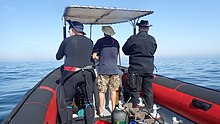
In South Africa, the standard dive boat is a large (6 to nearly 9 m) Rigid Inflatable Boat These are known as rubber ducks. Power is generally twin outboard motors, which may be two-stroke and smoky, but are increasingly often either four stroke, or the improved two-strokes which are cleaner and quieter.
These boats are generally powerful and fast, but speed is usually limited by sea state. They have a wet ride in a bumpy sea or if there is a crosswind. You travel in your dive suit, quite often with your hood on, and sometimes with your mask on to keep the spray out of your eyes. It has been known for the occasional diver to also use a snorkel to keep out heavy spray in rough conditions. If you wear a hat to protect your head from UV, make sure the hat is a tight fit, and preferably with a lanyard. The combination of cool sea air, wind, spray and high levels of UV can grill you in quite a short time, even in winter. Wear a good blockout or other method of keeping the sun from your skin. Unfortunately some blockouts wash off easily, and others sting your eyes if water gets into your mask and sloshes around a bit. A ski-mask is considered slightly eccentric, but it does the job.
Preparing for the dive.

If using all your own equipment, pack it as you find convenient, and check that everything is in good working order before leaving home. It will be wet on the way home, a waterproof bag or bin will keep the water off the upholstery. If using rental gear, get to the shop early to make sure it fits and works properly. If you are an unusual shape or size you may have difficulty finding a suit which fits well.At some places you will kit up at the side of the road or in a parking lot, and at others there will be changing rooms provided by the dive operator. If this is an issue, find out before the dive, You might want to take along a small mat or towel to stand on while putting on your suit, particularly if the ground is sandy or muddy.Some operators provide facilities at the dive shop for the customers to change into their dive suits and assemble equipment and load the boat before leaving for the launch site. In these cases the heavy equipment is usually loaded by staff, and the divers carry their light equipment to the boat. Where the boat collects divers from a jetty, the divers are expected to get their own kit to the boat. Actual loading will usually be done or supervised by the skipper.You will almost always be expected to wear your dive suit on the boat trip. There is no space to put it on during the ride, which may be wet.
What to take
- A small bag is useful to carry items like sunglasses, sunblock, hat, etc. Cell phones and car keys are usually kept in a waterproof bag or box by the skipper, and stored in the console. Large boxes for underwater cameras or video equipment should be negotiated before the dive, as there may or may not be space for them on board. In summer sunblock is advised for most skin types. UV factor is generally high and reflection from the water grills you from below. A peaked or brimmed hat may help if securely strapped on against the wind generated by boat speed.
- Kit bags for dive gear are not usually carried, but a medium sized soft bag to hold fins and mask, and other dive accessories like DSMB, reel, computer, dive light etc. is OK.
- On a long boat trip a small bottle of water or other suitable rehydration drink is nice to have, specially for after a deep or long dive. Similarly a small amount of high energy food may be welcome after a cold dive. In Cape Town, many dive boats supply a small chocolate bar or other sweet (candy) to each diver after the dive.
- A light waterproof windbreaker jacket is useful if the wind is strong, the weather or water is cold, or the trip is long. This can reduce wind-chill, particularly after the dive if you wear a wetsuit.
- A small emergency supplies (dive saver) kit of spare O-rings, fin strap, etc is acceptable.
What not to take
- Don’t take anything that you do not intend to use on the trip. (emergency equipment excepted).
- Don’t bring anything that must not get wet unless you have a watertight bag or box for it. A towel is usually a waste of time, as it will probably get wet. The same goes for dry clothing.
- Space is limited and must be shared by all. Do not annoy everyone by bringing a huge bin for your kit and fighting with the skipper at boarding time. No-one will have sympathy when you are evicted.
Loading kit and getting into the boat


The boat may loaded before launching, except where the water at the slipway is too shallow, when the boat is not taken out between dives, or when the slipway is not at the same place where the divers will be boarding.Loading of the boat is usually done by the skipper and divemaster. You are usually expected to transport your own equipment to the boat and hand it over to the person who will stow it for the trip. The standard arrangement is to stack scuba sets along a centreline rack, and tie them in place. You will usually sit at your scuba set, so if you want to do pre-dive buddy checks, ask for your gear and your buddy’s to be stowed together.Weight belts and pockets may be stacked on deck or in a box at the front or back of the rack. They are handed out when the boat gets to the site, so be sure you can identify your weights.
Fins and masks are usually stowed by the diver. There are often no special places reserved for this purpose, and fins are generally stowed either behind a handrope along the inner side of the pontoons, or between scuba sets along the rack. Be careful how you do this, as simply stacking them on top of the scuba sets can sometimes result in a fin or two being blown overboard by wind. This can ruin your dive, and is usually expensive. Masks are commonly stored in the foot pocket of a fin. The deck is not a good place for fragile items.Large cameras with strobe arms should be carried in the smallest plastic bin or crate that will hold them. There will often be several divers with camera boxes contending for the same limited storage space. Do not expect special treatment unless you have specifically organised it with the charterer.Some crews will carry your scuba set to the boat, but don’t count on it. If you need help, say so. If you are renting gear from the same organisation that runs the boat, they will usually load it for you. Make sure you can identify your rented gear and that it has all been loaded.
Slipway launches


Slipway launches are standard in the Western Cape
Where launching is from a slipway the procedure is fairly relaxed, and much depends on how far the slipway is from the parking area, and whether there is a convenient jetty.In some cases, usually at low tide, the water may be too shallow to launch the boat loaded with kit, but more often the boat is loaded with most of the dive gear, but not the divers, before launching. The boat is then launched with usually just the skipper on board, and the divers either get in from shallow water or from a jetty, as described above.Sometimes there may be commercial ski-boat fishermen launching at the same slipway. There are exceptions, but the lasting impression is of a mob of hooligans with no respect for anyone. They are generally a law unto themselves, and you will not gain brownie points by pointing out the error of their ways, and are likely to be given a brief introductory course in local invective at no charge.
Getting into the boat will depend on the launch site. In most cases the boat will be launched with only a skipper on board. Divers will board from the jetty or from the water.
Boarding from a jetty
Boarding from a jetty is usually easy, unless the step down to the boat is high. The crew will help where necessary and direct boarding. Follow their instructions. Do not leap down onto the deck, as it may not be designed to take this kind of shock load, and the sound of cracking glass fibre will not bring a smile to the skipper’s face. Also don’t leap down onto the pontoon, as this is likely to be followed by an inelegant face-plant onto the rack of scuba gear. The owners may be more concerned with damage to their equipment than your injuries.
The roll bar at the stern is a good place to hold if you can reach it. The radio antenna, plastic windscreen and engine control levers are not.Try to avoid getting parts of yourself between the boat and the jetty. The pontoons are fairly soft, but the jetty usually isn't, and may be decorated by barnacles and other abrasive material.
Boarding from shallow water
If boarding from standing in the water, try to get in where the water is not too deep, as most divers do not have the agility and upper body strength to boost themselves in without fins or a jump. Ask for help if you need it, but your fellow divers are more likely to be enthusiastic than skillful at pulling you in, Say goodbye to dignity, and hope for a reasonably comfortable landing.
The stern of the boat (blunt end) is usually lower and therefore easier to get into. This is often combined with it being in the shallowest water, so get in and out of the way of the people who have to hold the boat while the rest are getting in.
If you are a gymnast or acrobat you may safely ignore this advice.
Seating


Seating is almost exclusively on the pontoons, with your back to the water. This puts you in a position where losing your balance backwards will result in falling into the water, a manoeuvre most divers prefer to restrict to times when the boat is stationary at the dive site. To prevent unscheduled backward rolls, use the foot-straps and hand-ropes provided. As a general rule, sit opposite your scuba set, so you don’t have to move around when kitting up on site.
Occasionally there may be a seat across the stern in front of the motors. This will be the most comfortable place on the boat but may catch more spray in your face. The boat will bounce up and down as it hits waves. Bigger boats less so than small ones, and the part that bounces the least is the stern, so the most comfortable seating is as far back as you can get. This puts you close to the motors, and if they are two-stroke, closest to the exhaust smoke when the boat is not moving. You may not have much choice where you get to sit, but if you have a bad back or other disability which makes a rough ride a problem, mention this to your dive-master or the skipper as soon as possible. You will not be popular if the boat has to stop to re-arrange passengers. With practice it is possible to sit with one foot in a foot-strap (preferably the foot nearer the bow (pointy end)) and ride the bumps with very little effort. It is much like riding a horse, don’t fight the motion, absorb the bumps by relaxing a bit, and you will bounce less. A death-grip on the hand ropes will be exhausting if the ride is long.
Some boats have no footstraps. You will have to find something else to hold onto, or lean into the boat to keep more weight on your feet. Some divers may be seen comfortably sitting on the tubes, riding the waves with no obvious concern as the boat bounces along. They may not even need to hold on. They have done this before.
Moving around in the boat
If possible, don’t move around while the boat is moving, unless asked to trim the boat. You will be expected to sit where directed by the skipper, and unless there is a good reason not to, do as requested. Standing up when the boat is moving and there is nothing to hold onto can result in a fall and possible injury if the boat hits a wave or moves in an unexpected direction. If equipment comes loose under way, shout to the skipper, who will stop if it is safe, so that the equipment can be re-stowed.There may be cables and pipes in places on the deck. These are usually routed through areas where they are reasonably protected, but as a rule don’t stand on them or use them to hold on to. Batteries are often stored in plastic boxes near the transom, to keep the wires short. The lids are not usually load bearing structures, do not use them as steps.
Getting out of the boat

Getting into the water is usually done by a synchronised backward roll – falling into the water alongside your neighbour, neither on top nor underneath. Generally all the divers or a nominated group will roll off together, on a countdown from the skipper or divemaster. It is important to all roll together, as if you do not, the later divers may fall on top of the earlier ones, possibly casing injury or equipment damage. If you are not ready, or are not happy with this procedure, wait until the others are in and the boat is clear of them. The skipper will then let you roll in clear of the others, but you may have to fin a bit to get to them. This can be a problem if diving in a current. Some divers may not wish to backward roll with a large camera setup. Ular skiperdan suvda bo'lganlarida kamerani ularga berishlarini so'rashlari mumkin. Bunday holda, ular qayiqqa yaqin turishlari va kameralari pastga tushguncha uni ushlab turishlari kerak.
Shotline va marker shamshirasi

Keyptaundagi sho'ng'inlarning aksariyati rif yoki halokat ostida. Dalgıçlar kerakli joyga tushishi uchun sho'ng'in oldidan o'qni chiziq bilan belgilash odatiy holdir. Agar sirtda ozgina oqim bo'lsa, o'q chizig'i bo'shliqni egallash uchun pastga qarab siljiydi. Bu holda suvga suzgichning oqimidan qisqa masofada kirib borish va chiziq suv paydo bo'lishi bilan tushishni boshlash, oqimga qarshi suzish ishini kamaytirish odatiy holdir. Suzib ketgunga qadar suzib yurish, oqimga qarshi suzish kerakligini anglatadi. Shotline langar emas. Agar siz o'zingizni bug'doy chizig'idan tortib qo'ysangiz, u zarbani tortib olishi mumkin va siz orqangizdagi hamma kabi saytning pastki oqimiga aylanasiz. Agar o'q chizig'i juda qisqa bo'lsa, tortishish shamchiroq tomonidan ko'tarilishi va joydan siljishi mumkin, shuning uchun unga biroz sustlik kerak. Oqim to'g'ridan-to'g'ri pastga qarab ishlamasligi mumkin. Shamol ta'sirida bo'lgan oqim bo'lsa ham, Coriolis kuchlari uni Janubiy yarimsharda shamol yo'nalishidan soat yo'nalishi bo'yicha teskari yo'naltiradilar, bu esa Ekman transporti deb nomlanadi. Effekt chuqurlikda 45 ° atrofida, chuqurroq borgan sayin, lekin kamroq tezlik bilan.
Siz tortishish chizig'ida yoki undan uzoqlashishni tanlashingiz mumkin. Agar siz saytni bilmasangiz, orqaga qaytish yo'lini topish qiyin bo'lishi mumkin. Bu odatda muammo emas va Keyptaun aksariyat g'avvoslari sho'ng'in oxirida qaerda bo'lishidan qat'i nazar, yuqoriga ko'tarilishadi, ammo bu holda DSMB va sirtni o'z shamshirangizga yoki do'stingizning shamchasiga joylashtirish tavsiya etiladi. DSMB sho'ng'in borligini bildiradi, shunda mintaqadagi qayiqlar aniq yurishi mumkin va sizning sho'ng'in qayiqlari kemachisi mijozlari qayerga tushishi mumkinligini kuzatishi mumkin.

Agar qayiq qatnovi ko'p bo'lgan hududda o'q chizig'idan uzoqlashish ehtimoli katta bo'lsa, g'avvoslarga DSMB olib yurish va uni yuzaga chiqishdan oldin joylashtirish talab qilinadi. Dalgıçlardan DSMB olib yurish talab qilinishi mumkin bo'lgan boshqa saytlar - bu offshor joylar, yoki har qanday vaqtda kema egasi dengiz sharoiti tufayli g'avvosni topish qiyin bo'lishi mumkin deb o'ylaydi. Dam olish uchun sho'ng'in uchun, shaxsiy DSMB uchun rang va hajmni tanlash g'avvosga bog'liq. Sariq, to'q sariq va qizil ranglar tez-tez uchraydi, lekin ba'zida yorqin pushti ko'rinadi, va agar siz skiperga rang uchun maxsus ma'no haqida aniq xabar bermasangiz, unda sizning pozitsiyangizni belgilashdan boshqa maxsus ma'no yo'q deb taxmin qilinadi. Qanday qilib uni oqilona masofadan ko'rish mumkin bo'lsa, uning kattaligi hech kimga ahamiyat bermaydi. Yansıtıcı chiziqlar, miltillovchi chiroqlar va sizning ismingiz ham ixtiyoriy.
Divemasters
Qayiqda bitta bo'lishi mumkin yoki yo'q bo'lishi mumkin. Mahalliy aholiga xizmat ko'rsatadigan qayiqlar divemasterni maktablar bilan bog'langan yoki odatda o'tib ketadigan savdo va mehmonlarga xizmat ko'rsatadigan qayiqlarga qaraganda kamroq ta'minlaydi. Agar sizni ko'rgazmali odamsiz sho'ng'in qilishdan amin bo'lmasangiz, rezervasyon paytida buni eslatib o'ting va imkoniyatlari haqida so'rang.
Kelp sho'ng'in
Og'ir suv o'tlari bo'lgan joylarda g'avvoslar sho'ng'in paytida odatda KO'Klarni tortib olmaydilar. Yaxshiyamki, bu odatda oqimlar mavjud bo'lmagan joylardir, garchi oqim kuchli bo'lishi mumkin. Keyptaun qirg'oqlari va qirg'oqlarning aksariyat qismida og'ir suv o'tlari bor, ayniqsa Atlantika dengiz sohilida. Ushbu joylarda g'avvoslarga DSMBlarni olib yurish va ularni tortishish chizig'idan uzoqlashishda foydalanish tavsiya etiladi, shuning uchun kema egasi hamma qayerda paydo bo'lishini kuzatishi mumkin va shuning uchun o'tayotgan qayiqlar sizni bezovta qilayotgan bo'lsa, sizni qochib ketmaslik imkoniyatiga ega bo'lishi mumkin. qidiruvni davom ettirmoq. DSMB-lar, shuningdek, siz dengizda bo'lganingizda qayiqqa signal berish uchun juda samarali - bu qora suvli kostyumdagi qo'ldan ham ko'proqdir. Bu, ayniqsa, sho'ng'in paytida shamol ko'tarilsa va sirt oq suv bilan to'lib toshgan bo'lsa, bu juda qimmatli bo'lishi mumkin.
Sho'ng'ishdan keyin qayiqqa qaytish


1-qoida: Agar zinapoyangiz bo'lmasa, suvda qanotingizni yechmang. Sizni ko'tarish uchun ularga kerak. Aksariyat rezina o'rdaklar bort narvonlarini ta'minlamaydilar. Agar siz qayiqning shamol tomoniga o'tirsangiz, bu juda muhim, chunki qayiq deyarli har doim g'avvosga qaraganda tezroq pastga qarab shamolga siljiydi, qayiqqa yaqinlashing va tashqi qo'l ipingizni ushlang. Qayiqni doimo ushlab turishga harakat qiling va to'plamni olib tashlash uchun juda zarur bo'lgan vaqtgacha qo'yib yuboring, chunki siz ushlab turmaganingizda qayiq uzoqlashishi mumkin.
Bir nechta qayiqlar sizning qo'lingizni siljitadigan pastadir bilan qisqa tutashuv chizig'ini ta'minlashi mumkin, ammo ba'zi sabablarga ko'ra bu juda kam. Hatto kamroq tarqalgan bo'lib, uni olib tashlashdan oldin uskunaga ulashingiz mumkin bo'lgan klipli chiziq. Ehtimol, ushbu buyumlarga xaridorlarning talabi yo'q ... Sizning uskuna ekipaj yoki boshqa g'avvoslar tomonidan ko'tariladi.
Tavsiya etilgan protsedura - avval kameralar yoki boshqa bo'shashgan asbob-uskunalarni topshirish, keyin og'irliklarni ko'tarib topshirish. Bu sizning miloddan avvalgi avtoulovingizni olib tashlaganingizdan so'ng suzishingizni ta'minlaydi. Boshqangiz yaxshi ushlaganiga amin bo'lmaguningizcha qo'yib yubormang, og'irlik kamarlari juda tez cho'kadi, suvosti to'plamini olib tashlang va uni ekipajga topshiring. Ko'targanda to'plam ostiga bosib, DV va o'lchagichlarning qo'l arqonlariga ilib qo'yilmasligini tekshirish orqali yordam berishingiz mumkin. Niqob va snorkelni har qanday vaqtda, agar kerak bo'lsa, topshirish mumkin, taqdim etilgan tutqichlarni yaxshilab ushlang yoki pontonlarning yon tomoniga iloji boricha balandroq ipni oling. Qalqib chiquvchi ko'tarilishni olish uchun iloji boricha pastga cho'ming, so'ngra yuqoriga ko'taring va qo'llaringizni iloji boricha yuqoriga ko'taring, so'ngra tanangizning yuqori qismini pontonga ag'darishda arqon yoki tutqichlardan pastga tushiring. Ichki tutqichga yoki qo'l chizig'iga tutqichni o'zgartiring va oyog'ingizni qayiqqa burang. Kimdir sizning qanotingizni olib tashlagancha, bu erda to'xtash qulay bo'lishi mumkin, keyin o'tirib, boshqa oyog'ingizni qayiqqa silkitib qo'ying. Yaxshi qanotlari, yaxshi texnikasi va oqilona kuchi bilan shinamlik va qadr-qimmat bilan bu yo'lga chiqish mumkin. Agar shamol kuchli shamolda bo'lsa, bu usul ancha qiyin.

Agar sizda kuch bo'lmasa, protsedura o'xshash, ammo ekipaj yoki qayiqda bo'lgan g'avvoslar yordami bilan ular sizni asosiy kuch bilan tortib olishadi va ular qo'lga olishlari mumkin bo'lgan narsalar. Hech kimni nomaqbul tajovuzda ayblamasdan oldin, ularning qo'lga kiritilishi uchun oqilona alternativa bo'lgan yoki yo'qligini o'ylab ko'ring. Elegance sizning o'lchamingiz va massangizga teskari proportsionaldir. Agar kostyumingizning oldida son cho'ntaklaringiz bo'lsa, cho'ntaklaringizda biron bir mo'rt yoki katta hajmdagi uskunalar bilan o'tirmang. Yon cho'ntaklar odatda muammo emas.

Ba'zi qayiqlarda samolyotga chiqish uchun narvon berishning yangi tendentsiyasi mavjud. "Rojdestvo daraxti" uslubi nisbatan ommalashgan, chunki oyoqlaringning suyaklari bilan ko'tarilish oson. Kauchuk o'rdaklarda u odatda yon tomonga osib qo'yiladi va qattiq katamaranlarda transomga ustunlik beriladi.
Sho'ng'ishdan keyin qayiqdan chiqish

Iskala samolyotiga chiqish odatda oddiy, ammo baland iskala va past oqim bilan murakkablashishi mumkin. Agar bu muammo bo'lsa, ekipaj yordam beradi va ko'rsatmalar beradi. Agar siz o'zingizning ishingizni qilsangiz, xuddi samolyotdan kirish kabi ogohlantirishlar qo'llaniladi. Xususan, qayiq va iskala o'rtasida o'zingizni tutmaslik haqida.
Keyptaunda plyajga chiqish g'ayrioddiy, ammo nisbatan sodda. Odatda plyaj bo'ylab harakatlanayotganda qayiq qiyshayib qolsa, pastroqdan tushish xavfsizroq va qulayroq bo'ladi. Agar siz baland tomonda bo'lsangiz, bo'sh joy bo'lguncha kutib turing va past tomonga o'ting, yoki ba'zi hollarda yuk ko'tarilayotganda qayiq orqaga qaytganda yuqori tomon past tomonga aylanadi. Agar siz noto'g'ri joyda bo'lsangiz va qayiq sizning ustingizga ag'darilsa, to'plamni yuqori tomondan tushirishga urinmang. Bu, ayniqsa, qayiq to'lqinlardan to'liq tozalanmasa.
Qarang

Keyp yarim oroli va Soxta ko'rfazining suvlari mo''tadil mo''tadil dengiz organizmlarining rivojlangan ekologiyasini qo'llab-quvvatlaydi, ularning aksariyati Janubiy Afrikada yoki hatto kichik mintaqalarda tarqalgan va baliqlar tropik suvlarda bo'lgani kabi ajoyib rangga ega bo'lmasa ham, ko'plari riflarni qoplaydigan nihoyatda jonli umurtqasizlar orasida kamuflyaj qilish uchun juda rangli.
Dengiz hayvonlari
Ushbu mintaqada sho'ng'in paytida ko'rish mumkin bo'lgan dengiz hayvonlarining keng doirasi mavjud va ular g'avvos uchun eng ajoyib va ajoyib uchrashuvlarni o'z ichiga oladi.
Kitlar va delfinlar
False Bay - kitlarni tomosha qilish uchun belgilangan joy. Ko'rfazga har yili ko'plab janubiy o'ng kitlar tashrif buyurishadi, ammo sho'ng'in paytida uni ko'rish odatiy hol emas. False Bayda vaqti-vaqti bilan ko'riladigan boshqa kit turlari - bu Humpback kitlari, Brayd kitlari va Orca, va ular sho'ng'in paytida kamroq uchraydi. Agar sizga sho'ng'in paytida kit bilan uchrashish nasib qilsa, ehtiyot bo'ling, chunki ularning katta hajmi g'avvosning bexosdan jarohatlanishiga yordam beradi.
Delfinlar False Bay va Atlantika dengiz sohilida ham uchraydi. Oddiy delfinlar vaqti-vaqti bilan yuzlab-minglab maktablarga tashrif buyurishadi, lekin g'avvoslar tomonidan tez-tez uchratilmaydi. Qorong'u delfinlar kichik guruhlarda sayohat qilishga moyildirlar, ammo xavfsizlik punktida g'avvosni tekshirish ehtimoli ko'proq. Boshqa turlar vaqti-vaqti bilan tashrif buyuradi, lekin suv ostida g'avvoslar tomonidan ko'rilgan hodisalar ko'proq qayd etiladi.
Akulalar

False Bay - bu buyuk oq akulalarni ko'rish uchun eng ishonchli joylardan biri, garchi kamdan-kam hollarda sho'ng'in sifatida va boshqa bir qancha akula turlari ham uchraydi. Sevengill yoki Cowsharkni ko'pincha bir nechta saytlarda ko'rish mumkin, Gulli akulalar va mushukchalar esa keng tarqalgan. Rangli puffadder shysharkdan ancha kattaroq pijama akulasiga qadar mahalliy darajada to'rtta katshark turi mavjud. Boshqa pelagik akulalar odatda faqat janubiy yarim orolning offshor "ko'k-suvi" sho'ng'inlarida ko'rinadi va shunga o'xshash sayohatlarda bir nechta yirik pelagik baliq turlarini ko'rish mumkin.
Pelagikalar

Ba'zan sho'ng'in joylarida Yellowtailning yirik qirg'oqlari uchraydi va oldindan aytib bo'lmaydigan holatlarda g'avvoslar okean dengizidagi quyosh baliqlari, janubiy o'ng kitlar, kambur kitlar, oddiy, botlenoz yoki qorong'u delfinlarni ko'rish baxtiga muyassar bo'lishlari mumkin.
Mahalliy baliq ovlash sanoatining asosi bo'lgan oddiy Snoek juda uyatchan va sho'ng'inchilar tomonidan deyarli uchratish odatiga qaramay, juda ko'p.
Pingvinlar va muhrlar

False Bayda afrikalik penguenlarning koloniyalari mavjud, ammo ularni sho'ng'in paytida ko'rish juda g'alati. Boshqa tomondan, Keyp mo'ynasi muhrlari g'avvoslardan ham qiziquvchan, ham qo'rqmaydi va False Bayda ham, Atlantika dengiz qirg'og'ida ham juda tez-tez uchraydi. Ularni ko'rishni deyarli kafolatlaydigan bir nechta joylar mavjud.
Rif baliqlari

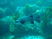


Ushbu mintaqadagi rif baliqlari False ko'rfazida eng xilma-xil bo'lib, ko'pincha dengiz muhofazalangan hududlarining cheklangan zonalarida keng tarqalgan, bu erda ular bir necha o'n yillar davomida qonun bilan muhofaza qilinmoqda, garchi hanuzgacha brakonerlik sodir bo'layotgan bo'lsa-da, ularni bajarish juda ishonchsiz. Rif baliqlarining aksariyati ma'lum darajada kamufle qilingan. Ko'pchilik kumushrang kulrang va peshtaxtali, hamma joyda tarqalgan Hottentot dengiz suvi, kumushrang Fransmadam va Stsentji kabi. Boshqalarida vertikal panjaralar yoki qorong'i yamaqlar mavjud bo'lib, ular kelgusidagi oq stumpnoz, zebra va oq steenbralar singari profillarini buzishga yordam beradi, aksariyat kichik turlari kriptografik rangga ega va atrof-muhitga juda mos keladi. Bular odatda o'zlarining ko'p vaqtlarini rifga yoki unga juda yaqin joyda o'tkazadigan baliqlardir va ularning ranglanishi odatda ularning yashash joylarining odatiy ranglaridan dalolat beradi. Bularga turli xil endemik klipfish va bir nechta blennies va gobies, barmoq barmoqlari, triplefin burni, Smoothskin chayon baliqlari, ot baliqlarining ikki turi, pipefish va Rocksucker kiradi. Bundan tashqari, juda tez-tez uchraydigan Rim va kamroq tarqalgan qizil stumpnose va Red steenbras kabi juda aniq ko'rinadigan bir nechta qizil baliqlar mavjud. Eslatib o'tilgan baliqlarning aksariyati yakka yoki mayda shollarda uchraydi, ammo Strepies va Maasbanker ham bor, ular juda ko'p sonli shoalga moyil bo'lib, Hottentotning o'rtacha katta shoalslari tez-tez uchraydi. Galjoen juda kam uchraydi va odatda to'lqin harakati ko'p bo'lgan rif tepasida kichik guruhlarda uchraydi va shunga o'xshash tashqi ko'rinishdagi Cape pichog'i toshlar orasidagi chuqurroq va balandroq reefni afzal ko'radi. Dengiz baliqlari uyatchan va kunduzi yoriqlar va teshiklarda o'tkazishga moyil.
Qumli joylar

Qumli hududlarda shuningdek o'ziga xos baliqlar mavjud bo'lib, ular tarkibiga bir necha turdagi nurlar, tagliklar, gurnardlar, pufferfish va tumshug'i qum baliqlari kiradi, ular kundan-kunga kamdan-kam uchraydigan va uyatchan, lekin tunda ba'zi joylarda kechalari ko'p ko'rish mumkin. u yashiringan qumdan chiqadi va erkin suzadi. Klipfishlarning bir nechta turlari ham qumda yashaydi, turli xil turlari qumning zichligini afzal ko'rishadi, mayda qumni afzal ko'rganlari ilonga o'xshash tanaga ega, qo'pol qumdagilar esa ancha mustahkam. Ularning tanasi naqshlari qum turiga ham mos keladi.
Rif umurtqasizlar
Bentik umurtqasiz hayvonlar ushbu mintaqadagi riflardagi yorqin ranglarning aksariyat qismini ta'minlaydi va turlarning tarqalishi chuqurlik va suv harorati kabi har xil pastki mintaqalarga xosdir. Xilma-xilligi katta va reef qoplamasida chuqurlik va geografik joylashuvi bilan katta farq bor. Xarakterli rif hayoti Keyp yarim orolining sharqiy va g'arbiy tomonlari o'rtasida sezilarli darajada farq qiladi va bu Janubiy G'arbiy Cape va Agulhas Inshore Bioregions o'rtasidagi chegara sifatida tan olingan. Vertikal zonalash turli bioregionlarga ham xosdir, shuning uchun har xil joylarda ko'rish mumkin bo'lgan narsalarda juda sezilarli farqlar bo'lishi mumkin.
Rifning ma'lum bir hududida ma'lum bir organizm turlari hukmron bo'lishining umumiy tendentsiyasi mavjud, masalan: Oddiy patlar yulduzlari, Qizil ko'krak dengiz bodringlari, Mauve dengiz bodringlari, Qizil o'lja yoki dengiz kirpiklari. sirt maydonining bir qismi dominant organizm tomonidan qoplanadi. Bu xilma-xillik yo'q degani emas, chunki yo'nalish va qo'pollikka qarab, aksariyat riflarda yashash joylari kengligi va katta darajada o'tirgan organizmlar imkoni bo'lgan joyda yashaydi va bu asosan planktonik lichinkalar joylashgan joyga bog'liq. tayanch topmoq.
O'rta suv
Pelagik umurtqasizlar asosan planktonik tabiatiga ko'ra ularni qachon va qaerda ko'rish mumkinligini oldindan aytib bo'lmaydi. Ular tarkibiga meduzalarning bir nechta turlari, taroqsimon jelelarning bir nechta turlari, bir nechta sporadik sifonoforlar, salps va pteropodlar va osongina sezilmasligi uchun juda kichik narsalar kiradi. Shuningdek, kalamar ham bor, lekin ular juda uyatchan va kundan-kunga kamdan-kam uchraydi.
Ushbu mintaqadan qayd etilgan gubkalar, cnidarians, taroqli jele, yassi qurtlar, segmentlangan qurtlar, artropodlar, mollyuskalar, bryozoanlar, echinodermalar, astsidiyalar, baliqlar, dengiz qushlari va dengiz sutemizuvchilari. Vikipediya: Keyp yarim oroli va Soxta ko'rfazdagi dengiz hayvonlari ro'yxati. Ularning aksariyati dam oluvchi sho'ng'in tomonidan ko'rilishi mumkin.
Dengiz o'tlari
Kelp o'rmonlari
Kelp o'rmonlari - Keyptaunning eng aniq dengiz o'tlari. Mahalliy, ba'zan yaqin joyda uch avlod mavjud. Eng yaqqol ko'rinib turgani shundaki, to'liq o'sib chiqqandan so'ng sirtga etib boradigan va yuqori qismida gaz bilan to'ldirilgan bo'shliqqa ega bo'lgan qalin stipe bor va yorug'likka maksimal ta'sir qilish uchun chekka yuzani ushlab turadigan dengiz bambusi. Ushbu suv o'tlari Atlantika dengiz sohilida juda ko'p uchraydi, shuningdek, False Bayning ikkala tomonida, lekin ko'proq ko'rfazning janubiy qismiga to'g'ri keladi.
Kichikroq Split-fan kelpasi chuqurroq riflarda o'sadi va yuzaga chiqmaydi. Stipendiya qisqaroq va gaz bilan to'ldirilgan bo'shliq yo'q, shuning uchun chekkalar qorong'i suvlarga botib qoladi. Ushbu suv o'tlari dengiz bambukiga qaraganda chuqurroq suvda joylashgan bo'lib, geografik doirasi o'xshash.
Uchinchisi - qovuq kelpasi, unda uzun ingichka shtrixlar to'planib, uzun qirralari va ko'p miqdordagi kichik gaz bilan to'ldirilgan qovuqlari bo'lib, ular kelpni tik holatidadir va yuzalarni esa ushlab turadilar. Ushbu suv o'tlari False Bayda topilmaydi va asosan Robben oroli yaqinida uchraydi.
Suv o'tlari o'tlari va suv o'tlari tagliklari.
Suv o'tlari bo'laklari ostida, yorug'lik etarli bo'lgan sayoz joylarda joylashgan rif turli xil dengiz o'tlarining pastki qatlami bilan qoplanishi mumkin va ma'lum turlar turli xil omillarga, shu jumladan mavjud yorug'lik miqdori va suv miqdoriga bog'liq bo'ladi. harakat. Qoida tariqasida sayoz joylarda yashil va jigarrang dengiz o'tlari uchraydi, qizil ranglar esa chuqurroq bo'ladi, chunki ular kamroq yorug'lik bilan omon qolishlari mumkin. Eng chuqur - ko'pincha toshlarning yuqori yuzalarida zich maysazor hosil qilishi mumkin bo'lgan qizil korallin suv o'tlari.
Korallinlarni ishonib topshirish.
Sörf juda kuchli yoki yorug'lik boshqa dengiz o'tlari uchun juda xira bo'lgan joyda, qamrab olgan korallin suv o'tlari baribir o'z o'rnini topib, gullab-yashnashi mumkin. Ushbu qizil suv o'tlari rifda juda qattiq va mahkam yopishgan qobiqni hosil qiladi, shuningdek, "pushti bo'yoq" deb nomlanadi, bu ularning tashqi ko'rinishini adolatli tavsiflaydi - ular dengiz o'tlariga o'xshamaydi. Ularning diapazoni mintaqaning deyarli hamma joylarida etarli darajada yorug'lik kirib boradi va rifda boshqa odam yo'q.
Ushbu mintaqadan 57 ga yaqin yashil dengiz o'tlari, 49 ta jigarrang va 240 ta qizil dengiz o'tlari qayd etilgan. Vikipediya: Keyp yarimoroli va Soxta ko'rfazdagi dengiz o'simliklari ro'yxati.
Kema halokatlari

The Dovullar burni va Yaxshi umid burni ikkalasi ham ushbu mintaqa uchun an'anaviy apellyatsiyalardir va bu yaxshi sababdir. Ba'zida ob-havo juda yomon bo'lishi mumkin, va qirg'oq juda ochiq, garchi boshpanalari kam, lekin ayni paytda dunyodagi buyuk dengiz savdo yo'llaridan birining muhim yo'lidir. Natijada, mahalliy qirg'oq bo'ylab qayd etilgan juda ko'p sonli kema halokatlari mavjud.
Ushbu halokatlarning aksariyati hech qachon topilmagan va boshqalari tanib bo'lmas darajada bo'linib ketgan yoki qum bilan qoplangan yoki Stol ko'rfazida melioratsiya loyihalari ostida ko'milgan, ammo bir nechtasi sho'ng'in joylarida va ular tashrif buyurishi mumkin. sharoitlar mos bo'lsa, g'avvoslar.
Sho'ng'in vayronalarining chuqurligi 3 yoki 4 metrdan 65 metrdan ko'proq o'zgaradi va holat yarim ko'milgan yog'och yoki po'lat bo'laklaridan, asl tuzilishi va tashqi ko'rinishini aksariyat qismini saqlaydigan kemalarga qadar o'zgarib turadi va go'yo chuqurlikdan chiqib ketadi. qum tubi orqali suzib yurish.
Ularning aksariyati sayoz suvdagi dengiz o'tlaridan tortib, chuqurroq suvdagi rang-barang umurtqasiz hayvonlarga qadar bo'lgan rif organizmlari bilan o'ralgan. Shuningdek, ular turli xil rif baliqlarini boshpana qiladilar va oldindan aytib bo'lmaydigan holatlarda pelagik baliqlar tashrif buyurishi mumkin. Aslida, ular sun'iy riflar bo'lib xizmat qiladi va natijada, odatda, ularga asarlar sifatida qiziqmaydigan g'avvoslar ham qiziqishadi.
Topografik xususiyatlari
Ko'pgina saytlar qiziqarli topografik xususiyatlar bilan ajralib turadi, jumladan ziraklar, jarliklar, g'orlar, suzish va ko'tarilish. Bu xususiyatlar nafaqat dengiz manzarasiga qo'shgan hissalari bilan ajralib turadi, balki ushbu hududda mavjud bo'lgan yashash joylarining katta o'zgarishini ta'minlaydi va natijada yuqori bioxilma-xillik va qiziqarli topografiya o'rtasida kuchli bog'liqlik mavjud. Saytning umumiy topografik xususiyati geologiyaga bog'liq bo'lib, granit joylari cho'kindi qumtosh va slanets joylaridan bir zumda ajralib turadi. Granit jinslar odatda yaxlitlanadi va bir xil toshning ustki qismida toshlar bo'lib, ko'pincha ular orasida oq kvarts qumi joylashgan bo'lib yoki asta-sekin qiyshiq poydevor sifatida to'planadi. Har xil o'lchamdagi toshlardan tashkil topgan bu uyumlar ko'pincha cho'qqilarni hosil qiladi va tasodifiy yo'nalishdagi jarliklarni hosil qiladi va ular orasidagi balandliklar va teshiklar ba'zi hollarda g'avvoslar suzib o'tishlari uchun etarlicha katta bo'lib, ular ajoyib reef tuzilishini ta'minlaydi.
Qumtosh qatlamlari mahalliy sho'ng'in va zarbalar hukmron bo'lgan shakllanishlarni hosil qilish tendentsiyasiga ega va bu ko'proq taxmin qilinmoqda. Shu bilan birga, kichikroq o'lchamdagi detal granit maydonlaridan ko'ra ko'proq kichik teshiklar, yoriqlar, qirralar va tizmalar hosil qilishga intiladi va bu umumiy qoidaga ko'ra unchalik ajoyib emas. Istisno holatlar mavjud, bu erda qumtosh riflari juda dag'al, odatda cho'milish ancha tik, ammo vertikal emas va qirg'oq ancha tik, ammo cho'ntakka boshqa tekislikda.
Yaxshiyamki, "yuqoridagi kabi, quyida ham" eskirgan diktat juda yaxshi amal qiladi va qirg'oqning atrofidagi landshaftni kuzatish orqali riflarning xarakterini etarlicha ishonchli taxmin qilish mumkin. Smitsvinkel ko'rfazining janubidagi ushbu qoidadan istisno, bu erda suv ustida qumtoshlar va pastda granit bor.
Ushbu mintaqaning geologik tuzilishi va tarixi qisqacha bayon etilgan Vikipediya: Keyp yarim orolining va soxta ko'rfazning dengiz geologiyasi
O'qing
Keyptaun suvlari ekologiyasi bo'yicha ma'lumotnomalar:
Kimdan Jarrohlik, ayniqsa ushbu mintaqadagi g'avvoslar uchun: Keyptaundagi tanlangan sho'ng'in do'konlari va kitob do'konlarida va to'g'ridan-to'g'ri SURG-da mavjud.
- Jons, Jorjina. 2008 yil. Keyp yarim orolidagi dengiz hayvonlari uchun dala qo'llanmasi, SURG, Keyptaun. ISBN 9780620416399
- Zsilavecz, Gvido. 2005 yil. Keyp yarim orolining va soxta ko'rfazning qirg'oq baliqlari, SURG, Keyptaun. ISBN 0620342307
- Zsilavecz, Gvido. 2007 yil. Keyp yarim orolining nudibranxlari va soxta ko'rfaz, SURG, Keyptaun. ISBN 0620380543
Boshqa noshirlardan va umumiy qo'llanilishidan:
- Filial, G. va filial, M. 1981 yil, Janubiy Afrikaning tirik qirg'oqlari, Struik, Keyptaun. ISBN 0869771159
- Filial, G.M. Griffits, KL. Filial, M.L va Bekli, L.E. 2010 yil, Ikki okean - Janubiy Afrikaning dengiz hayoti uchun qo'llanma, Devid Filipp, Keyptaun. ISBN 9781770077720
- Gosliner, T. 1987 yil. Janubiy Orikaning nudibranchlari, Sea Challengers & Jeff Hamann, Monterey. ISBN 0930118138
- Heemstra, P. va Heemstra E. 2004, Janubiy Afrikaning qirg'oq baliqlari, NISC / SAIAB, Gremstaun.
- Ed. Smit, M.M. va Heemstra, P. 2003 yil Smitning dengiz baliqlari. Struik, Keyptaun
- Stegenga, H. Bolton, J.J. va Anderson, R.J. 1997 yil, Janubiy Afrikaning G'arbiy sohilidagi dengiz o'simliklari. Bolus gerbariysi, Keyptaun. ISBN 079921793X (aksincha texnik)
Keyp yarim orolining geologiyasi bo'yicha ma'lumotnomalar:
- Kompton, Jon S. 2004, Keyptaunning qoyalari va tog'lari. Ikki qavatli uy, Keyptaun. ISBN 1919930701

![]()